Property Record
5527 Lewis B Puller Memorial Hwy, Mattaponi, VA 23110
NEARBY LISTINGS FOR SALE OR LEASE
Property Detail
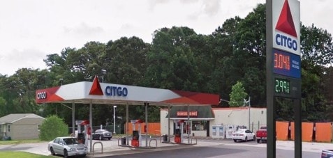
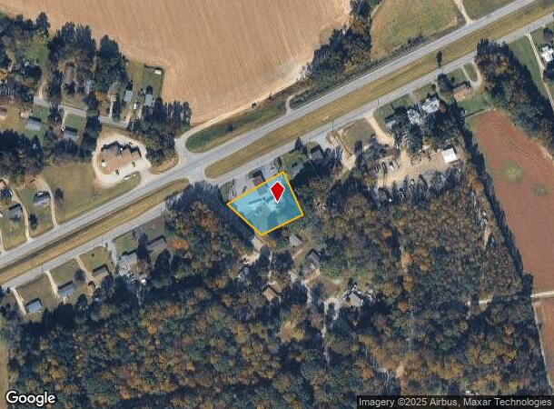
5527 Lewis B Puller Memorial Hwy
23 165XX 802U
Bowden
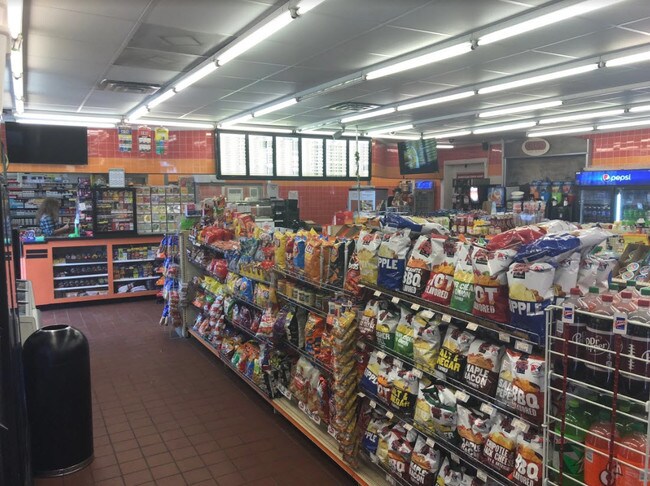
Servicestation
BOWDEN LOT 20
X
King and Queen
51101C0292F
Virginia
2024
20
2024
0.75 AC
950500
King and Queen County
1,920 SF
Richmond VA
DEMOGRAPHICS near 5527 Lewis B Puller Memorial Hwy
1 Mile
3 Mile
5 Mile
2024 Total Population
251
2,133
6,724
2029 Population
244
2,254
7,392
Pop Growth 2024-2029
(2.79%)
+ 5.67%
+ 9.93%
Average Age
47
44
43
2024 Total Households
115
891
2,639
HH Growth 2024-2029
(2.61%)
+ 5.05%
+ 9.13%
Median Household Inc
$77,941
$71,874
$77,052
Avg Household Size
2.20
2.40
2.40
2024 Avg HH Vehicles
2.00
2.00
2.00
Median Home Value
$173,275
$228,269
$245,300
Median Year Built
1963
1977
1980
Nearby Places
Map Layers
Map Styles
 Street
 Aerial
- Restaurants
- Banks
- Shops
- Fitness
- Groceries
SALE & LEASE HISTORY
LISTING DATE
SALE/LEASE

Sep 19, 2018
For Sale
Nearby Properties
Address
Land Use
TOTAL SIZE
Lot Size
Zoning
Address
Land Use
TOTAL SIZE
Lot Size
Zoning
85,500 SF
42 AC
R-1
Address
Land Use
TOTAL SIZE
Lot Size
Zoning
4,888 SF
362 AC
INDUSTRIAL
Address
Land Use
TOTAL SIZE
Lot Size
Zoning
29,920 SF
0.14 AC
B-1
Address
Land Use
TOTAL SIZE
Lot Size
Zoning
4,290 SF
1.62 AC
B-1
Address
Land Use
TOTAL SIZE
Lot Size
Zoning
8,181 SF
7 AC
INDUSTRIAL
Address
Land Use
TOTAL SIZE
Lot Size
Zoning
11,732 SF
10 AC
GENERAL BU
Address
Land Use
TOTAL SIZE
Lot Size
Zoning
8,400 SF
30.50 AC
INDUSTRIAL
Address
Land Use
TOTAL SIZE
Lot Size
Zoning
8,500 SF
0.27 AC
B-1
Address
Land Use
TOTAL SIZE
Lot Size
Zoning
7,208 SF
0.13 AC
R-4
Address
Land Use
TOTAL SIZE
Lot Size
Zoning
9,224 SF
3 AC
GENERAL BU
Address
Land Use
TOTAL SIZE
Lot Size
Zoning
4,028 SF
0.18 AC
B-1
Address
Land Use
TOTAL SIZE
Lot Size
Zoning
4,473 SF
0.13 AC
B-2
Address
Land Use
TOTAL SIZE
Lot Size
Zoning
5,682 SF
0.25 AC
B-1
Address
Land Use
TOTAL SIZE
Lot Size
Zoning
3,029 SF
B-1
Address
Land Use
TOTAL SIZE
Lot Size
Zoning
9,312 SF
0.13 AC
B-2
Address
Land Use
TOTAL SIZE
Lot Size
Zoning
2 AC
GENERAL BU
Address
Land Use
TOTAL SIZE
Lot Size
Zoning
5,116 SF
1.02 AC
B-1
Address
Land Use
TOTAL SIZE
Lot Size
Zoning
8,000 SF
8.75 AC
RESIDENTIA
Address
Land Use
TOTAL SIZE
Lot Size
Zoning
3,176 SF
0.13 AC
B-2
Address
Land Use
TOTAL SIZE
Lot Size
Zoning
1,566 SF
1.25 AC
GENERAL BU
Address
Land Use
TOTAL SIZE
Lot Size
Zoning
11,695 SF
0.13 AC
B-1
Address
Land Use
TOTAL SIZE
Lot Size
Zoning
8,742 SF
0.33 AC
R-4
Address
Land Use
TOTAL SIZE
Lot Size
Zoning
12,222 SF
3.50 AC
GENERAL BU
Address
Land Use
TOTAL SIZE
Lot Size
Zoning
3,346 SF
1.25 AC
R-1
Address
Land Use
TOTAL SIZE
Lot Size
Zoning
11,074 SF
0.12 AC
B-2
Address
Land Use
TOTAL SIZE
Lot Size
Zoning
4,340 SF
2.75 AC
RESIDENTIA
Address
Land Use
TOTAL SIZE
Lot Size
Zoning
13,992 SF
11 AC
INDUSTRIAL
The World's #1 Commercial Real Estate Marketplace
Connect with us
© 2025 CoStar Group
The information above has been obtained from sources believed reliable. While we do not doubt its accuracy we have not verified it and make no guarantee, warranty or representation about it. It is your responsibility to independently confirm its accuracy and completeness. Any projections, opinions, assumptions, or estimates used are for example only and do not represent the current or future performance of the property. The value of this transaction to you depends on tax and other factors which should be evaluated by your tax, financial, and legal advisors. You and your advisors should conduct a careful, independent investigation of the property to determine to your satisfaction the suitability of the property for your needs.