Property Record
553 Cooper River Cir, Fort Mill, SC 29715


NEARBY LISTINGS FOR SALE OR LEASE
Property Detail
553 Cooper River Cir
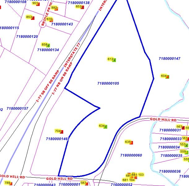
7180000147
Map Of Boundary Survey Of Parcel A & A P
Commercialnec
PARCEL A-1 (21.272AC), LESS 0.042AC GOLD HILL RD & I-77
AE
York
45091C0204F
South Carolina
2025
21.23 AC
2025
York County
061006
Charlotte
38,954 SF
Charlotte-Concord-Gastonia, NC-SC
DEMOGRAPHICS near 553 Cooper River Cir
1 Mile
3 Mile
5 Mile
2024 Total Population
5,617
53,069
135,057
2029 Population
6,359
59,480
149,417
Pop Growth 2024-2029
+ 13.21%
+ 12.08%
+ 10.63%
Average Age
41
38
38
2024 Total Households
2,208
19,822
51,810
HH Growth 2024-2029
+ 13.63%
+ 12.40%
+ 10.67%
Median Household Inc
$107,612
$96,884
$95,967
Avg Household Size
2.50
2.60
2.60
2024 Avg HH Vehicles
2.00
2.00
2.00
Median Home Value
$400,711
$363,269
$356,485
Median Year Built
2004
2007
2005
Nearby Places
Map Layers
Map Styles
 Street
 Aerial
- Restaurants
- Banks
- Shops
- Fitness
- Groceries
PUBLIC TRANSPORTATION
AIRPORT
Charlotte/Douglas International
DRIVE
WALK
Distance
Charlotte/Douglas International
25 min
13.2 mi
Concord-Padgett Regional
DRIVE
WALK
Distance
Concord-Padgett Regional
43 min
30.2 mi
Freight Ports
North Charleston Terminal
DRIVE
WALK
Distance
North Charleston Terminal
209 min
186.2 mi
Nearby Properties
Address
Land Use
TOTAL SIZE
Lot Size
Zoning
Address
Land Use
TOTAL SIZE
Lot Size
Zoning
252,275 SF
20.23 AC
Address
Land Use
TOTAL SIZE
Lot Size
Zoning
151,844 SF
11.65 AC
Address
Land Use
TOTAL SIZE
Lot Size
Zoning
363,238 SF
153.46 AC
Address
Land Use
TOTAL SIZE
Lot Size
Zoning
596,863 SF
41.28 AC
I-2
Address
Land Use
TOTAL SIZE
Lot Size
Zoning
36.84 AC
UD
Address
Land Use
TOTAL SIZE
Lot Size
Zoning
370,000 SF
59.74 AC
LI
Address
Land Use
TOTAL SIZE
Lot Size
Zoning
354,545 SF
36.49 AC
I-2
Address
Land Use
TOTAL SIZE
Lot Size
Zoning
91,440 SF
8.52 AC
Address
Land Use
TOTAL SIZE
Lot Size
Zoning
402,376 SF
25.97 AC
I-2
Address
Land Use
TOTAL SIZE
Lot Size
Zoning
401.79 AC
Address
Land Use
TOTAL SIZE
Lot Size
Zoning
84,163 SF
24.16 AC
I-2
Address
Land Use
TOTAL SIZE
Lot Size
Zoning
335.85 AC
AGC
Address
Land Use
TOTAL SIZE
Lot Size
Zoning
75,520 SF
14.31 AC
I-2
Address
Land Use
TOTAL SIZE
Lot Size
Zoning
152,286 SF
21.77 AC
LI
Address
Land Use
TOTAL SIZE
Lot Size
Zoning
45,720 SF
2.93 AC
Address
Land Use
TOTAL SIZE
Lot Size
Zoning
56,465 SF
19.27 AC
INST(CD)
Address
Land Use
TOTAL SIZE
Lot Size
Zoning
151,284 SF
11.76 AC
I-2
Address
Land Use
TOTAL SIZE
Lot Size
Zoning
60,024 SF
37 AC
INSTCD
Address
Land Use
TOTAL SIZE
Lot Size
Zoning
790,440 SF
53.19 AC
Address
Land Use
TOTAL SIZE
Lot Size
Zoning
2,476 SF
88.14 AC
Address
Land Use
TOTAL SIZE
Lot Size
Zoning
99,965 SF
13.93 AC
I-2
Address
Land Use
TOTAL SIZE
Lot Size
Zoning
162.78 AC
RCI
Address
Land Use
TOTAL SIZE
Lot Size
Zoning
132,320 SF
5.55 AC
I-2
Address
Land Use
TOTAL SIZE
Lot Size
Zoning
45,600 SF
5.50 AC
I-2
Address
Land Use
TOTAL SIZE
Lot Size
Zoning
105,500 SF
11.55 AC
I-1
Address
Land Use
TOTAL SIZE
Lot Size
Zoning
8,760 SF
223.51 AC
I2
Address
Land Use
TOTAL SIZE
Lot Size
Zoning
18,368 SF
2.41 AC
RMX
Address
Land Use
TOTAL SIZE
Lot Size
Zoning
197,864 SF
39.37 AC
Address
Land Use
TOTAL SIZE
Lot Size
Zoning
76,776 SF
8.70 AC
I-1
Address
Land Use
TOTAL SIZE
Lot Size
Zoning
22,860 SF
2.18 AC
The World's #1 Commercial Real Estate Marketplace
Connect with us
© 2025 CoStar Group
The information above has been obtained from sources believed reliable. While we do not doubt its accuracy we have not verified it and make no guarantee, warranty or representation about it. It is your responsibility to independently confirm its accuracy and completeness. Any projections, opinions, assumptions, or estimates used are for example only and do not represent the current or future performance of the property. The value of this transaction to you depends on tax and other factors which should be evaluated by your tax, financial, and legal advisors. You and your advisors should conduct a careful, independent investigation of the property to determine to your satisfaction the suitability of the property for your needs.