Property Record
553 Cross Keys Rd, Sicklerville, NJ 08081

Property Detail
553 Cross Keys Rd
Philadelphia-Camden-Wilmington, PA-NJ-DE-MD
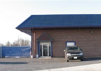
FACILITY NAME: VACANT LAND
15-18403-0000-00020
CAMDEN
Governmentalpublicusegeneral
New Jersey
B and X Area of moderate flood hazard, usually the area between the limits of the 100-year and 500-year floods.
20
0
11.94 AC
2025
South Camden County
608403
Philadelphia
NEARBY LISTINGS FOR SALE OR LEASE
DEMOGRAPHICS near 553 Cross Keys Rd
1 mile
3 mile
5 mile
2025 Total Population
8,293
64,815
153,804
2030 Population
8,475
66,433
157,589
Pop Growth 2025-2030
+ 2.19%
+ 2.50%
+ 2.46%
Average Age
39
41
40
2025 Total Households
2,643
23,511
57,053
HH Growth 2025-2030
+ 2.27%
+ 2.57%
+ 2.52%
Median Household Inc
$135,569
$97,221
$92,140
Avg Household Size
3.10
2.70
2.60
2025 Avg HH Vehicles
2.00
2.00
2.00
Median Home Value
$346,254
$299,673
$303,202
Median Year Built
1993
1987
1981
Nearby Places
Map Layers
Map Styles
 Street
 Aerial
Layers
 Traffic
 Biking
Places
Listings with unknown addresses are not visible on the map
- Restaurants
- Banks
- Shops
- Fitness
- Groceries
PUBLIC TRANSPORTATION
COMMUTER RAIL
Atco (Atlantic City Line - NJ Transit Commuter Rail (NJ Transit))
Drive
Walk
Distance
Atco (Atlantic City Line - NJ Transit Commuter Rail (NJ Transit))
12 min
8.0 mi
Lindenwold (Njt) (Atlantic City Line - NJ Transit Commuter Rail (NJ Transit))
Drive
Walk
Distance
Lindenwold (Njt) (Atlantic City Line - NJ Transit Commuter Rail (NJ Transit))
15 min
10.0 mi
AIRPORT
Philadelphia International
Drive
Walk
Distance
Philadelphia International
38 min
24.1 mi
Atlantic City International
Drive
Walk
Distance
Atlantic City International
62 min
35.6 mi
Freight Ports
Broadway Terminal - Pier 5
Drive
Walk
Distance
Broadway Terminal - Pier 5
22 min
15.6 mi
Nearby Properties
Address
Land Use
TOTAL SIZE
Lot Size
Zoning
Address
Land Use
TOTAL SIZE
Lot Size
Zoning
136.22 AC
Address
Land Use
TOTAL SIZE
Lot Size
Zoning
68.30 AC
Address
Land Use
TOTAL SIZE
Lot Size
Zoning
64.09 AC
HC
Address
Land Use
TOTAL SIZE
Lot Size
Zoning
38.92 AC
HC
Address
Land Use
TOTAL SIZE
Lot Size
Zoning
26.77 AC
HC
Address
Land Use
TOTAL SIZE
Lot Size
Zoning
14.07 AC
Address
Land Use
TOTAL SIZE
Lot Size
Zoning
18.02 AC
HC
Address
Land Use
TOTAL SIZE
Lot Size
Zoning
21.13 AC
H
Address
Land Use
TOTAL SIZE
Lot Size
Zoning
23.61 AC
SC
Address
Land Use
TOTAL SIZE
Lot Size
Zoning
1,796 SF
13.47 AC
Address
Land Use
TOTAL SIZE
Lot Size
Zoning
20.63 AC
C
Address
Land Use
TOTAL SIZE
Lot Size
Zoning
15.36 AC
Address
Land Use
TOTAL SIZE
Lot Size
Zoning
1,563 SF
32.90 AC
RL
Address
Land Use
TOTAL SIZE
Lot Size
Zoning
14.92 AC
HC
Address
Land Use
TOTAL SIZE
Lot Size
Zoning
8.34 AC
INS
Address
Land Use
TOTAL SIZE
Lot Size
Zoning
4.76 AC
Address
Land Use
TOTAL SIZE
Lot Size
Zoning
136,951 SF
18 AC
HC
Address
Land Use
TOTAL SIZE
Lot Size
Zoning
Address
Land Use
TOTAL SIZE
Lot Size
Zoning
13.69 AC
CC
Address
Land Use
TOTAL SIZE
Lot Size
Zoning
15.45 AC
HC
Address
Land Use
TOTAL SIZE
Lot Size
Zoning
19.86 AC
HC
Address
Land Use
TOTAL SIZE
Lot Size
Zoning
Address
Land Use
TOTAL SIZE
Lot Size
Zoning
12.78 AC
INS
Address
Land Use
TOTAL SIZE
Lot Size
Zoning
Address
Land Use
TOTAL SIZE
Lot Size
Zoning
15.60 AC
Address
Land Use
TOTAL SIZE
Lot Size
Zoning
12.66 AC
Address
Land Use
TOTAL SIZE
Lot Size
Zoning
19.22 AC
Address
Land Use
TOTAL SIZE
Lot Size
Zoning
7.08 AC
CM
Address
Land Use
TOTAL SIZE
Lot Size
Zoning
5.60 AC
Address
Land Use
TOTAL SIZE
Lot Size
Zoning
3.44 AC
RM
The World's #1 Commercial Real Estate Marketplace
Connect with us
© 2026 CoStar Group
The information above has been obtained from sources believed reliable. While we do not doubt its accuracy we have not verified it and make no guarantee, warranty or representation about it. It is your responsibility to independently confirm its accuracy and completeness. Any projections, opinions, assumptions, or estimates used are for example only and do not represent the current or future performance of the property. The value of this transaction to you depends on tax and other factors which should be evaluated by your tax, financial, and legal advisors. You and your advisors should conduct a careful, independent investigation of the property to determine to your satisfaction the suitability of the property for your needs.