Property Record
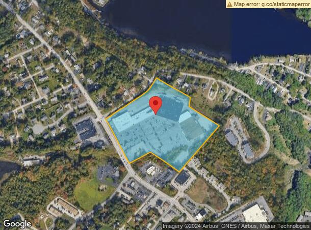
553 Mast Rd, Goffstown, NH 03045


NEARBY LISTINGS FOR SALE OR LEASE
Property Detail
553 Mast Rd
Regionalshoppingcenterormallwithanchorstore
Hillsborough
A
New Hampshire
33013C0670E
16.70 AC
2024
Hillsborough
2024
Boston
002802
Manchester-Nashua, NH
111,511 SF
18 58B
DEMOGRAPHICS near 553 Mast Rd
1 Mile
3 Mile
5 Mile
2024 Total Population
6,939
55,113
133,857
2029 Population
7,029
56,039
136,085
Pop Growth 2024-2029
+ 1.30%
+ 1.68%
+ 1.66%
Average Age
38
40
40
2024 Total Households
2,380
23,402
54,837
HH Growth 2024-2029
+ 1.68%
+ 1.82%
+ 1.73%
Median Household Inc
$75,646
$70,476
$75,135
Avg Household Size
2.30
2.10
2.30
2024 Avg HH Vehicles
2.00
2.00
2.00
Median Home Value
$259,708
$312,415
$329,932
Median Year Built
1975
1965
1969
Nearby Places
Map Layers
Map Styles
 Street
 Aerial
- Restaurants
- Banks
- Shops
- Fitness
- Groceries
PUBLIC TRANSPORTATION
AIRPORT
Manchester Boston Regional
DRIVE
WALK
Distance
Manchester Boston Regional
22 min
9.0 mi
Freight Ports
Port of Boston
DRIVE
WALK
Distance
Port of Boston
93 min
59.9 mi
SALE & LEASE HISTORY
LISTING DATE
SALE/LEASE

Sep 25, 2016
For Lease
Oct 25, 2017
For Lease
Oct 23, 2023
For Lease
Dec 19, 2023
For Lease
Nearby Properties
Address
Land Use
TOTAL SIZE
Lot Size
Zoning
Address
Land Use
TOTAL SIZE
Lot Size
Zoning
60,000 SF
144.50 AC
R2
Address
Land Use
TOTAL SIZE
Lot Size
Zoning
256,041 SF
6.69 AC
Address
Land Use
TOTAL SIZE
Lot Size
Zoning
250,905 SF
1.16 AC
Address
Land Use
TOTAL SIZE
Lot Size
Zoning
229,089 SF
3.58 AC
Address
Land Use
TOTAL SIZE
Lot Size
Zoning
135,879 SF
2.36 AC
Address
Land Use
TOTAL SIZE
Lot Size
Zoning
26,125 SF
150.66 AC
Address
Land Use
TOTAL SIZE
Lot Size
Zoning
43,576 SF
R2
Address
Land Use
TOTAL SIZE
Lot Size
Zoning
143,630 SF
57.86 AC
Address
Land Use
TOTAL SIZE
Lot Size
Zoning
16,464 SF
15.19 AC
Address
Land Use
TOTAL SIZE
Lot Size
Zoning
398,130 SF
1.68 AC
Address
Land Use
TOTAL SIZE
Lot Size
Zoning
221,144 SF
3.77 AC
Address
Land Use
TOTAL SIZE
Lot Size
Zoning
16,000 SF
58.17 AC
Address
Land Use
TOTAL SIZE
Lot Size
Zoning
44,878 SF
12.89 AC
CO
Address
Land Use
TOTAL SIZE
Lot Size
Zoning
181,610 SF
0.58 AC
Address
Land Use
TOTAL SIZE
Lot Size
Zoning
230,582 SF
0.31 AC
Address
Land Use
TOTAL SIZE
Lot Size
Zoning
148,880 SF
2.38 AC
Address
Land Use
TOTAL SIZE
Lot Size
Zoning
95,643 SF
16 AC
RA
Address
Land Use
TOTAL SIZE
Lot Size
Zoning
264,671 SF
4.04 AC
Address
Land Use
TOTAL SIZE
Lot Size
Zoning
42,795 SF
17.92 AC
Address
Land Use
TOTAL SIZE
Lot Size
Zoning
8,318 SF
8.71 AC
Address
Land Use
TOTAL SIZE
Lot Size
Zoning
515,760 SF
0.04 AC
Address
Land Use
TOTAL SIZE
Lot Size
Zoning
130,851 SF
2.07 AC
Address
Land Use
TOTAL SIZE
Lot Size
Zoning
106,164 SF
3.89 AC
Address
Land Use
TOTAL SIZE
Lot Size
Zoning
206,478 SF
3.91 AC
Address
Land Use
TOTAL SIZE
Lot Size
Zoning
50,954 SF
14.95 AC
R2
Address
Land Use
TOTAL SIZE
Lot Size
Zoning
138,175 SF
9 AC
CIFZ
Address
Land Use
TOTAL SIZE
Lot Size
Zoning
90,323 SF
0.92 AC
Address
Land Use
TOTAL SIZE
Lot Size
Zoning
8,530 SF
26.33 AC
Address
Land Use
TOTAL SIZE
Lot Size
Zoning
27,450 SF
9.10 AC
Address
Land Use
TOTAL SIZE
Lot Size
Zoning
121,464 SF
60.30 AC
A
The World's #1 Commercial Real Estate Marketplace
Connect with us
© 2025 CoStar Group
The information above has been obtained from sources believed reliable. While we do not doubt its accuracy we have not verified it and make no guarantee, warranty or representation about it. It is your responsibility to independently confirm its accuracy and completeness. Any projections, opinions, assumptions, or estimates used are for example only and do not represent the current or future performance of the property. The value of this transaction to you depends on tax and other factors which should be evaluated by your tax, financial, and legal advisors. You and your advisors should conduct a careful, independent investigation of the property to determine to your satisfaction the suitability of the property for your needs.