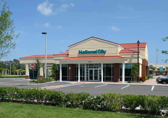
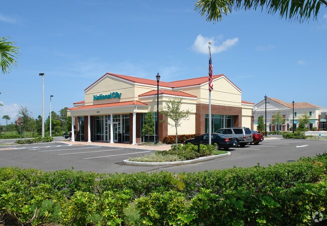
Property Record
5535 N Wickham Rd, Melbourne, FL 32940

NEARBY LISTINGS FOR SALE OR LEASE
Property Detail
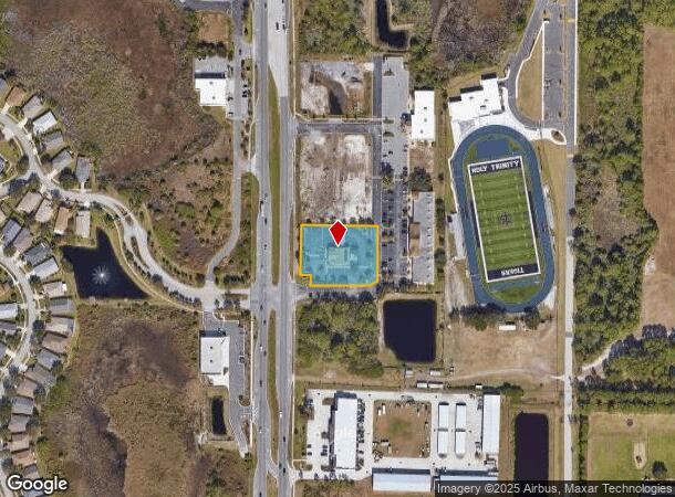
5535 N Wickham Rd
Palm Bay-Melbourne-Titusville, FL
Crossroads Village
26-37-30-26-00000.0-0002.00
CROSSROADS VILLAGE LOT 2
Financialbuilding
Brevard
A
Florida
12009C0510H
2
2024
0.99 AC
2025
Brevard County
064127
Orlando
4,390 SF
DEMOGRAPHICS near 5535 N Wickham Rd
1 Mile
3 Mile
5 Mile
2024 Total Population
4,884
34,687
103,268
2029 Population
5,264
37,798
113,273
Pop Growth 2024-2029
+ 7.78%
+ 8.97%
+ 9.69%
Average Age
47
47
45
2024 Total Households
1,953
14,790
43,748
HH Growth 2024-2029
+ 7.68%
+ 8.86%
+ 9.34%
Median Household Inc
$111,820
$87,125
$83,105
Avg Household Size
2.50
2.30
2.30
2024 Avg HH Vehicles
2.00
2.00
2.00
Median Home Value
$375,174
$343,642
$339,421
Median Year Built
1997
1993
1991
Nearby Places
Map Layers
Map Styles
 Street
 Aerial
- Restaurants
- Banks
- Shops
- Fitness
- Groceries
PUBLIC TRANSPORTATION
AIRPORT
Melbourne Orlando International
DRIVE
WALK
Distance
Melbourne Orlando International
22 min
9.9 mi
Freight Ports
Port Canaveral
DRIVE
WALK
Distance
Port Canaveral
35 min
18.8 mi
Nearby Properties
Address
Land Use
TOTAL SIZE
Lot Size
Zoning
Address
Land Use
TOTAL SIZE
Lot Size
Zoning
676,548 SF
117.62 AC
I1
Address
Land Use
TOTAL SIZE
Lot Size
Zoning
438,381 SF
25.66 AC
R2
Address
Land Use
TOTAL SIZE
Lot Size
Zoning
354,864 SF
26.76 AC
PIP
Address
Land Use
TOTAL SIZE
Lot Size
Zoning
406,986 SF
30.50 AC
PUD
Address
Land Use
TOTAL SIZE
Lot Size
Zoning
360,921 SF
85.76 AC
R2
Address
Land Use
TOTAL SIZE
Lot Size
Zoning
269,541 SF
17.80 AC
PUD
Address
Land Use
TOTAL SIZE
Lot Size
Zoning
216,446 SF
14.09 AC
R2
Address
Land Use
TOTAL SIZE
Lot Size
Zoning
188,093 SF
13.11 AC
R2
Address
Land Use
TOTAL SIZE
Lot Size
Zoning
227,172 SF
26.78 AC
BU1
Address
Land Use
TOTAL SIZE
Lot Size
Zoning
132,340 SF
14.58 AC
R2
Address
Land Use
TOTAL SIZE
Lot Size
Zoning
113,498 SF
37.57 AC
PUD
Address
Land Use
TOTAL SIZE
Lot Size
Zoning
133,137 SF
10.59 AC
PUD
Address
Land Use
TOTAL SIZE
Lot Size
Zoning
102,972 SF
18 AC
R2(6)
Address
Land Use
TOTAL SIZE
Lot Size
Zoning
162,629 SF
16.90 AC
Address
Land Use
TOTAL SIZE
Lot Size
Zoning
97,430 SF
51.89 AC
BU1
Address
Land Use
TOTAL SIZE
Lot Size
Zoning
87,681 SF
11.53 AC
I1
Address
Land Use
TOTAL SIZE
Lot Size
Zoning
83,420 SF
5.94 AC
PUD
Address
Land Use
TOTAL SIZE
Lot Size
Zoning
91,470 SF
3.01 AC
BU1
Address
Land Use
TOTAL SIZE
Lot Size
Zoning
54,114 SF
11.48 AC
Address
Land Use
TOTAL SIZE
Lot Size
Zoning
120,600 SF
2.76 AC
Address
Land Use
TOTAL SIZE
Lot Size
Zoning
222,414 SF
13.13 AC
BU1
Address
Land Use
TOTAL SIZE
Lot Size
Zoning
82,494 SF
11.49 AC
BU1
Address
Land Use
TOTAL SIZE
Lot Size
Zoning
67,313 SF
335.11 AC
PUD
Address
Land Use
TOTAL SIZE
Lot Size
Zoning
168,229 SF
20.36 AC
BU1/BU2
Address
Land Use
TOTAL SIZE
Lot Size
Zoning
73,100 SF
5.67 AC
C2
Address
Land Use
TOTAL SIZE
Lot Size
Zoning
128,415 SF
9.98 AC
BU2
Address
Land Use
TOTAL SIZE
Lot Size
Zoning
1.10 AC
BU-1
Address
Land Use
TOTAL SIZE
Lot Size
Zoning
62,431 SF
16.51 AC
BU-1
Address
Land Use
TOTAL SIZE
Lot Size
Zoning
94,217 SF
9.74 AC
PUD
Address
Land Use
TOTAL SIZE
Lot Size
Zoning
113,029 SF
8.53 AC
R2
The World's #1 Commercial Real Estate Marketplace
Connect with us
© 2025 CoStar Group
The information above has been obtained from sources believed reliable. While we do not doubt its accuracy we have not verified it and make no guarantee, warranty or representation about it. It is your responsibility to independently confirm its accuracy and completeness. Any projections, opinions, assumptions, or estimates used are for example only and do not represent the current or future performance of the property. The value of this transaction to you depends on tax and other factors which should be evaluated by your tax, financial, and legal advisors. You and your advisors should conduct a careful, independent investigation of the property to determine to your satisfaction the suitability of the property for your needs.