Property Record
5536 Platt Springs Rd, Lexington, SC 29073
NEARBY LISTINGS FOR SALE OR LEASE
Property Detail
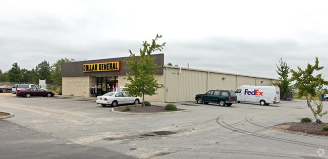
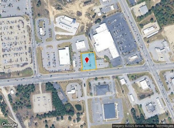
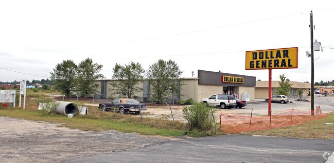
5536 Platt Springs Rd
007600-04-116
157X215 DOLLAR GENERAL
Storebuilding
Lexington
X
South Carolina
45063C0261J
0.78 AC
2025
Lexington
2024
Columbia
021035
Columbia, SC
9,040 SF
DEMOGRAPHICS near 5536 Platt Springs Rd
1 Mile
3 Mile
5 Mile
2024 Total Population
5,453
26,460
63,595
2029 Population
6,069
29,104
69,627
Pop Growth 2024-2029
+ 11.30%
+ 9.99%
+ 9.49%
Average Age
34
36
38
2024 Total Households
1,929
9,723
23,953
HH Growth 2024-2029
+ 11.46%
+ 10.15%
+ 9.66%
Median Household Inc
$64,772
$65,987
$68,789
Avg Household Size
2.80
2.70
2.60
2024 Avg HH Vehicles
2.00
2.00
2.00
Median Home Value
$193,070
$172,150
$179,375
Median Year Built
2008
2000
1999
Nearby Places
Map Layers
Map Styles
 Street
 Aerial
- Restaurants
- Banks
- Shops
- Fitness
- Groceries
PUBLIC TRANSPORTATION
AIRPORT
Columbia Metro
DRIVE
WALK
Distance
Columbia Metro
20 min
7.7 mi
Nearby Properties
Address
Land Use
TOTAL SIZE
Lot Size
Zoning
Address
Land Use
TOTAL SIZE
Lot Size
Zoning
219,967 SF
23.37 AC
ID
Address
Land Use
TOTAL SIZE
Lot Size
Zoning
139,481 SF
15.48 AC
ID
Address
Land Use
TOTAL SIZE
Lot Size
Zoning
54,540 SF
15.22 AC
RD
Address
Land Use
TOTAL SIZE
Lot Size
Zoning
15,541 SF
2.04 AC
ID
Address
Land Use
TOTAL SIZE
Lot Size
Zoning
54,747 SF
5.70 AC
ID
Address
Land Use
TOTAL SIZE
Lot Size
Zoning
13,640 SF
4 AC
ID
Address
Land Use
TOTAL SIZE
Lot Size
Zoning
17,087 SF
2.60 AC
RD
Address
Land Use
TOTAL SIZE
Lot Size
Zoning
1,200 SF
7.16 AC
ID
Address
Land Use
TOTAL SIZE
Lot Size
Zoning
2,265 SF
2.05 AC
RD
Address
Land Use
TOTAL SIZE
Lot Size
Zoning
21,360 SF
2.82 AC
RD
Address
Land Use
TOTAL SIZE
Lot Size
Zoning
7,227 SF
1.03 AC
RD
Address
Land Use
TOTAL SIZE
Lot Size
Zoning
20.21 AC
RD
Address
Land Use
TOTAL SIZE
Lot Size
Zoning
5,355 SF
4.93 AC
ID
Address
Land Use
TOTAL SIZE
Lot Size
Zoning
1,800 SF
1.30 AC
ID
Address
Land Use
TOTAL SIZE
Lot Size
Zoning
10,640 SF
1.47 AC
RD
Address
Land Use
TOTAL SIZE
Lot Size
Zoning
6,226 SF
2.26 AC
RD
Address
Land Use
TOTAL SIZE
Lot Size
Zoning
3,318 SF
0.68 AC
Address
Land Use
TOTAL SIZE
Lot Size
Zoning
12,704 SF
3.60 AC
RD
Address
Land Use
TOTAL SIZE
Lot Size
Zoning
1,771 SF
6 AC
ID
Address
Land Use
TOTAL SIZE
Lot Size
Zoning
40,345 SF
5.50 AC
RD
Address
Land Use
TOTAL SIZE
Lot Size
Zoning
7,200 SF
1.04 AC
RD
Address
Land Use
TOTAL SIZE
Lot Size
Zoning
10,080 SF
8 AC
RD
Address
Land Use
TOTAL SIZE
Lot Size
Zoning
3,897 SF
1.60 AC
RD
Address
Land Use
TOTAL SIZE
Lot Size
Zoning
1,998 SF
1.25 AC
Address
Land Use
TOTAL SIZE
Lot Size
Zoning
14,640 SF
1.98 AC
Address
Land Use
TOTAL SIZE
Lot Size
Zoning
4,680 SF
1.77 AC
RD
Address
Land Use
TOTAL SIZE
Lot Size
Zoning
4,248 SF
1.24 AC
Address
Land Use
TOTAL SIZE
Lot Size
Zoning
3,800 SF
14.73 AC
RD
Address
Land Use
TOTAL SIZE
Lot Size
Zoning
2,790 SF
1.52 AC
ID
Address
Land Use
TOTAL SIZE
Lot Size
Zoning
6,480 SF
1.17 AC
RD
The World's #1 Commercial Real Estate Marketplace
Connect with us
© 2026 CoStar Group
The information above has been obtained from sources believed reliable. While we do not doubt its accuracy we have not verified it and make no guarantee, warranty or representation about it. It is your responsibility to independently confirm its accuracy and completeness. Any projections, opinions, assumptions, or estimates used are for example only and do not represent the current or future performance of the property. The value of this transaction to you depends on tax and other factors which should be evaluated by your tax, financial, and legal advisors. You and your advisors should conduct a careful, independent investigation of the property to determine to your satisfaction the suitability of the property for your needs.