Property Record
5539 Carolina Beach Rd, Wilmington, NC 28412
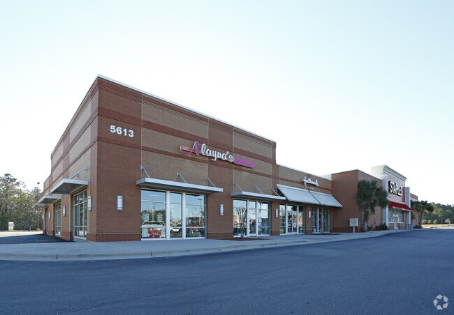

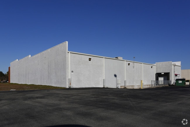

Property Detail
5539 Carolina Beach Rd
R07614-001-010-000
MYRTLE GROVE SHOPPING DIV
Stripcommercialcenter
New Hanover
B-2,BUSINE
North Carolina
B and X Area of moderate flood hazard, usually the area between the limits of the 100-year and 500-year floods.
10
2025
19.68 AC
2025
Monkey Junction
012110
Wilmington
7,320 SF
Wilmington, NC
NEARBY LISTINGS FOR SALE OR LEASE
DEMOGRAPHICS near 5539 Carolina Beach Rd
1 mile
3 mile
5 mile
2025 Total Population
6,273
46,129
79,034
2030 Population
6,579
48,568
83,151
Pop Growth 2025-2030
+ 4.88%
+ 5.29%
+ 5.21%
Average Age
43
42
43
2025 Total Households
2,496
19,572
33,672
HH Growth 2025-2030
+ 4.85%
+ 5.38%
+ 5.33%
Median Household Inc
$96,528
$87,646
$83,224
Avg Household Size
2.40
2.30
2.30
2025 Avg HH Vehicles
2.00
2.00
2.00
Median Home Value
$384,712
$386,083
$391,509
Median Year Built
2001
1998
1996
Nearby Places
Map Layers
Map Styles
 Street
 Aerial
Layers
 Traffic
 Biking
Places
Listings with unknown addresses are not visible on the map
- Restaurants
- Banks
- Shops
- Fitness
- Groceries
PUBLIC TRANSPORTATION
AIRPORT
Wilmington International
Drive
Walk
Distance
Wilmington International
29 min
14.6 mi
Nearby Properties
Address
Land Use
TOTAL SIZE
Lot Size
Zoning
Address
Land Use
TOTAL SIZE
Lot Size
Zoning
116,271 SF
199.82 AC
R-15,RESID
Address
Land Use
TOTAL SIZE
Lot Size
Zoning
49,980 SF
48.54 AC
EDZD
Address
Land Use
TOTAL SIZE
Lot Size
Zoning
126,336 SF
14.54 AC
MD-17
Address
Land Use
TOTAL SIZE
Lot Size
Zoning
1,152 SF
21.73 AC
MX
Address
Land Use
TOTAL SIZE
Lot Size
Zoning
41,076 SF
5.29 AC
MX
Address
Land Use
TOTAL SIZE
Lot Size
Zoning
41,118 SF
4.05 AC
MX
Address
Land Use
TOTAL SIZE
Lot Size
Zoning
1,646 SF
48.98 AC
R-15,RESID
Address
Land Use
TOTAL SIZE
Lot Size
Zoning
39,866 SF
15.89 AC
R-15,RESID
Address
Land Use
TOTAL SIZE
Lot Size
Zoning
120,825 SF
22.34 AC
B-2,BUSINE
Address
Land Use
TOTAL SIZE
Lot Size
Zoning
79,920 SF
9.59 AC
MD-17
Address
Land Use
TOTAL SIZE
Lot Size
Zoning
3,190 SF
59.66 AC
R-15,RESID
Address
Land Use
TOTAL SIZE
Lot Size
Zoning
100,430 SF
25.96 AC
R-15,RESID
Address
Land Use
TOTAL SIZE
Lot Size
Zoning
1,872 SF
1.23 AC
I-1,INDUST
Address
Land Use
TOTAL SIZE
Lot Size
Zoning
206,988 SF
24.80 AC
B-2,BUSINE
Address
Land Use
TOTAL SIZE
Lot Size
Zoning
70,845 SF
3.86 AC
R-15,RESID
Address
Land Use
TOTAL SIZE
Lot Size
Zoning
25,550 SF
7.08 AC
B-2,BUSINE
Address
Land Use
TOTAL SIZE
Lot Size
Zoning
81,330 SF
15.02 AC
O&I,OFFICE
Address
Land Use
TOTAL SIZE
Lot Size
Zoning
16,000 SF
10.04 AC
B-2,BUSINE
Address
Land Use
TOTAL SIZE
Lot Size
Zoning
65,689 SF
10.12 AC
B-1,BUSINE
Address
Land Use
TOTAL SIZE
Lot Size
Zoning
17,860 SF
7.48 AC
B-2,BUSINE
Address
Land Use
TOTAL SIZE
Lot Size
Zoning
135,802 SF
19.37 AC
B-2,BUSINE
Address
Land Use
TOTAL SIZE
Lot Size
Zoning
1,816 SF
2.56 AC
R-15,RESID
Address
Land Use
TOTAL SIZE
Lot Size
Zoning
19,560 SF
10.98 AC
R-15,RESID
Address
Land Use
TOTAL SIZE
Lot Size
Zoning
44,767 SF
7.49 AC
R-15,RESID
Address
Land Use
TOTAL SIZE
Lot Size
Zoning
100,491 SF
4.48 AC
B-2,BUSINE
Address
Land Use
TOTAL SIZE
Lot Size
Zoning
49,468 SF
24.96 AC
R-15,RESID
Address
Land Use
TOTAL SIZE
Lot Size
Zoning
23,000 SF
3.76 AC
CB,COMMUNI
Address
Land Use
TOTAL SIZE
Lot Size
Zoning
54,310 SF
6.97 AC
CB,COMMUNI
Address
Land Use
TOTAL SIZE
Lot Size
Zoning
26.29 AC
MX
The World's #1 Commercial Real Estate Marketplace
Connect with us
© 2026 CoStar Group
The information above has been obtained from sources believed reliable. While we do not doubt its accuracy we have not verified it and make no guarantee, warranty or representation about it. It is your responsibility to independently confirm its accuracy and completeness. Any projections, opinions, assumptions, or estimates used are for example only and do not represent the current or future performance of the property. The value of this transaction to you depends on tax and other factors which should be evaluated by your tax, financial, and legal advisors. You and your advisors should conduct a careful, independent investigation of the property to determine to your satisfaction the suitability of the property for your needs.