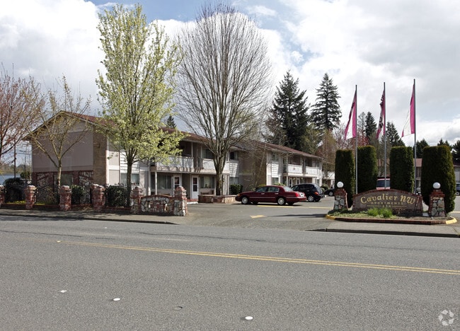
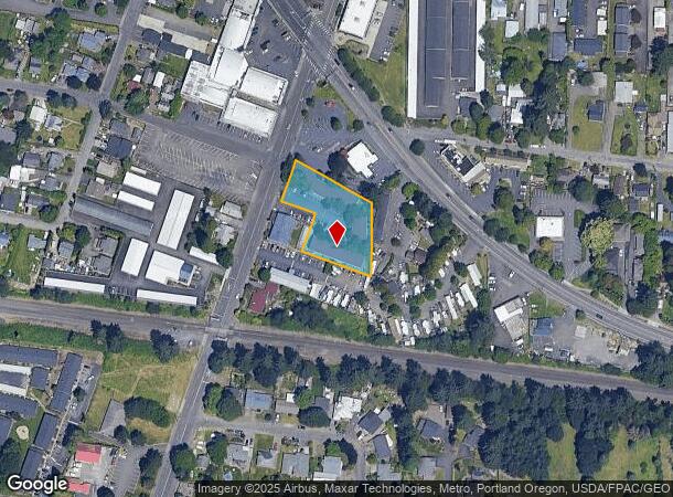
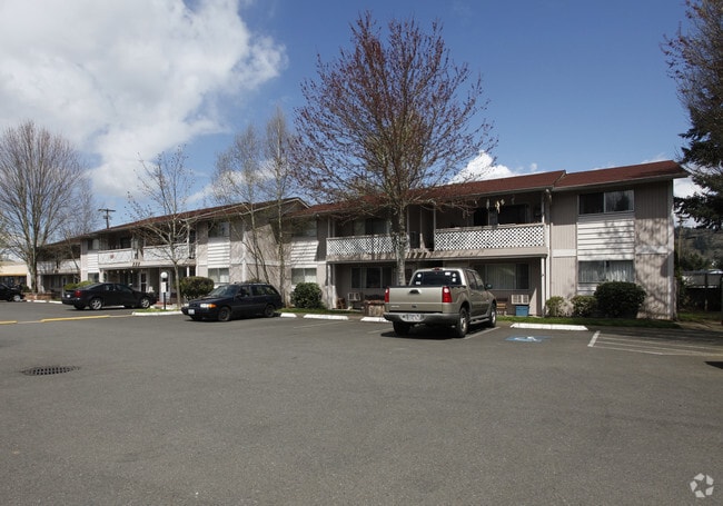
Property Record
554 6Th St, Washougal, WA 98671
NEARBY LISTINGS FOR SALE OR LEASE
Property Detail
554 6Th St
Portland-Vancouver-Hillsboro, OR-WA
Midland Acres;Weir Park
076515-010
WEIR PARK LOT 4 & #1 LOTS 1,2,3,4 & 6 BLK 6 FOR ASSESSOR USE ONLY EXC #2 LOTS 1 3 BLK 6 SUBJ TO EAS PER DD 636581
Multifamilydwelling
Clark
X
Washington
41051C0228J
4,1-3
2025
0.94 AC
2025
Downtown Washougal
040509
Portland
34,120 SF
DEMOGRAPHICS near 554 6Th St
1 Mile
3 Mile
5 Mile
2024 Total Population
7,608
31,558
81,653
2029 Population
8,210
34,031
84,961
Pop Growth 2024-2029
+ 7.91%
+ 7.84%
+ 4.05%
Average Age
40
40
40
2024 Total Households
2,956
11,417
28,815
HH Growth 2024-2029
+ 7.98%
+ 7.93%
+ 3.99%
Median Household Inc
$83,309
$96,322
$94,716
Avg Household Size
2.60
2.70
2.80
2024 Avg HH Vehicles
2.00
2.00
2.00
Median Home Value
$497,180
$499,303
$474,315
Median Year Built
1993
1995
1993
Nearby Places
Map Layers
Map Styles
 Street
 Aerial
- Restaurants
- Banks
- Shops
- Fitness
- Groceries
PUBLIC TRANSPORTATION
AIRPORT
Portland International
DRIVE
WALK
Distance
Portland International
25 min
14.9 mi
Freight Ports
Port of Portland
DRIVE
WALK
Distance
Port of Portland
35 min
23.9 mi
Nearby Properties
Address
Land Use
TOTAL SIZE
Lot Size
Zoning
Address
Land Use
TOTAL SIZE
Lot Size
Zoning
1,500,000 SF
189.27 AC
HI
Address
Land Use
TOTAL SIZE
Lot Size
Zoning
Address
Land Use
TOTAL SIZE
Lot Size
Zoning
478,472 SF
77.86 AC
GI
Address
Land Use
TOTAL SIZE
Lot Size
Zoning
255,683 SF
32.06 AC
R-7.5
Address
Land Use
TOTAL SIZE
Lot Size
Zoning
857,470 SF
73.72 AC
GI
Address
Land Use
TOTAL SIZE
Lot Size
Zoning
262,320 SF
25.24 AC
IP
Address
Land Use
TOTAL SIZE
Lot Size
Zoning
14,059 SF
12.83 AC
GI
Address
Land Use
TOTAL SIZE
Lot Size
Zoning
224,500 SF
12.30 AC
R-7.5
Address
Land Use
TOTAL SIZE
Lot Size
Zoning
123,157 SF
24.23 AC
GR 5
Address
Land Use
TOTAL SIZE
Lot Size
Zoning
114,696 SF
2.29 AC
MF-18
Address
Land Use
TOTAL SIZE
Lot Size
Zoning
156,393 SF
5.82 AC
GC
Address
Land Use
TOTAL SIZE
Lot Size
Zoning
142,571 SF
1.73 AC
TC-C
Address
Land Use
TOTAL SIZE
Lot Size
Zoning
Address
Land Use
TOTAL SIZE
Lot Size
Zoning
349,080 SF
18.69 AC
GI
Address
Land Use
TOTAL SIZE
Lot Size
Zoning
65,604 SF
11.35 AC
R-7.5
Address
Land Use
TOTAL SIZE
Lot Size
Zoning
Address
Land Use
TOTAL SIZE
Lot Size
Zoning
4,490 SF
75.54 AC
GI
Address
Land Use
TOTAL SIZE
Lot Size
Zoning
85,150 SF
16.32 AC
R-7.5
Address
Land Use
TOTAL SIZE
Lot Size
Zoning
83,139 SF
7.36 AC
HI
Address
Land Use
TOTAL SIZE
Lot Size
Zoning
98,577 SF
7.28 AC
GI
Address
Land Use
TOTAL SIZE
Lot Size
Zoning
256,888 SF
18.91 AC
TC-C
Address
Land Use
TOTAL SIZE
Lot Size
Zoning
52,631 SF
3.04 AC
MF-10
Address
Land Use
TOTAL SIZE
Lot Size
Zoning
44.82 AC
SU
Address
Land Use
TOTAL SIZE
Lot Size
Zoning
108,108 SF
5.35 AC
IP
Address
Land Use
TOTAL SIZE
Lot Size
Zoning
64,400 SF
3.30 AC
MF-18
Address
Land Use
TOTAL SIZE
Lot Size
Zoning
10,000 SF
13.63 AC
R-7.5
Address
Land Use
TOTAL SIZE
Lot Size
Zoning
75,360 SF
4.46 AC
RC
Address
Land Use
TOTAL SIZE
Lot Size
Zoning
51,600 SF
2.35 AC
AR-16
Address
Land Use
TOTAL SIZE
Lot Size
Zoning
68,130 SF
9.19 AC
R-7.5
The World's #1 Commercial Real Estate Marketplace
Connect with us
© 2026 CoStar Group
The information above has been obtained from sources believed reliable. While we do not doubt its accuracy we have not verified it and make no guarantee, warranty or representation about it. It is your responsibility to independently confirm its accuracy and completeness. Any projections, opinions, assumptions, or estimates used are for example only and do not represent the current or future performance of the property. The value of this transaction to you depends on tax and other factors which should be evaluated by your tax, financial, and legal advisors. You and your advisors should conduct a careful, independent investigation of the property to determine to your satisfaction the suitability of the property for your needs.