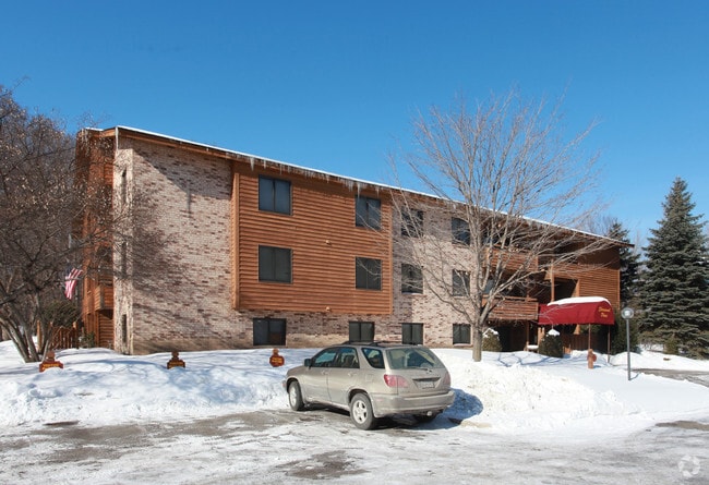
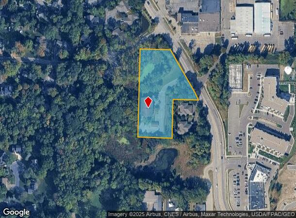
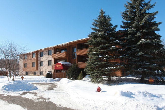
Property Record
5540 Co Rd N, Excelsior, MN 55331
NEARBY LISTINGS FOR SALE OR LEASE
Property Detail
5540 Co Rd N
Minneapolis-St. Paul-Bloomington, MN-WI
Manitou Glen
33-117-23-12-0031
LOT 024 A MANITOU GLEN COM AT SW COR OF LOT 23 TH N TO NW COR THEREOF TH E PAR WITH S LINE OF LOTS 23 AND 24 TO E LINE OF LOT 24 TH SELY ALONG SAID E LINE TO A PT T IRREGULAR
Apartment
Hennepin
X
Minnesota
27019C0114D
24
2024
2.69 AC
2024
Outlying Hennepin Far Western Suburbs
027503
Minneapolis/St Paul
DEMOGRAPHICS near 5540 Co Rd N
1 Mile
3 Mile
5 Mile
2024 Total Population
4,204
27,833
81,467
2029 Population
4,245
28,590
83,285
Pop Growth 2024-2029
+ 0.98%
+ 2.72%
+ 2.23%
Average Age
44
43
43
2024 Total Households
1,615
10,861
31,850
HH Growth 2024-2029
+ 0.93%
+ 2.46%
+ 2.12%
Median Household Inc
$122,713
$131,688
$122,095
Avg Household Size
2.60
2.50
2.50
2024 Avg HH Vehicles
2.00
2.00
2.00
Median Home Value
$694,444
$677,277
$488,570
Median Year Built
1983
1985
1983
Nearby Places
Map Layers
Map Styles
 Street
 Aerial
- Restaurants
- Banks
- Shops
- Fitness
- Groceries
PUBLIC TRANSPORTATION
AIRPORT
Minneapolis-St Paul International/Wold-Chamberlain
DRIVE
WALK
Distance
Minneapolis-St Paul International/Wold-Chamberlain
34 min
23.6 mi
Freight Ports
Port Milwaukee
DRIVE
WALK
Distance
Port Milwaukee
402 min
357.4 mi
Nearby Properties
Address
Land Use
TOTAL SIZE
Lot Size
Zoning
Address
Land Use
TOTAL SIZE
Lot Size
Zoning
4.32 AC
Address
Land Use
TOTAL SIZE
Lot Size
Zoning
55,208 SF
49.75 AC
Address
Land Use
TOTAL SIZE
Lot Size
Zoning
122,807 SF
30.62 AC
Address
Land Use
TOTAL SIZE
Lot Size
Zoning
3.82 AC
Address
Land Use
TOTAL SIZE
Lot Size
Zoning
1.85 AC
Address
Land Use
TOTAL SIZE
Lot Size
Zoning
21.72 AC
Address
Land Use
TOTAL SIZE
Lot Size
Zoning
94,387 SF
14.77 AC
Address
Land Use
TOTAL SIZE
Lot Size
Zoning
Address
Land Use
TOTAL SIZE
Lot Size
Zoning
35,745 SF
5.78 AC
Address
Land Use
TOTAL SIZE
Lot Size
Zoning
Address
Land Use
TOTAL SIZE
Lot Size
Zoning
67,386 SF
10.62 AC
Address
Land Use
TOTAL SIZE
Lot Size
Zoning
1,200 SF
62.14 AC
Address
Land Use
TOTAL SIZE
Lot Size
Zoning
Address
Land Use
TOTAL SIZE
Lot Size
Zoning
1.67 AC
Address
Land Use
TOTAL SIZE
Lot Size
Zoning
113,602 SF
9.16 AC
Address
Land Use
TOTAL SIZE
Lot Size
Zoning
6.52 AC
Address
Land Use
TOTAL SIZE
Lot Size
Zoning
3.20 AC
Address
Land Use
TOTAL SIZE
Lot Size
Zoning
5.68 AC
Address
Land Use
TOTAL SIZE
Lot Size
Zoning
2.10 AC
Address
Land Use
TOTAL SIZE
Lot Size
Zoning
Address
Land Use
TOTAL SIZE
Lot Size
Zoning
5,496 SF
52.15 AC
Address
Land Use
TOTAL SIZE
Lot Size
Zoning
2.54 AC
Address
Land Use
TOTAL SIZE
Lot Size
Zoning
0.91 AC
Address
Land Use
TOTAL SIZE
Lot Size
Zoning
8.08 AC
Address
Land Use
TOTAL SIZE
Lot Size
Zoning
15,315 SF
3.20 AC
Address
Land Use
TOTAL SIZE
Lot Size
Zoning
16,525 SF
3.12 AC
Address
Land Use
TOTAL SIZE
Lot Size
Zoning
2.03 AC
Address
Land Use
TOTAL SIZE
Lot Size
Zoning
0.19 AC
Address
Land Use
TOTAL SIZE
Lot Size
Zoning
Address
Land Use
TOTAL SIZE
Lot Size
Zoning
2.53 AC
The World's #1 Commercial Real Estate Marketplace
Connect with us
© 2025 CoStar Group
The information above has been obtained from sources believed reliable. While we do not doubt its accuracy we have not verified it and make no guarantee, warranty or representation about it. It is your responsibility to independently confirm its accuracy and completeness. Any projections, opinions, assumptions, or estimates used are for example only and do not represent the current or future performance of the property. The value of this transaction to you depends on tax and other factors which should be evaluated by your tax, financial, and legal advisors. You and your advisors should conduct a careful, independent investigation of the property to determine to your satisfaction the suitability of the property for your needs.