Property Record
27510 Bermont Rd, Punta Gorda, FL 33982
NEARBY LISTINGS FOR SALE OR LEASE
Property Detail
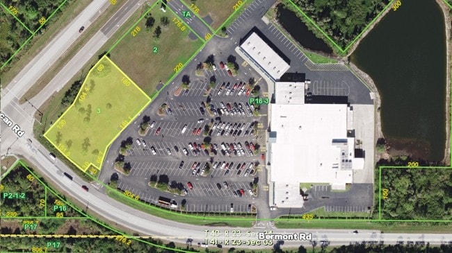
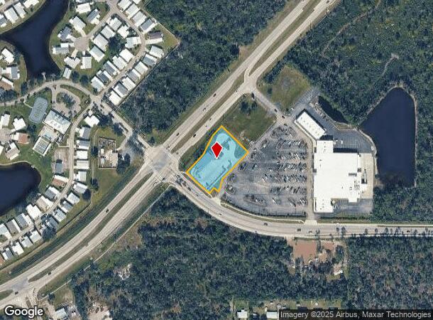
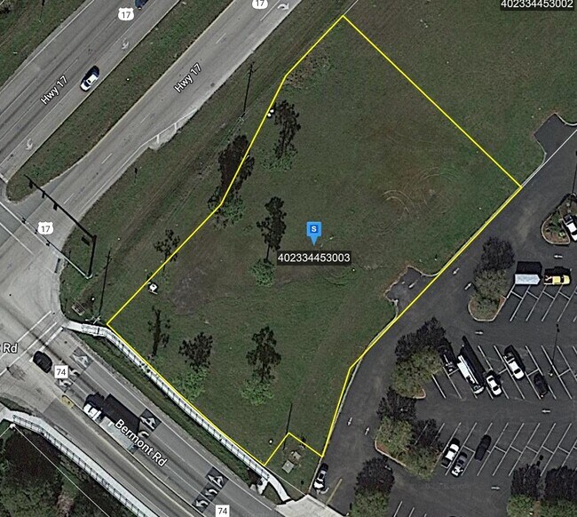
27510 Bermont Rd
Punta Gorda, FL
Cleveland Marketplace.
402334453003
CLEVELAND MARKETPLACE LT 3 1.06 AC. 4480/488 5041/141 E3346578 3346741 E3372343
Vehiclerentalsvehiclesales
Charlotte
AE
Florida
12015C0234G
3
2024
1.06 AC
2025
Charlotte County
010200
Southwest Florida
4,084 SF
DEMOGRAPHICS near 27510 Bermont Rd
1 Mile
3 Mile
5 Mile
2024 Total Population
2,443
11,582
49,972
2029 Population
2,937
14,008
60,294
Pop Growth 2024-2029
+ 20.22%
+ 20.95%
+ 20.66%
Average Age
53
48
54
2024 Total Households
1,130
5,313
23,719
HH Growth 2024-2029
+ 20.44%
+ 21.17%
+ 20.96%
Median Household Inc
$41,127
$39,176
$53,371
Avg Household Size
2.10
2.10
2.00
2024 Avg HH Vehicles
2.00
2.00
2.00
Median Home Value
$173,097
$198,835
$253,517
Median Year Built
1991
1992
1992
Nearby Places
Map Layers
Map Styles
 Street
 Aerial
- Restaurants
- Banks
- Shops
- Fitness
- Groceries
PUBLIC TRANSPORTATION
AIRPORT
Punta Gorda
DRIVE
WALK
Distance
Punta Gorda
8 min
3.8 mi
Southwest Florida International
DRIVE
WALK
Distance
Southwest Florida International
47 min
38.3 mi
SALE & LEASE HISTORY
LISTING DATE
SALE/LEASE

Nov 16, 2017
For Sale
Nearby Properties
Address
Land Use
TOTAL SIZE
Lot Size
Zoning
Address
Land Use
TOTAL SIZE
Lot Size
Zoning
349,844 SF
78.47 AC
P
Address
Land Use
TOTAL SIZE
Lot Size
Zoning
164,121 SF
44.20 AC
ECAP
Address
Land Use
TOTAL SIZE
Lot Size
Zoning
77,154 SF
10.30 AC
CC
Address
Land Use
TOTAL SIZE
Lot Size
Zoning
161,439 SF
171 AC
RE1
Address
Land Use
TOTAL SIZE
Lot Size
Zoning
121,585 SF
696.03 AC
RE1
Address
Land Use
TOTAL SIZE
Lot Size
Zoning
345,043 SF
33.12 AC
ECAP
Address
Land Use
TOTAL SIZE
Lot Size
Zoning
254.31 AC
PD
Address
Land Use
TOTAL SIZE
Lot Size
Zoning
62,415 SF
281.65 AC
ECAP
Address
Land Use
TOTAL SIZE
Lot Size
Zoning
15,253 SF
13.27 AC
P
Address
Land Use
TOTAL SIZE
Lot Size
Zoning
208,560 SF
36.69 AC
PD-GM
Address
Land Use
TOTAL SIZE
Lot Size
Zoning
385,350 SF
374.81 AC
ECAP
Address
Land Use
TOTAL SIZE
Lot Size
Zoning
134,308 SF
16 AC
RSF3.5
Address
Land Use
TOTAL SIZE
Lot Size
Zoning
125.54 AC
PD
Address
Land Use
TOTAL SIZE
Lot Size
Zoning
24,880 SF
84.50 AC
PKR
Address
Land Use
TOTAL SIZE
Lot Size
Zoning
30,940 SF
0.42 AC
NC
Address
Land Use
TOTAL SIZE
Lot Size
Zoning
116,186 SF
20.02 AC
RMF10
Address
Land Use
TOTAL SIZE
Lot Size
Zoning
181,137 SF
12.34 AC
NR-15
Address
Land Use
TOTAL SIZE
Lot Size
Zoning
49,958 SF
6.81 AC
CC
Address
Land Use
TOTAL SIZE
Lot Size
Zoning
136.11 AC
ECAP
Address
Land Use
TOTAL SIZE
Lot Size
Zoning
60,000 SF
9.87 AC
ECAP
Address
Land Use
TOTAL SIZE
Lot Size
Zoning
66,461 SF
10.86 AC
CG
Address
Land Use
TOTAL SIZE
Lot Size
Zoning
54.25 AC
RMF10
Address
Land Use
TOTAL SIZE
Lot Size
Zoning
103,870 SF
17.06 AC
CG
Address
Land Use
TOTAL SIZE
Lot Size
Zoning
1,556 SF
23.08 AC
CG
Address
Land Use
TOTAL SIZE
Lot Size
Zoning
14,980 SF
2.57 AC
OMI
Address
Land Use
TOTAL SIZE
Lot Size
Zoning
60,000 SF
1.44 AC
ECAP
Address
Land Use
TOTAL SIZE
Lot Size
Zoning
60.56 AC
PD
Address
Land Use
TOTAL SIZE
Lot Size
Zoning
46,912 SF
3.41 AC
CG
Address
Land Use
TOTAL SIZE
Lot Size
Zoning
22,058 SF
19.32 AC
RMF5
Address
Land Use
TOTAL SIZE
Lot Size
Zoning
30,719 SF
107.17 AC
PKR
The World's #1 Commercial Real Estate Marketplace
Connect with us
© 2026 CoStar Group
The information above has been obtained from sources believed reliable. While we do not doubt its accuracy we have not verified it and make no guarantee, warranty or representation about it. It is your responsibility to independently confirm its accuracy and completeness. Any projections, opinions, assumptions, or estimates used are for example only and do not represent the current or future performance of the property. The value of this transaction to you depends on tax and other factors which should be evaluated by your tax, financial, and legal advisors. You and your advisors should conduct a careful, independent investigation of the property to determine to your satisfaction the suitability of the property for your needs.