Property Record
5540 Peek Rd, Katy, TX 77449
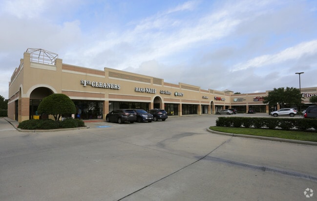

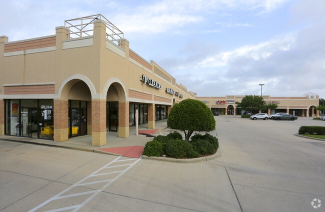
Property Detail
5540 Peek Rd
3519-08-000-0045-914
GRAND LAKES SEC 8, ACRES 3.2162, (PT) RESTRICTED RESERVE D (COMMERCIAL)
Commercialnec
FORT BEND
X
Texas
B and X Area of moderate flood hazard, usually the area between the limits of the 100-year and 500-year floods.
3.22 AC
2024
Far Katy South
2025
Houston
542202
Houston-Pasadena-The Woodlands, TX
24,850 SF
NEARBY LISTINGS FOR SALE OR LEASE
DEMOGRAPHICS near 5540 Peek Rd
1 mile
3 mile
5 mile
2025 Total Population
14,233
121,233
300,916
2030 Population
15,992
136,578
336,157
Pop Growth 2025-2030
+ 12.36%
+ 12.66%
+ 11.71%
Average Age
37
37
37
2025 Total Households
4,392
38,621
96,627
HH Growth 2025-2030
+ 12.80%
+ 13.03%
+ 11.93%
Median Household Inc
$163,326
$128,720
$118,626
Avg Household Size
3.20
3.10
3.10
2025 Avg HH Vehicles
2.00
2.00
2.00
Median Home Value
$481,165
$439,559
$419,585
Median Year Built
2006
2008
2009
Nearby Places
Map Layers
Map Styles
 Street
 Aerial
Transit
 Traffic
 Biking
Places
Listings with unknown addresses are not visible on the map
- Restaurants
- Banks
- Shops
- Fitness
- Groceries
PUBLIC TRANSPORTATION
AIRPORT
William P Hobby
Drive
Walk
Distance
William P Hobby
53 min
36.4 mi
Freight Ports
Port of Houston
Drive
Walk
Distance
Port of Houston
49 min
35.7 mi
SALE & LEASE HISTORY
LISTING DATE
SALE/LEASE

Dec 21, 2016
For Lease
Nearby Properties
Address
Land Use
TOTAL SIZE
Lot Size
Zoning
Address
Land Use
TOTAL SIZE
Lot Size
Zoning
786,753 SF
116.13 AC
Address
Land Use
TOTAL SIZE
Lot Size
Zoning
433,000 SF
59.75 AC
Address
Land Use
TOTAL SIZE
Lot Size
Zoning
523,641 SF
17.31 AC
X
Address
Land Use
TOTAL SIZE
Lot Size
Zoning
900 SF
20.64 AC
MS
Address
Land Use
TOTAL SIZE
Lot Size
Zoning
481,055 SF
4.56 AC
Address
Land Use
TOTAL SIZE
Lot Size
Zoning
1,022 SF
21.43 AC
RAD
Address
Land Use
TOTAL SIZE
Lot Size
Zoning
13.15 AC
Address
Land Use
TOTAL SIZE
Lot Size
Zoning
15.88 AC
X
Address
Land Use
TOTAL SIZE
Lot Size
Zoning
20.70 AC
Address
Land Use
TOTAL SIZE
Lot Size
Zoning
168,051 SF
12.68 AC
Address
Land Use
TOTAL SIZE
Lot Size
Zoning
13.36 AC
QY
Address
Land Use
TOTAL SIZE
Lot Size
Zoning
Address
Land Use
TOTAL SIZE
Lot Size
Zoning
95,597 SF
13.46 AC
Address
Land Use
TOTAL SIZE
Lot Size
Zoning
320,427 SF
15.15 AC
Address
Land Use
TOTAL SIZE
Lot Size
Zoning
240,930 SF
15 AC
Address
Land Use
TOTAL SIZE
Lot Size
Zoning
351,505 SF
13.38 AC
Address
Land Use
TOTAL SIZE
Lot Size
Zoning
388,578 SF
16.78 AC
Address
Land Use
TOTAL SIZE
Lot Size
Zoning
105,718 SF
14.52 AC
Address
Land Use
TOTAL SIZE
Lot Size
Zoning
26,631 SF
10.61 AC
Address
Land Use
TOTAL SIZE
Lot Size
Zoning
183,216 SF
10.84 AC
Address
Land Use
TOTAL SIZE
Lot Size
Zoning
202,589 SF
9.24 AC
J
Address
Land Use
TOTAL SIZE
Lot Size
Zoning
375,895 SF
14 AC
Address
Land Use
TOTAL SIZE
Lot Size
Zoning
169,191 SF
14.42 AC
Address
Land Use
TOTAL SIZE
Lot Size
Zoning
101,783 SF
14.43 AC
Address
Land Use
TOTAL SIZE
Lot Size
Zoning
184,398 SF
28.22 AC
I
Address
Land Use
TOTAL SIZE
Lot Size
Zoning
141,552 SF
38.03 AC
TS
Address
Land Use
TOTAL SIZE
Lot Size
Zoning
101,443 SF
11.60 AC
S
Address
Land Use
TOTAL SIZE
Lot Size
Zoning
377,890 SF
12.68 AC
Address
Land Use
TOTAL SIZE
Lot Size
Zoning
390,016 SF
14.44 AC
Address
Land Use
TOTAL SIZE
Lot Size
Zoning
285,735 SF
14.63 AC
The World's #1 Commercial Real Estate Marketplace
Connect with us
© 2026 CoStar Group
The information above has been obtained from sources believed reliable. While we do not doubt its accuracy we have not verified it and make no guarantee, warranty or representation about it. It is your responsibility to independently confirm its accuracy and completeness. Any projections, opinions, assumptions, or estimates used are for example only and do not represent the current or future performance of the property. The value of this transaction to you depends on tax and other factors which should be evaluated by your tax, financial, and legal advisors. You and your advisors should conduct a careful, independent investigation of the property to determine to your satisfaction the suitability of the property for your needs.