Property Record
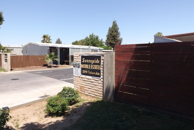
5541 E Tulare St, Fresno, CA 93727

NEARBY LISTINGS FOR SALE OR LEASE
Property Detail
5541 E Tulare St
Fresno
Easterby Rho
Fresno, CA
Fresno
462-020-24
California
Mobilemanufacturedhomeregardlessoflandownership
9.85 AC
X
Sunnyside
06019C2130H
DEMOGRAPHICS near 5541 E Tulare St
1 Mile
3 Mile
5 Mile
2024 Total Population
16,027
120,406
286,163
2029 Population
16,367
123,387
292,698
Pop Growth 2024-2029
+ 2.12%
+ 2.48%
+ 2.28%
Average Age
34
34
34
2024 Total Households
4,816
34,271
86,096
HH Growth 2024-2029
+ 2.14%
+ 2.49%
+ 2.32%
Median Household Inc
$56,199
$58,000
$55,469
Avg Household Size
3.20
3.40
3.20
2024 Avg HH Vehicles
2.00
2.00
2.00
Median Home Value
$289,596
$304,090
$294,466
Median Year Built
1976
1978
1975
Nearby Places
Map Layers
Map Styles
 Street
 Aerial
- Restaurants
- Banks
- Shops
- Fitness
- Groceries
PUBLIC TRANSPORTATION
COMMUTER RAIL
Fresno (San Joaquins - Amtrak)
DRIVE
WALK
Distance
Fresno (San Joaquins - Amtrak)
9 min
4.7 mi
AIRPORT
Fresno Yosemite International
DRIVE
WALK
Distance
Fresno Yosemite International
7 min
3.2 mi
Freight Ports
Port of Stockton
DRIVE
WALK
Distance
Port of Stockton
159 min
133.6 mi
SALE & LEASE HISTORY
LISTING DATE
SALE/LEASE

Aug 05, 2018
For Sale
Nearby Properties
Address
Land Use
TOTAL SIZE
Lot Size
Zoning
Address
Land Use
TOTAL SIZE
Lot Size
Zoning
1,081,456 SF
113.56 AC
M1
Address
Land Use
TOTAL SIZE
Lot Size
Zoning
794,471 SF
73.71 AC
Address
Land Use
TOTAL SIZE
Lot Size
Zoning
74,499 SF
17.48 AC
M3
Address
Land Use
TOTAL SIZE
Lot Size
Zoning
2,008 SF
20.14 AC
M1
Address
Land Use
TOTAL SIZE
Lot Size
Zoning
177,312 SF
28.12 AC
R1
Address
Land Use
TOTAL SIZE
Lot Size
Zoning
202,149 SF
27.56 AC
SPLIT
Address
Land Use
TOTAL SIZE
Lot Size
Zoning
216,342 SF
28.49 AC
Address
Land Use
TOTAL SIZE
Lot Size
Zoning
385,529 SF
29.36 AC
R2
Address
Land Use
TOTAL SIZE
Lot Size
Zoning
372,862 SF
42.43 AC
R1
Address
Land Use
TOTAL SIZE
Lot Size
Zoning
116,349 SF
16.56 AC
CP
Address
Land Use
TOTAL SIZE
Lot Size
Zoning
60,227 SF
4.72 AC
M1
Address
Land Use
TOTAL SIZE
Lot Size
Zoning
194,109 SF
19.42 AC
C3
Address
Land Use
TOTAL SIZE
Lot Size
Zoning
175,310 SF
19.22 AC
CMX
Address
Land Use
TOTAL SIZE
Lot Size
Zoning
94,584 SF
10.93 AC
M1
Address
Land Use
TOTAL SIZE
Lot Size
Zoning
93,172 SF
4.97 AC
Address
Land Use
TOTAL SIZE
Lot Size
Zoning
249,126 SF
17.33 AC
SPLIT
Address
Land Use
TOTAL SIZE
Lot Size
Zoning
319,790 SF
41.15 AC
R1
Address
Land Use
TOTAL SIZE
Lot Size
Zoning
190,006 SF
19.35 AC
RM1
Address
Land Use
TOTAL SIZE
Lot Size
Zoning
102,765 SF
8.90 AC
M1
Address
Land Use
TOTAL SIZE
Lot Size
Zoning
212,113 SF
13.21 AC
R3
Address
Land Use
TOTAL SIZE
Lot Size
Zoning
119,914 SF
4.50 AC
CMX
Address
Land Use
TOTAL SIZE
Lot Size
Zoning
141,577 SF
12.76 AC
IL
Address
Land Use
TOTAL SIZE
Lot Size
Zoning
226,937 SF
20.15 AC
SPLIT
Address
Land Use
TOTAL SIZE
Lot Size
Zoning
226,937 SF
11.52 AC
Address
Land Use
TOTAL SIZE
Lot Size
Zoning
26,978 SF
2.25 AC
Address
Land Use
TOTAL SIZE
Lot Size
Zoning
95,932 SF
10.98 AC
C3
Address
Land Use
TOTAL SIZE
Lot Size
Zoning
59,073 SF
2.66 AC
CM
Address
Land Use
TOTAL SIZE
Lot Size
Zoning
76,720 SF
10.78 AC
Address
Land Use
TOTAL SIZE
Lot Size
Zoning
108,512 SF
9.92 AC
R2
Address
Land Use
TOTAL SIZE
Lot Size
Zoning
97,174 SF
10.17 AC
C2
The World's #1 Commercial Real Estate Marketplace
Connect with us
© 2026 CoStar Group
The information above has been obtained from sources believed reliable. While we do not doubt its accuracy we have not verified it and make no guarantee, warranty or representation about it. It is your responsibility to independently confirm its accuracy and completeness. Any projections, opinions, assumptions, or estimates used are for example only and do not represent the current or future performance of the property. The value of this transaction to you depends on tax and other factors which should be evaluated by your tax, financial, and legal advisors. You and your advisors should conduct a careful, independent investigation of the property to determine to your satisfaction the suitability of the property for your needs.