Property Record
5545 Park Ave, Fairfield, CT 06825


Property Detail
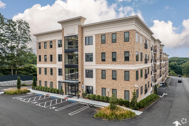
5545 Park Ave
Apartmenthouse100plusunits
Greater Bridgeport
R3
Connecticut
B and X Area of moderate flood hazard, usually the area between the limits of the 100-year and 500-year floods.
2.41 AC
2025
Outer Middle Fairfield County
2025
Westchester/So Connecticut
060100
Bridgeport-Stamford-Danbury, CT
145,860 SF
FAIR-000014-000000-000002
NEARBY LISTINGS FOR SALE OR LEASE
-
-
View all Fairfield listings for sale on LoopNet.com
DEMOGRAPHICS near 5545 Park Ave
1 mile
3 mile
5 mile
2025 Total Population
7,514
82,055
226,193
2030 Population
7,889
85,016
232,639
Pop Growth 2025-2030
+ 4.99%
+ 3.61%
+ 2.85%
Average Age
37
41
40
2025 Total Households
2,036
28,039
79,311
HH Growth 2025-2030
+ 5.21%
+ 3.66%
+ 2.95%
Median Household Inc
$126,526
$107,944
$87,601
Avg Household Size
2.70
2.70
2.70
2025 Avg HH Vehicles
2.00
2.00
2.00
Median Home Value
$478,297
$437,922
$454,262
Median Year Built
1960
1959
1957
Nearby Places
Map Layers
Map Styles
 Street
 Aerial
Layers
 Traffic
 Biking
Places
Listings with unknown addresses are not visible on the map
- Restaurants
- Banks
- Shops
- Fitness
- Groceries
PUBLIC TRANSPORTATION
COMMUTER RAIL
Bridgeport Station (New Haven Line - Metro-North Commuter Railroad Company (Metro-North))
Drive
Walk
Distance
Bridgeport Station (New Haven Line - Metro-North Commuter Railroad Company (Metro-North))
10 min
5.8 mi
Drive
Walk
Distance
13 min
6.7 mi
AIRPORT
Tweed/New Haven
Drive
Walk
Distance
Tweed/New Haven
39 min
23.8 mi
Westchester County
Drive
Walk
Distance
Westchester County
49 min
33.2 mi
Long Island MacArthur
Drive
Walk
Distance
Long Island MacArthur
117 min
38.9 mi
Freight Ports
Port of New Haven
Drive
Walk
Distance
Port of New Haven
33 min
21.6 mi
Nearby Properties
Address
Land Use
TOTAL SIZE
Lot Size
Zoning
Address
Land Use
TOTAL SIZE
Lot Size
Zoning
77.74 AC
BC
Address
Land Use
TOTAL SIZE
Lot Size
Zoning
10.42 AC
MDD
Address
Land Use
TOTAL SIZE
Lot Size
Zoning
111,525 SF
Address
Land Use
TOTAL SIZE
Lot Size
Zoning
38.62 AC
Address
Land Use
TOTAL SIZE
Lot Size
Zoning
356,837 SF
8.87 AC
RA
Address
Land Use
TOTAL SIZE
Lot Size
Zoning
120,955 SF
9.37 AC
RA
Address
Land Use
TOTAL SIZE
Lot Size
Zoning
22,848 SF
16.84 AC
IL-2
Address
Land Use
TOTAL SIZE
Lot Size
Zoning
335,633 SF
39.70 AC
R3
Address
Land Use
TOTAL SIZE
Lot Size
Zoning
97,554 SF
6.25 AC
DR
Address
Land Use
TOTAL SIZE
Lot Size
Zoning
43,489 SF
21.09 AC
AAA
Address
Land Use
TOTAL SIZE
Lot Size
Zoning
1,482 SF
215.26 AC
R3
Address
Land Use
TOTAL SIZE
Lot Size
Zoning
22.43 AC
R3
Address
Land Use
TOTAL SIZE
Lot Size
Zoning
182,000 SF
12.10 AC
IL-2
Address
Land Use
TOTAL SIZE
Lot Size
Zoning
136,008 SF
104.41 AC
R3
Address
Land Use
TOTAL SIZE
Lot Size
Zoning
13.15 AC
ORR
Address
Land Use
TOTAL SIZE
Lot Size
Zoning
3.77 AC
RA
Address
Land Use
TOTAL SIZE
Lot Size
Zoning
14.18 AC
RC
Address
Land Use
TOTAL SIZE
Lot Size
Zoning
109,800 SF
1.24 AC
RA
Address
Land Use
TOTAL SIZE
Lot Size
Zoning
8.41 AC
RC
Address
Land Use
TOTAL SIZE
Lot Size
Zoning
11.87 AC
RA
Address
Land Use
TOTAL SIZE
Lot Size
Zoning
78,692 SF
10.79 AC
MFO
Address
Land Use
TOTAL SIZE
Lot Size
Zoning
69,918 SF
15.75 AC
AAA
Address
Land Use
TOTAL SIZE
Lot Size
Zoning
82,717 SF
34.40 AC
IL2
Address
Land Use
TOTAL SIZE
Lot Size
Zoning
68,810 SF
5.21 AC
R3
Address
Land Use
TOTAL SIZE
Lot Size
Zoning
76,630 SF
13.28 AC
AA
Address
Land Use
TOTAL SIZE
Lot Size
Zoning
32.50 AC
AA
Address
Land Use
TOTAL SIZE
Lot Size
Zoning
311.80 AC
AAA
Address
Land Use
TOTAL SIZE
Lot Size
Zoning
12.41 AC
BC
Address
Land Use
TOTAL SIZE
Lot Size
Zoning
62,985 SF
2.42 AC
I-L2
The World's #1 Commercial Real Estate Marketplace
Connect with us
© 2026 CoStar Group
The information above has been obtained from sources believed reliable. While we do not doubt its accuracy we have not verified it and make no guarantee, warranty or representation about it. It is your responsibility to independently confirm its accuracy and completeness. Any projections, opinions, assumptions, or estimates used are for example only and do not represent the current or future performance of the property. The value of this transaction to you depends on tax and other factors which should be evaluated by your tax, financial, and legal advisors. You and your advisors should conduct a careful, independent investigation of the property to determine to your satisfaction the suitability of the property for your needs.