Property Record
555 Duncan Rd, Royston, GA 30662


NEARBY LISTINGS FOR SALE OR LEASE
-
-
View all Royston listings for sale on LoopNet.com
Property Detail
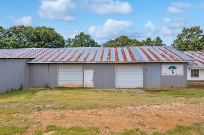
555 Duncan Rd
C10-005
Commercial County
Publicstorage
GMD 1113 PB 23-412
X
Hart
13147C0175D
Georgia
2024
0.86 AC
2024
Georgia Northeast
960300
Other Market Areas
12,415 SF
DEMOGRAPHICS near 555 Duncan Rd
1 Mile
3 Mile
5 Mile
2024 Total Population
239
2,832
9,151
2029 Population
256
3,023
9,727
Pop Growth 2024-2029
+ 7.11%
+ 6.74%
+ 6.29%
Average Age
41
41
40
2024 Total Households
94
1,111
3,419
HH Growth 2024-2029
+ 6.38%
+ 6.57%
+ 6.14%
Median Household Inc
$55,000
$48,478
$46,405
Avg Household Size
2.50
2.40
2.40
2024 Avg HH Vehicles
2.00
2.00
2.00
Median Home Value
$152,631
$148,477
$139,652
Median Year Built
1984
1982
1981
Nearby Places
Map Layers
Map Styles
 Street
 Aerial
- Restaurants
- Banks
- Shops
- Fitness
- Groceries
SALE & LEASE HISTORY
LISTING DATE
SALE/LEASE

Jun 26, 2024
For Sale
Nearby Properties
Address
Land Use
TOTAL SIZE
Lot Size
Zoning
Address
Land Use
TOTAL SIZE
Lot Size
Zoning
228,564 SF
62.59 AC
Address
Land Use
TOTAL SIZE
Lot Size
Zoning
279,084 SF
68.28 AC
Address
Land Use
TOTAL SIZE
Lot Size
Zoning
1,216 SF
66.97 AC
C
Address
Land Use
TOTAL SIZE
Lot Size
Zoning
2,248 SF
25 AC
Address
Land Use
TOTAL SIZE
Lot Size
Zoning
8,000 SF
3.33 AC
GB
Address
Land Use
TOTAL SIZE
Lot Size
Zoning
768 SF
2.44 AC
COMMERCIAL
Address
Land Use
TOTAL SIZE
Lot Size
Zoning
103.07 AC
Address
Land Use
TOTAL SIZE
Lot Size
Zoning
82.43 AC
A1
Address
Land Use
TOTAL SIZE
Lot Size
Zoning
34,000 SF
5 AC
B
Address
Land Use
TOTAL SIZE
Lot Size
Zoning
143.21 AC
A1
Address
Land Use
TOTAL SIZE
Lot Size
Zoning
1,320 SF
4.24 AC
Address
Land Use
TOTAL SIZE
Lot Size
Zoning
86.70 AC
A1
Address
Land Use
TOTAL SIZE
Lot Size
Zoning
116.23 AC
A1
Address
Land Use
TOTAL SIZE
Lot Size
Zoning
28.58 AC
Address
Land Use
TOTAL SIZE
Lot Size
Zoning
108.85 AC
A1
Address
Land Use
TOTAL SIZE
Lot Size
Zoning
13,164 SF
5.38 AC
Address
Land Use
TOTAL SIZE
Lot Size
Zoning
100.70 AC
C
Address
Land Use
TOTAL SIZE
Lot Size
Zoning
95.36 AC
C
Address
Land Use
TOTAL SIZE
Lot Size
Zoning
25 AC
C
Address
Land Use
TOTAL SIZE
Lot Size
Zoning
3,200 SF
10.61 AC
Address
Land Use
TOTAL SIZE
Lot Size
Zoning
99.37 AC
A1
Address
Land Use
TOTAL SIZE
Lot Size
Zoning
768 SF
94.70 AC
A1
Address
Land Use
TOTAL SIZE
Lot Size
Zoning
154 AC
Address
Land Use
TOTAL SIZE
Lot Size
Zoning
148.40 AC
A2
Address
Land Use
TOTAL SIZE
Lot Size
Zoning
86.01 AC
Address
Land Use
TOTAL SIZE
Lot Size
Zoning
16.32 AC
C
Address
Land Use
TOTAL SIZE
Lot Size
Zoning
82.16 AC
Address
Land Use
TOTAL SIZE
Lot Size
Zoning
76.08 AC
C
Address
Land Use
TOTAL SIZE
Lot Size
Zoning
57.63 AC
Address
Land Use
TOTAL SIZE
Lot Size
Zoning
576 SF
6.46 AC
The World's #1 Commercial Real Estate Marketplace
Connect with us
© 2026 CoStar Group
The information above has been obtained from sources believed reliable. While we do not doubt its accuracy we have not verified it and make no guarantee, warranty or representation about it. It is your responsibility to independently confirm its accuracy and completeness. Any projections, opinions, assumptions, or estimates used are for example only and do not represent the current or future performance of the property. The value of this transaction to you depends on tax and other factors which should be evaluated by your tax, financial, and legal advisors. You and your advisors should conduct a careful, independent investigation of the property to determine to your satisfaction the suitability of the property for your needs.