Property Record
555 E Outer 21 Rd, Arnold, MO 63010
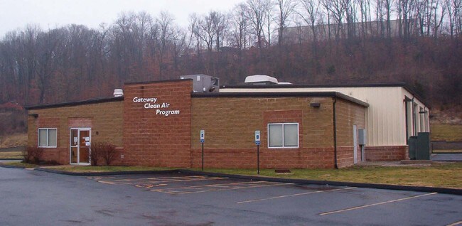

Property Detail
555 E Outer 21 Rd
St. Louis, MO-IL
PT US SURVEY 664
02-6.0-14.0-4-001-024.01
Jefferson
Autorepair
Missouri
AE The base floodplain where base flood elevations are provided. AE Zones are now used on new format FIRMs instead of A1-A30 Zones.
3,4
2024
4.69 AC
2025
Southwest County
700119
St. Louis
8,560 SF
NEARBY LISTINGS FOR SALE OR LEASE
DEMOGRAPHICS near 555 E Outer 21 Rd
1 mile
3 mile
5 mile
2024 Total Population
1,814
38,469
119,141
2029 Population
1,855
39,098
119,755
Pop Growth 2024-2029
+ 2.26%
+ 1.64%
+ 0.52%
Average Age
42
42
42
2024 Total Households
706
15,586
47,466
HH Growth 2024-2029
+ 2.41%
+ 1.58%
+ 0.52%
Median Household Inc
$75,547
$87,944
$88,650
Avg Household Size
2.50
2.40
2.50
2024 Avg HH Vehicles
2.00
2.00
2.00
Median Home Value
$199,999
$276,234
$278,661
Median Year Built
1988
1987
1983
Nearby Places
Map Layers
Map Styles
 Street
 Aerial
Transit
 Traffic
 Biking
Places
Listings with unknown addresses are not visible on the map
- Restaurants
- Banks
- Shops
- Fitness
- Groceries
PUBLIC TRANSPORTATION
AIRPORT
St Louis Lambert International
Drive
Walk
Distance
St Louis Lambert International
42 min
27.5 mi
Scott AFB/Midamerica St Louis
Drive
Walk
Distance
Scott AFB/Midamerica St Louis
64 min
44.8 mi
Nearby Properties
Address
Land Use
TOTAL SIZE
Lot Size
Zoning
Address
Land Use
TOTAL SIZE
Lot Size
Zoning
76,892 SF
Address
Land Use
TOTAL SIZE
Lot Size
Zoning
221,771 SF
25.15 AC
CT1
Address
Land Use
TOTAL SIZE
Lot Size
Zoning
265,291 SF
14.91 AC
PR2
Address
Land Use
TOTAL SIZE
Lot Size
Zoning
156,592 SF
9.80 AC
PR2
Address
Land Use
TOTAL SIZE
Lot Size
Zoning
183,528 SF
20.63 AC
R6A
Address
Land Use
TOTAL SIZE
Lot Size
Zoning
150,857 SF
7.73 AC
R6A
Address
Land Use
TOTAL SIZE
Lot Size
Zoning
143,779 SF
15.65 AC
R6A
Address
Land Use
TOTAL SIZE
Lot Size
Zoning
138,591 SF
5.46 AC
Address
Land Use
TOTAL SIZE
Lot Size
Zoning
52,886 SF
262.80 AC
P5
Address
Land Use
TOTAL SIZE
Lot Size
Zoning
15.82 AC
NU
Address
Land Use
TOTAL SIZE
Lot Size
Zoning
78,030 SF
10 AC
R6A
Address
Land Use
TOTAL SIZE
Lot Size
Zoning
95,382 SF
1.88 AC
CT1
Address
Land Use
TOTAL SIZE
Lot Size
Zoning
75,733 SF
2.46 AC
Address
Land Use
TOTAL SIZE
Lot Size
Zoning
94,833 SF
10.45 AC
R6A
Address
Land Use
TOTAL SIZE
Lot Size
Zoning
50,901 SF
3.14 AC
C-8
Address
Land Use
TOTAL SIZE
Lot Size
Zoning
71,112 SF
3.78 AC
R6A
Address
Land Use
TOTAL SIZE
Lot Size
Zoning
56,476 SF
2.14 AC
Address
Land Use
TOTAL SIZE
Lot Size
Zoning
79,866 SF
7.17 AC
R6A
Address
Land Use
TOTAL SIZE
Lot Size
Zoning
87,466 SF
8.17 AC
Address
Land Use
TOTAL SIZE
Lot Size
Zoning
65,056 SF
10.18 AC
Address
Land Use
TOTAL SIZE
Lot Size
Zoning
72,136 SF
13.73 AC
CT1
Address
Land Use
TOTAL SIZE
Lot Size
Zoning
152,346 SF
17.02 AC
CT1
Address
Land Use
TOTAL SIZE
Lot Size
Zoning
28,982 SF
7.21 AC
C5
Address
Land Use
TOTAL SIZE
Lot Size
Zoning
66,441 SF
5.40 AC
M1
Address
Land Use
TOTAL SIZE
Lot Size
Zoning
132,848 SF
11.43 AC
PB
Address
Land Use
TOTAL SIZE
Lot Size
Zoning
37,640 SF
1.44 AC
Address
Land Use
TOTAL SIZE
Lot Size
Zoning
122,427 SF
40.27 AC
PI
Address
Land Use
TOTAL SIZE
Lot Size
Zoning
64,764 SF
5.20 AC
R6A
Address
Land Use
TOTAL SIZE
Lot Size
Zoning
50,904 SF
2.37 AC
R6A
The World's #1 Commercial Real Estate Marketplace
Connect with us
© 2026 CoStar Group
The information above has been obtained from sources believed reliable. While we do not doubt its accuracy we have not verified it and make no guarantee, warranty or representation about it. It is your responsibility to independently confirm its accuracy and completeness. Any projections, opinions, assumptions, or estimates used are for example only and do not represent the current or future performance of the property. The value of this transaction to you depends on tax and other factors which should be evaluated by your tax, financial, and legal advisors. You and your advisors should conduct a careful, independent investigation of the property to determine to your satisfaction the suitability of the property for your needs.