Property Record
555 E Willis Rd, Chandler, AZ 85286
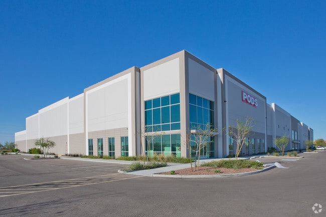

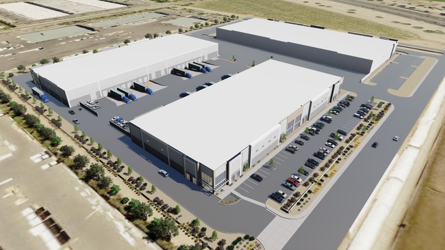
Property Detail
555 E Willis Rd
303-28-982
AZ 202 COMMERCE PARK MCR 1367-18
Warehouse
Maricopa
PAD
Arizona
C and X Area of minimal flood hazard, usually depicted on FIRMs as above the 500-year flood level.
1
2025
6.59 AC
2025
Chandler Airport
812400
Phoenix
106,602 SF
Phoenix-Mesa-Chandler, AZ
NEARBY LISTINGS FOR SALE OR LEASE
DEMOGRAPHICS near 555 E Willis Rd
1 mile
3 mile
5 mile
2025 Total Population
11,601
125,781
298,846
2030 Population
12,147
130,239
309,363
Pop Growth 2025-2030
+ 4.71%
+ 3.54%
+ 3.52%
Average Age
35
37
39
2025 Total Households
4,233
45,055
108,748
HH Growth 2025-2030
+ 4.56%
+ 3.67%
+ 3.58%
Median Household Inc
$91,824
$102,583
$111,687
Avg Household Size
2.60
2.70
2.70
2025 Avg HH Vehicles
2.00
2.00
2.00
Median Home Value
$521,073
$527,584
$567,462
Median Year Built
2004
1998
1998
Nearby Places
Map Layers
Map Styles
 Street
 Aerial
Layers
 Traffic
 Biking
Places
Listings with unknown addresses are not visible on the map
- Restaurants
- Banks
- Shops
- Fitness
- Groceries
PUBLIC TRANSPORTATION
AIRPORT
Phoenix Sky Harbor International
Drive
Walk
Distance
Phoenix Sky Harbor International
23 min
20.5 mi
Freight Ports
Port of San Diego
Drive
Walk
Distance
Port of San Diego
1 min
311.1 mi
SALE & LEASE HISTORY
LISTING DATE
SALE/LEASE

Sep 25, 2016
For Lease
Nearby Properties
Address
Land Use
TOTAL SIZE
Lot Size
Zoning
Address
Land Use
TOTAL SIZE
Lot Size
Zoning
1,420,114 SF
66.08 AC
PAD
Address
Land Use
TOTAL SIZE
Lot Size
Zoning
733,019 SF
13.13 AC
PAD
Address
Land Use
TOTAL SIZE
Lot Size
Zoning
10.02 AC
Address
Land Use
TOTAL SIZE
Lot Size
Zoning
1.13 AC
Address
Land Use
TOTAL SIZE
Lot Size
Zoning
30,414 SF
97.19 AC
PAD
Address
Land Use
TOTAL SIZE
Lot Size
Zoning
434,857 SF
36.73 AC
PF
Address
Land Use
TOTAL SIZE
Lot Size
Zoning
288,023 SF
48.20 AC
PAD
Address
Land Use
TOTAL SIZE
Lot Size
Zoning
498,377 SF
29.12 AC
Address
Land Use
TOTAL SIZE
Lot Size
Zoning
263,599 SF
18.33 AC
PAD
Address
Land Use
TOTAL SIZE
Lot Size
Zoning
416,954 SF
9.59 AC
PF
Address
Land Use
TOTAL SIZE
Lot Size
Zoning
416,098 SF
22.48 AC
Address
Land Use
TOTAL SIZE
Lot Size
Zoning
348,249 SF
6.42 AC
M-H
Address
Land Use
TOTAL SIZE
Lot Size
Zoning
363,785 SF
46.73 AC
Address
Land Use
TOTAL SIZE
Lot Size
Zoning
374,847 SF
20.84 AC
PAD
Address
Land Use
TOTAL SIZE
Lot Size
Zoning
563,460 SF
33.65 AC
Address
Land Use
TOTAL SIZE
Lot Size
Zoning
256,618 SF
19.49 AC
PAD
Address
Land Use
TOTAL SIZE
Lot Size
Zoning
465,645 SF
30.78 AC
PAD
Address
Land Use
TOTAL SIZE
Lot Size
Zoning
300,885 SF
37.63 AC
AG
Address
Land Use
TOTAL SIZE
Lot Size
Zoning
444,707 SF
21.62 AC
I-2
Address
Land Use
TOTAL SIZE
Lot Size
Zoning
403,326 SF
8.71 AC
PAD
Address
Land Use
TOTAL SIZE
Lot Size
Zoning
329,305 SF
18.06 AC
PAD
Address
Land Use
TOTAL SIZE
Lot Size
Zoning
324,283 SF
18.75 AC
PAD
Address
Land Use
TOTAL SIZE
Lot Size
Zoning
348,379 SF
6.49 AC
PAD
Address
Land Use
TOTAL SIZE
Lot Size
Zoning
159,419 SF
10.11 AC
RC
Address
Land Use
TOTAL SIZE
Lot Size
Zoning
199,808 SF
48.05 AC
PAD
Address
Land Use
TOTAL SIZE
Lot Size
Zoning
423,725 SF
23.16 AC
PAD
Address
Land Use
TOTAL SIZE
Lot Size
Zoning
287,222 SF
20.71 AC
PAD
Address
Land Use
TOTAL SIZE
Lot Size
Zoning
316,658 SF
47.91 AC
PAD
Address
Land Use
TOTAL SIZE
Lot Size
Zoning
128,416 SF
8.28 AC
C-BP
Address
Land Use
TOTAL SIZE
Lot Size
Zoning
325,445 SF
15.28 AC
PAD
The World's #1 Commercial Real Estate Marketplace
Connect with us
© 2026 CoStar Group
The information above has been obtained from sources believed reliable. While we do not doubt its accuracy we have not verified it and make no guarantee, warranty or representation about it. It is your responsibility to independently confirm its accuracy and completeness. Any projections, opinions, assumptions, or estimates used are for example only and do not represent the current or future performance of the property. The value of this transaction to you depends on tax and other factors which should be evaluated by your tax, financial, and legal advisors. You and your advisors should conduct a careful, independent investigation of the property to determine to your satisfaction the suitability of the property for your needs.