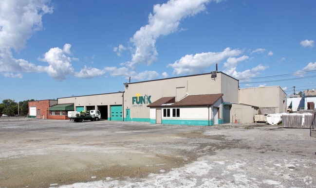
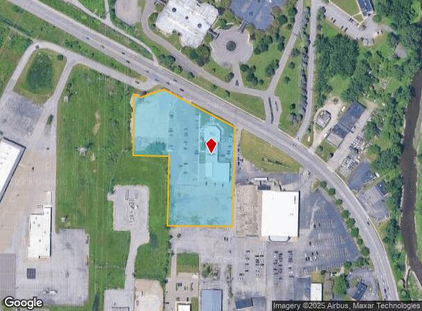
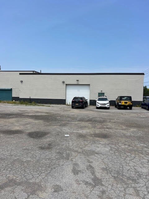
Property Record
555 Orchard Park Rd, Buffalo, NY 14224
Current Lease Availabilities
NEARBY LISTINGS FOR SALE OR LEASE
Property Detail
555 Orchard Park Rd
Buffalo-Cheektowaga-Niagara Falls, NY
Buffalo Creek Reservation
146800-143-060-0004-002-100
PART OF FL-296 EBENEZER LANDS(3.99 AC'S) 462.07 X 419.75 IRR.
Restaurantbuilding
Erie
X
New York
36029C0334H
2.100
2025
3.99 AC
2024
South
012001
Buffalo/Niagara Falls
15,523 SF
DEMOGRAPHICS near 555 Orchard Park Rd
1 Mile
3 Mile
5 Mile
2024 Total Population
7,412
87,645
177,167
2029 Population
7,371
86,117
174,463
Pop Growth 2024-2029
(0.55%)
(1.74%)
(1.53%)
Average Age
44
42
42
2024 Total Households
3,381
38,662
77,982
HH Growth 2024-2029
(0.47%)
(1.80%)
(1.57%)
Median Household Inc
$66,757
$62,665
$59,238
Avg Household Size
2.10
2.20
2.20
2024 Avg HH Vehicles
2.00
2.00
2.00
Median Home Value
$165,839
$163,551
$163,524
Median Year Built
1959
1954
1957
Nearby Places
- Restaurants
- Banks
- Shops
- Fitness
- Groceries
PUBLIC TRANSPORTATION
COMMUTER RAIL
DRIVE
WALK
Distance
13 min
6.7 mi
DRIVE
WALK
Distance
16 min
8.2 mi
AIRPORT
Buffalo Niagara International
DRIVE
WALK
Distance
Buffalo Niagara International
21 min
12.4 mi
Niagara Falls International
DRIVE
WALK
Distance
Niagara Falls International
41 min
26.6 mi
Nearby Properties
Address
Land Use
TOTAL SIZE
Lot Size
Zoning
Address
Land Use
TOTAL SIZE
Lot Size
Zoning
13,152 SF
496 AC
08 - GOVER
Address
Land Use
TOTAL SIZE
Lot Size
Zoning
425,796 SF
7.10 AC
D-M
Address
Land Use
TOTAL SIZE
Lot Size
Zoning
972 SF
194.01 AC
D-OG
Address
Land Use
TOTAL SIZE
Lot Size
Zoning
5,304 SF
17.90 AC
03RA
Address
Land Use
TOTAL SIZE
Lot Size
Zoning
197,584 SF
32.50 AC
B2
Address
Land Use
TOTAL SIZE
Lot Size
Zoning
48.14 AC
OP
Address
Land Use
TOTAL SIZE
Lot Size
Zoning
104,881 SF
24.43 AC
12
Address
Land Use
TOTAL SIZE
Lot Size
Zoning
43,942 SF
14.34 AC
CBD
Address
Land Use
TOTAL SIZE
Lot Size
Zoning
124,112 SF
53.10 AC
05 - COMME
Address
Land Use
TOTAL SIZE
Lot Size
Zoning
149,065 SF
21.53 AC
B2
Address
Land Use
TOTAL SIZE
Lot Size
Zoning
205,680 SF
37.40 AC
11
Address
Land Use
TOTAL SIZE
Lot Size
Zoning
145,881 SF
29.40 AC
10
Address
Land Use
TOTAL SIZE
Lot Size
Zoning
107,760 SF
4.14 AC
D-E
Address
Land Use
TOTAL SIZE
Lot Size
Zoning
0.07 AC
Address
Land Use
TOTAL SIZE
Lot Size
Zoning
3,268 SF
1.68 AC
Address
Land Use
TOTAL SIZE
Lot Size
Zoning
123 AC
OP
Address
Land Use
TOTAL SIZE
Lot Size
Zoning
166,303 SF
3.82 AC
Address
Land Use
TOTAL SIZE
Lot Size
Zoning
Address
Land Use
TOTAL SIZE
Lot Size
Zoning
198,558 SF
3.16 AC
N-3R
Address
Land Use
TOTAL SIZE
Lot Size
Zoning
191,026 SF
32.60 AC
10
Address
Land Use
TOTAL SIZE
Lot Size
Zoning
72.11 AC
Address
Land Use
TOTAL SIZE
Lot Size
Zoning
34,968 SF
18.26 AC
10
Address
Land Use
TOTAL SIZE
Lot Size
Zoning
99,000 SF
26.60 AC
N-3R
Address
Land Use
TOTAL SIZE
Lot Size
Zoning
89,838 SF
4.24 AC
Address
Land Use
TOTAL SIZE
Lot Size
Zoning
149,858 SF
24.18 AC
Address
Land Use
TOTAL SIZE
Lot Size
Zoning
2,490 SF
0.19 AC
N-3E
Address
Land Use
TOTAL SIZE
Lot Size
Zoning
51,992 SF
10.20 AC
13
Address
Land Use
TOTAL SIZE
Lot Size
Zoning
2,250 SF
148.60 AC
D-OG
Address
Land Use
TOTAL SIZE
Lot Size
Zoning
264,816 SF
2.08 AC
D-M
Address
Land Use
TOTAL SIZE
Lot Size
Zoning
3,361 SF
28.04 AC
R3
The World's #1 Commercial Real Estate Marketplace
Connect with us
© 2025 CoStar Group
The information above has been obtained from sources believed reliable. While we do not doubt its accuracy we have not verified it and make no guarantee, warranty or representation about it. It is your responsibility to independently confirm its accuracy and completeness. Any projections, opinions, assumptions, or estimates used are for example only and do not represent the current or future performance of the property. The value of this transaction to you depends on tax and other factors which should be evaluated by your tax, financial, and legal advisors. You and your advisors should conduct a careful, independent investigation of the property to determine to your satisfaction the suitability of the property for your needs.