Property Record
555 Parque Dr, Ormond Beach, FL 32174


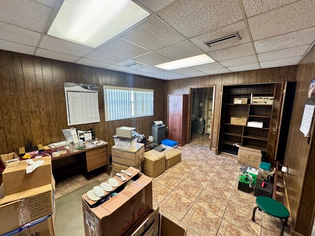

This Property Is For Sale
Property Detail
555 Parque Dr
4242-10-02-0050
LOTS 5 & 6 BLK 2 RIO VISTA GARDENS MB 9 PGS 37-38 PER OR 3765 PG 4132 PER OR 8535 PG 3271
Warehouse
VOLUSIA
13I1
Florida
A Areas with a 1% annual chance of flooding and a 26% chance of flooding over the life of a 30-year mortgage.
5,6
2025
0.21 AC
2026
Ormond Beach
080807
Deltona/Daytona Beach
2,680 SF
Deltona-Daytona Beach-Ormond Beach, FL
NEARBY LISTINGS FOR SALE OR LEASE
DEMOGRAPHICS near 555 Parque Dr
1 mile
3 mile
5 mile
2024 Total Population
5,835
59,977
119,849
2029 Population
6,203
64,681
129,897
Pop Growth 2024-2029
+ 6.31%
+ 7.84%
+ 8.38%
Average Age
45
47
45
2024 Total Households
2,522
27,385
53,332
HH Growth 2024-2029
+ 6.23%
+ 7.95%
+ 8.52%
Median Household Inc
$55,367
$55,320
$55,417
Avg Household Size
2.20
2.10
2.10
2024 Avg HH Vehicles
2.00
2.00
2.00
Median Home Value
$312,040
$304,293
$321,368
Median Year Built
1975
1977
1978
Nearby Places
Map Layers
Map Styles
 Street
 Aerial
Transit
 Traffic
 Biking
Places
Listings with unknown addresses are not visible on the map
- Restaurants
- Banks
- Shops
- Fitness
- Groceries
PUBLIC TRANSPORTATION
AIRPORT
Daytona Beach International
Drive
Walk
Distance
Daytona Beach International
19 min
9.6 mi
Orlando Sanford International
Drive
Walk
Distance
Orlando Sanford International
68 min
48.2 mi
Nearby Properties
Address
Land Use
TOTAL SIZE
Lot Size
Zoning
Address
Land Use
TOTAL SIZE
Lot Size
Zoning
405,946 SF
2.79 AC
Address
Land Use
TOTAL SIZE
Lot Size
Zoning
12,394 SF
139.59 AC
Address
Land Use
TOTAL SIZE
Lot Size
Zoning
10,637 SF
0.15 AC
R2
Address
Land Use
TOTAL SIZE
Lot Size
Zoning
434,487 SF
20.54 AC
Address
Land Use
TOTAL SIZE
Lot Size
Zoning
375,572 SF
0.13 AC
R2
Address
Land Use
TOTAL SIZE
Lot Size
Zoning
300,760 SF
20.75 AC
Address
Land Use
TOTAL SIZE
Lot Size
Zoning
403,130 SF
28.45 AC
Address
Land Use
TOTAL SIZE
Lot Size
Zoning
16.50 AC
Address
Land Use
TOTAL SIZE
Lot Size
Zoning
Address
Land Use
TOTAL SIZE
Lot Size
Zoning
Address
Land Use
TOTAL SIZE
Lot Size
Zoning
102,495 SF
10.81 AC
02R2
Address
Land Use
TOTAL SIZE
Lot Size
Zoning
5,426 SF
6.28 AC
09R9
Address
Land Use
TOTAL SIZE
Lot Size
Zoning
168,456 SF
15.74 AC
Address
Land Use
TOTAL SIZE
Lot Size
Zoning
4,182 SF
0.16 AC
MH1
Address
Land Use
TOTAL SIZE
Lot Size
Zoning
144,576 SF
11.19 AC
13R6
Address
Land Use
TOTAL SIZE
Lot Size
Zoning
149,872 SF
20 AC
09R6
Address
Land Use
TOTAL SIZE
Lot Size
Zoning
162,450 SF
1.42 AC
13B9
Address
Land Use
TOTAL SIZE
Lot Size
Zoning
179,868 SF
0.33 AC
Address
Land Use
TOTAL SIZE
Lot Size
Zoning
102,266 SF
2.20 AC
02T1
Address
Land Use
TOTAL SIZE
Lot Size
Zoning
61,570 SF
23.04 AC
Address
Land Use
TOTAL SIZE
Lot Size
Zoning
Address
Land Use
TOTAL SIZE
Lot Size
Zoning
73,540 SF
9.84 AC
02R2
Address
Land Use
TOTAL SIZE
Lot Size
Zoning
148,966 SF
5.54 AC
13B10
Address
Land Use
TOTAL SIZE
Lot Size
Zoning
Address
Land Use
TOTAL SIZE
Lot Size
Zoning
135,886 SF
1.18 AC
Address
Land Use
TOTAL SIZE
Lot Size
Zoning
119,331 SF
9.09 AC
Address
Land Use
TOTAL SIZE
Lot Size
Zoning
96,309 SF
29.04 AC
Address
Land Use
TOTAL SIZE
Lot Size
Zoning
460,540 SF
20.46 AC
09R6
Address
Land Use
TOTAL SIZE
Lot Size
Zoning
58,429 SF
1.33 AC
02T1
Address
Land Use
TOTAL SIZE
Lot Size
Zoning
58,132 SF
1.50 AC
The World's #1 Commercial Real Estate Marketplace
Connect with us
© 2026 CoStar Group
The information above has been obtained from sources believed reliable. While we do not doubt its accuracy we have not verified it and make no guarantee, warranty or representation about it. It is your responsibility to independently confirm its accuracy and completeness. Any projections, opinions, assumptions, or estimates used are for example only and do not represent the current or future performance of the property. The value of this transaction to you depends on tax and other factors which should be evaluated by your tax, financial, and legal advisors. You and your advisors should conduct a careful, independent investigation of the property to determine to your satisfaction the suitability of the property for your needs.