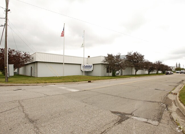
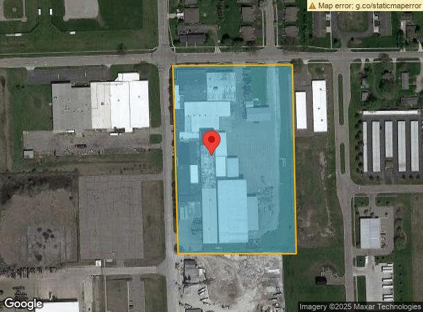
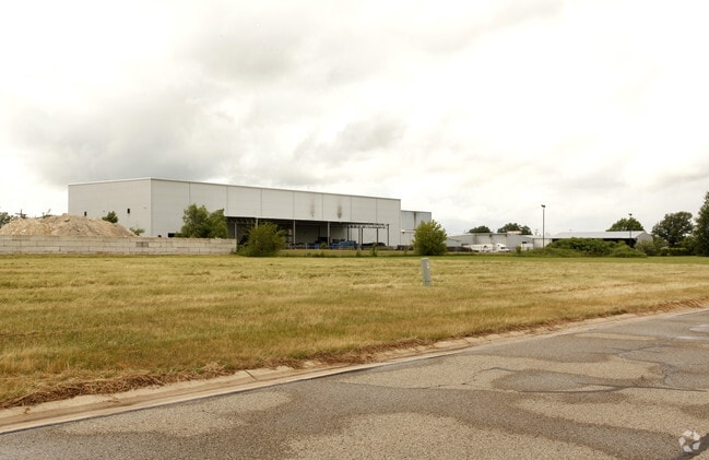
Property Record
555 S Platt Rd, Milan, MI 48160
NEARBY LISTINGS FOR SALE OR LEASE
Property Detail
555 S Platt Rd
53-040-233-00
Assrs Of Village Of Milan
Lightindustrial
PORTION LOT164
X
Monroe
26115C0030E
Michigan
2025
9.25 AC
2025
Monroe County
830700
Detroit
165,904 SF
Monroe, MI
DEMOGRAPHICS near 555 S Platt Rd
1 Mile
3 Mile
5 Mile
2024 Total Population
3,372
9,252
12,678
2029 Population
3,395
9,294
12,712
Pop Growth 2024-2029
+ 0.68%
+ 0.45%
+ 0.27%
Average Age
40
40
41
2024 Total Households
1,432
3,117
4,377
HH Growth 2024-2029
+ 0.42%
+ 0.32%
+ 0.11%
Median Household Inc
$66,602
$76,867
$79,386
Avg Household Size
2.30
2.50
2.60
2024 Avg HH Vehicles
2.00
2.00
2.00
Median Home Value
$178,090
$208,121
$229,434
Median Year Built
1968
1965
1966
Nearby Places
Map Layers
Map Styles
 Street
 Aerial
- Restaurants
- Banks
- Shops
- Fitness
- Groceries
PUBLIC TRANSPORTATION
AIRPORT
Detroit Metro Wayne County
DRIVE
WALK
Distance
Detroit Metro Wayne County
45 min
34.0 mi
Eugene F Kranz Toledo Express
DRIVE
WALK
Distance
Eugene F Kranz Toledo Express
64 min
45.8 mi
Freight Ports
DRIVE
WALK
Distance
62 min
45.0 mi
Nearby Properties
Address
Land Use
TOTAL SIZE
Lot Size
Zoning
Address
Land Use
TOTAL SIZE
Lot Size
Zoning
1,207,496 SF
92.13 AC
Address
Land Use
TOTAL SIZE
Lot Size
Zoning
352,751 SF
58.19 AC
Address
Land Use
TOTAL SIZE
Lot Size
Zoning
45,200 SF
7.48 AC
Address
Land Use
TOTAL SIZE
Lot Size
Zoning
23,850 SF
17.80 AC
Address
Land Use
TOTAL SIZE
Lot Size
Zoning
73,840 SF
7.22 AC
Address
Land Use
TOTAL SIZE
Lot Size
Zoning
41,003 SF
5.99 AC
Address
Land Use
TOTAL SIZE
Lot Size
Zoning
179,682 SF
28.59 AC
LI
Address
Land Use
TOTAL SIZE
Lot Size
Zoning
67,834 SF
5.99 AC
GB
Address
Land Use
TOTAL SIZE
Lot Size
Zoning
864 SF
4 AC
R3
Address
Land Use
TOTAL SIZE
Lot Size
Zoning
22,644 SF
2.48 AC
O
Address
Land Use
TOTAL SIZE
Lot Size
Zoning
31,338 SF
1.72 AC
HS
Address
Land Use
TOTAL SIZE
Lot Size
Zoning
14,364 SF
4.05 AC
HS-W/C
Address
Land Use
TOTAL SIZE
Lot Size
Zoning
51,438 SF
9.87 AC
Address
Land Use
TOTAL SIZE
Lot Size
Zoning
80,848 SF
7.05 AC
Address
Land Use
TOTAL SIZE
Lot Size
Zoning
38,848 SF
4.97 AC
Address
Land Use
TOTAL SIZE
Lot Size
Zoning
Address
Land Use
TOTAL SIZE
Lot Size
Zoning
20,100 SF
80 AC
Address
Land Use
TOTAL SIZE
Lot Size
Zoning
24.61 AC
MHP
Address
Land Use
TOTAL SIZE
Lot Size
Zoning
5,310 SF
1.57 AC
GB-W/C
Address
Land Use
TOTAL SIZE
Lot Size
Zoning
10,800 SF
1.58 AC
GB
Address
Land Use
TOTAL SIZE
Lot Size
Zoning
10,905 SF
1.28 AC
GB-W/C
Address
Land Use
TOTAL SIZE
Lot Size
Zoning
18,940 SF
1.35 AC
R3
Address
Land Use
TOTAL SIZE
Lot Size
Zoning
10,838 SF
2 AC
R3-M-PUD
Address
Land Use
TOTAL SIZE
Lot Size
Zoning
23,980 SF
5.17 AC
Address
Land Use
TOTAL SIZE
Lot Size
Zoning
Address
Land Use
TOTAL SIZE
Lot Size
Zoning
37,810 SF
3.74 AC
Address
Land Use
TOTAL SIZE
Lot Size
Zoning
5,253 SF
1.72 AC
HS
Address
Land Use
TOTAL SIZE
Lot Size
Zoning
31,328 SF
4.50 AC
Address
Land Use
TOTAL SIZE
Lot Size
Zoning
25,293 SF
0.47 AC
The World's #1 Commercial Real Estate Marketplace
Connect with us
© 2026 CoStar Group
The information above has been obtained from sources believed reliable. While we do not doubt its accuracy we have not verified it and make no guarantee, warranty or representation about it. It is your responsibility to independently confirm its accuracy and completeness. Any projections, opinions, assumptions, or estimates used are for example only and do not represent the current or future performance of the property. The value of this transaction to you depends on tax and other factors which should be evaluated by your tax, financial, and legal advisors. You and your advisors should conduct a careful, independent investigation of the property to determine to your satisfaction the suitability of the property for your needs.