Property Record
555 S Rochester Rd, Rochester Hills, MI 48307


NEARBY LISTINGS FOR SALE OR LEASE
Property Detail
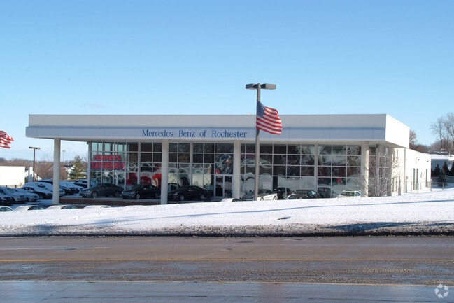
555 S Rochester Rd
Detroit-Warren-Dearborn, MI
Supervisors Plat #2
15-14-302-037
T3N, R11E, SEC 14 PART OF SW 1/4, ALSO PART OF LOTS 60 & 63 OF 'SUPERVISOR'S PLAT NO 2' ALL DESC AS BEG AT PT DIST N 00-14-16
Commercialnec
Oakland
X
Michigan
26125C0392F
60,63
2024
6.77 AC
2022
Rochester
193400
Detroit
8,600 SF
DEMOGRAPHICS near 555 S Rochester Rd
1 Mile
3 Mile
5 Mile
2024 Total Population
9,721
70,729
166,038
2029 Population
9,641
70,096
164,585
Pop Growth 2024-2029
(0.82%)
(0.89%)
(0.88%)
Average Age
41
42
42
2024 Total Households
4,368
28,572
65,774
HH Growth 2024-2029
(0.71%)
(0.85%)
(0.84%)
Median Household Inc
$94,916
$102,688
$101,263
Avg Household Size
2.10
2.40
2.40
2024 Avg HH Vehicles
2.00
2.00
2.00
Median Home Value
$325,853
$350,234
$355,423
Median Year Built
1982
1981
1984
Nearby Places
Map Layers
Map Styles
 Street
 Aerial
- Restaurants
- Banks
- Shops
- Fitness
- Groceries
PUBLIC TRANSPORTATION
AIRPORT
Windsor International
DRIVE
WALK
Distance
Windsor International
58 min
35.2 mi
Freight Ports
Port of Toledo
DRIVE
WALK
Distance
Port of Toledo
108 min
85.7 mi
Nearby Properties
Address
Land Use
TOTAL SIZE
Lot Size
Zoning
Address
Land Use
TOTAL SIZE
Lot Size
Zoning
444,087 SF
83.19 AC
II
Address
Land Use
TOTAL SIZE
Lot Size
Zoning
3,529 SF
29.19 AC
BI
Address
Land Use
TOTAL SIZE
Lot Size
Zoning
57.84 AC
AV
Address
Land Use
TOTAL SIZE
Lot Size
Zoning
389,465 SF
30.24 AC
II
Address
Land Use
TOTAL SIZE
Lot Size
Zoning
Address
Land Use
TOTAL SIZE
Lot Size
Zoning
195,413 SF
4.43 AC
Address
Land Use
TOTAL SIZE
Lot Size
Zoning
35.60 AC
R-12
Address
Land Use
TOTAL SIZE
Lot Size
Zoning
22.09 AC
AI
Address
Land Use
TOTAL SIZE
Lot Size
Zoning
134,904 SF
5 AC
Address
Land Use
TOTAL SIZE
Lot Size
Zoning
19.47 AC
R-8
Address
Land Use
TOTAL SIZE
Lot Size
Zoning
119.30 AC
Address
Land Use
TOTAL SIZE
Lot Size
Zoning
21.52 AC
AI
Address
Land Use
TOTAL SIZE
Lot Size
Zoning
19.86 AC
AI
Address
Land Use
TOTAL SIZE
Lot Size
Zoning
Address
Land Use
TOTAL SIZE
Lot Size
Zoning
51.98 AC
MHP
Address
Land Use
TOTAL SIZE
Lot Size
Zoning
11.98 AC
RI
Address
Land Use
TOTAL SIZE
Lot Size
Zoning
Address
Land Use
TOTAL SIZE
Lot Size
Zoning
62,495 SF
2.49 AC
MM
Address
Land Use
TOTAL SIZE
Lot Size
Zoning
89,450 SF
0.41 AC
BI
Address
Land Use
TOTAL SIZE
Lot Size
Zoning
29.30 AC
AI
Address
Land Use
TOTAL SIZE
Lot Size
Zoning
26.25 AC
AI
Address
Land Use
TOTAL SIZE
Lot Size
Zoning
96,460 SF
17.50 AC
Address
Land Use
TOTAL SIZE
Lot Size
Zoning
55,651 SF
23.39 AC
II
Address
Land Use
TOTAL SIZE
Lot Size
Zoning
191.40 AC
AI
Address
Land Use
TOTAL SIZE
Lot Size
Zoning
112,300 SF
25.04 AC
The World's #1 Commercial Real Estate Marketplace
Connect with us
© 2026 CoStar Group
The information above has been obtained from sources believed reliable. While we do not doubt its accuracy we have not verified it and make no guarantee, warranty or representation about it. It is your responsibility to independently confirm its accuracy and completeness. Any projections, opinions, assumptions, or estimates used are for example only and do not represent the current or future performance of the property. The value of this transaction to you depends on tax and other factors which should be evaluated by your tax, financial, and legal advisors. You and your advisors should conduct a careful, independent investigation of the property to determine to your satisfaction the suitability of the property for your needs.