Property Record
555 S Trooper Rd, Norristown, PA 19403
NEARBY LISTINGS FOR SALE OR LEASE
Property Detail
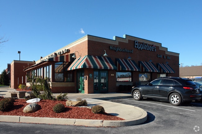
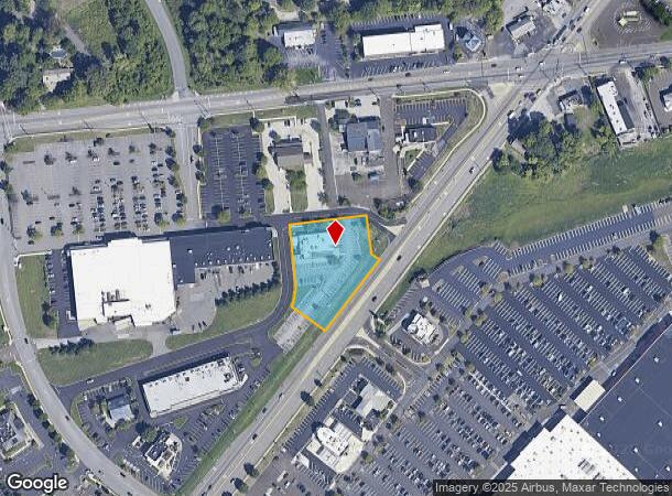
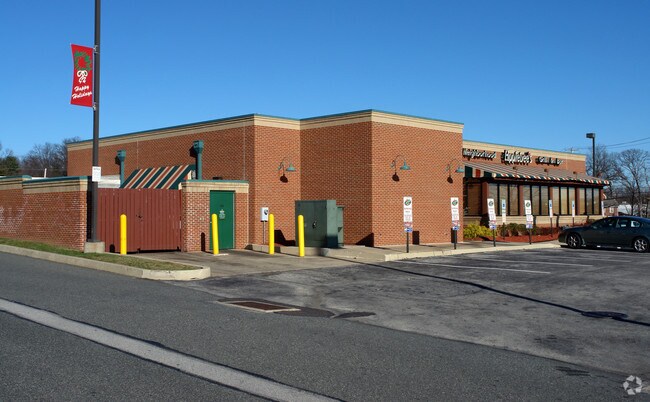
555 S Trooper Rd
Philadelphia-Camden-Wilmington, PA-NJ-DE-MD
Audubon Square
43-00-15157-028
248 X IRR 52292 SF
Restaurantbuilding
Montgomery
X
Pennsylvania
42091C0245G
5
2024
1.20 AC
2025
Norristown/Valley Forge
206006
Philadelphia
5,627 SF
DEMOGRAPHICS near 555 S Trooper Rd
1 Mile
3 Mile
5 Mile
2024 Total Population
6,273
70,608
166,759
2029 Population
6,327
71,695
170,216
Pop Growth 2024-2029
+ 0.86%
+ 1.54%
+ 2.07%
Average Age
49
41
41
2024 Total Households
2,935
28,086
65,859
HH Growth 2024-2029
+ 0.65%
+ 1.58%
+ 2.19%
Median Household Inc
$83,524
$95,658
$95,787
Avg Household Size
2.00
2.40
2.40
2024 Avg HH Vehicles
2.00
2.00
2.00
Median Home Value
$311,305
$339,874
$357,063
Median Year Built
1984
1973
1972
Nearby Places
Map Layers
Map Styles
 Street
 Aerial
- Restaurants
- Banks
- Shops
- Fitness
- Groceries
PUBLIC TRANSPORTATION
COMMUTER RAIL
Main Street (Norristown) (R6 - Southeastern Pennsylvania Transportation Authority Regional Rail (SEPTA Regional Rail))
DRIVE
WALK
Distance
Main Street (Norristown) (R6 - Southeastern Pennsylvania Transportation Authority Regional Rail (SEPTA Regional Rail))
9 min
3.4 mi
Elm Street (Norristown) (R6 - Southeastern Pennsylvania Transportation Authority Regional Rail (SEPTA Regional Rail))
DRIVE
WALK
Distance
Elm Street (Norristown) (R6 - Southeastern Pennsylvania Transportation Authority Regional Rail (SEPTA Regional Rail))
9 min
3.8 mi
AIRPORT
Philadelphia International
DRIVE
WALK
Distance
Philadelphia International
47 min
30.7 mi
Freight Ports
Port of Philadelphia
DRIVE
WALK
Distance
Port of Philadelphia
42 min
27.9 mi
Nearby Properties
Address
Land Use
TOTAL SIZE
Lot Size
Zoning
Address
Land Use
TOTAL SIZE
Lot Size
Zoning
2,373,472 SF
96.77 AC
SC
Address
Land Use
TOTAL SIZE
Lot Size
Zoning
1,807,465 SF
120.12 AC
R2
Address
Land Use
TOTAL SIZE
Lot Size
Zoning
536,904 SF
8.84 AC
AG
Address
Land Use
TOTAL SIZE
Lot Size
Zoning
679,715 SF
58.23 AC
R2
Address
Land Use
TOTAL SIZE
Lot Size
Zoning
1,724,092 SF
24 AC
SC
Address
Land Use
TOTAL SIZE
Lot Size
Zoning
58,212 SF
20.89 AC
M2
Address
Land Use
TOTAL SIZE
Lot Size
Zoning
124,789 SF
155.99 AC
INO
Address
Land Use
TOTAL SIZE
Lot Size
Zoning
972,935 SF
20.51 AC
INO
Address
Land Use
TOTAL SIZE
Lot Size
Zoning
388,042 SF
24.45 AC
SM
Address
Land Use
TOTAL SIZE
Lot Size
Zoning
547,377 SF
3.28 AC
AG
Address
Land Use
TOTAL SIZE
Lot Size
Zoning
617,174 SF
25.32 AC
HR
Address
Land Use
TOTAL SIZE
Lot Size
Zoning
454,933 SF
17.85 AC
SM
Address
Land Use
TOTAL SIZE
Lot Size
Zoning
422,975 SF
92.05 AC
RA
Address
Land Use
TOTAL SIZE
Lot Size
Zoning
413,892 SF
21.94 AC
SM
Address
Land Use
TOTAL SIZE
Lot Size
Zoning
493,690 SF
4.75 AC
AG
Address
Land Use
TOTAL SIZE
Lot Size
Zoning
502,080 SF
11.36 AC
RA
Address
Land Use
TOTAL SIZE
Lot Size
Zoning
348,190 SF
68 AC
R1
Address
Land Use
TOTAL SIZE
Lot Size
Zoning
488,970 SF
24.68 AC
AR
Address
Land Use
TOTAL SIZE
Lot Size
Zoning
197,108 SF
2.08 AC
SC
Address
Land Use
TOTAL SIZE
Lot Size
Zoning
503,942 SF
11.26 AC
RA
Address
Land Use
TOTAL SIZE
Lot Size
Zoning
1,470,449 SF
80.02 AC
R1
Address
Land Use
TOTAL SIZE
Lot Size
Zoning
199,873 SF
71.47 AC
INO
Address
Land Use
TOTAL SIZE
Lot Size
Zoning
381,927 SF
5.10 AC
SM
Address
Land Use
TOTAL SIZE
Lot Size
Zoning
918,170 SF
89.93 AC
LI
Address
Land Use
TOTAL SIZE
Lot Size
Zoning
396,137 SF
2.26 AC
HR
Address
Land Use
TOTAL SIZE
Lot Size
Zoning
253,500 SF
5.47 AC
AG
Address
Land Use
TOTAL SIZE
Lot Size
Zoning
435,884 SF
26.70 AC
R5
Address
Land Use
TOTAL SIZE
Lot Size
Zoning
273,724 SF
8.05 AC
INO
Address
Land Use
TOTAL SIZE
Lot Size
Zoning
94,055 SF
16.24 AC
LI
Address
Land Use
TOTAL SIZE
Lot Size
Zoning
290,066 SF
8.50 AC
SM
The World's #1 Commercial Real Estate Marketplace
Connect with us
© 2025 CoStar Group
The information above has been obtained from sources believed reliable. While we do not doubt its accuracy we have not verified it and make no guarantee, warranty or representation about it. It is your responsibility to independently confirm its accuracy and completeness. Any projections, opinions, assumptions, or estimates used are for example only and do not represent the current or future performance of the property. The value of this transaction to you depends on tax and other factors which should be evaluated by your tax, financial, and legal advisors. You and your advisors should conduct a careful, independent investigation of the property to determine to your satisfaction the suitability of the property for your needs.