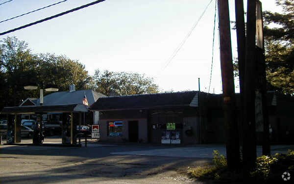
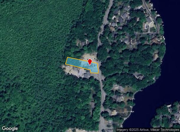
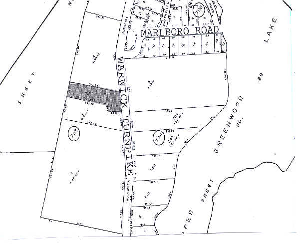
Property Record
555 Warwick Tpke, Hewitt, NJ 07421
NEARBY LISTINGS FOR SALE OR LEASE
Property Detail
555 Warwick Tpke
15-00703-0000-00003
Passaic
Servicestation
New Jersey
A
3
34037C0220E
0.60 AC
2024
Upper Suburban Passaic
2025
Northern New Jersey
256801
New York-Jersey City-White Plains, NY-NJ
DEMOGRAPHICS near 555 Warwick Tpke
1 Mile
3 Mile
5 Mile
2024 Total Population
2,273
9,743
28,659
2029 Population
2,290
9,814
29,033
Pop Growth 2024-2029
+ 0.75%
+ 0.73%
+ 1.31%
Average Age
43
43
44
2024 Total Households
881
3,861
11,131
HH Growth 2024-2029
+ 0.57%
+ 0.52%
+ 1.23%
Median Household Inc
$96,093
$101,363
$103,469
Avg Household Size
2.50
2.50
2.50
2024 Avg HH Vehicles
2.00
2.00
2.00
Median Home Value
$336,482
$318,008
$328,179
Median Year Built
1974
1972
1973
Nearby Places
Map Layers
Map Styles
 Street
 Aerial
- Restaurants
- Banks
- Shops
- Fitness
- Groceries
PUBLIC TRANSPORTATION
AIRPORT
New York Stewart International
DRIVE
WALK
Distance
New York Stewart International
58 min
34.4 mi
Freight Ports
Port Newark Container Terminal
DRIVE
WALK
Distance
Port Newark Container Terminal
70 min
48.8 mi
Nearby Properties
Address
Land Use
TOTAL SIZE
Lot Size
Zoning
Address
Land Use
TOTAL SIZE
Lot Size
Zoning
Address
Land Use
TOTAL SIZE
Lot Size
Zoning
1,980.99 AC
Address
Land Use
TOTAL SIZE
Lot Size
Zoning
12.50 AC
Address
Land Use
TOTAL SIZE
Lot Size
Zoning
1,486.31 AC
Address
Land Use
TOTAL SIZE
Lot Size
Zoning
1,854.80 AC
Address
Land Use
TOTAL SIZE
Lot Size
Zoning
Address
Land Use
TOTAL SIZE
Lot Size
Zoning
2,056 SF
2,729.93 AC
Address
Land Use
TOTAL SIZE
Lot Size
Zoning
1,344 SF
36.33 AC
Address
Land Use
TOTAL SIZE
Lot Size
Zoning
15 AC
Address
Land Use
TOTAL SIZE
Lot Size
Zoning
Address
Land Use
TOTAL SIZE
Lot Size
Zoning
Address
Land Use
TOTAL SIZE
Lot Size
Zoning
Address
Land Use
TOTAL SIZE
Lot Size
Zoning
276.91 AC
Address
Land Use
TOTAL SIZE
Lot Size
Zoning
Address
Land Use
TOTAL SIZE
Lot Size
Zoning
220.45 AC
Address
Land Use
TOTAL SIZE
Lot Size
Zoning
6.60 AC
Address
Land Use
TOTAL SIZE
Lot Size
Zoning
1,301 SF
1.51 AC
Address
Land Use
TOTAL SIZE
Lot Size
Zoning
Address
Land Use
TOTAL SIZE
Lot Size
Zoning
Address
Land Use
TOTAL SIZE
Lot Size
Zoning
379.50 AC
Address
Land Use
TOTAL SIZE
Lot Size
Zoning
25,485 SF
10.23 AC
Address
Land Use
TOTAL SIZE
Lot Size
Zoning
3.25 AC
Address
Land Use
TOTAL SIZE
Lot Size
Zoning
1.66 AC
Address
Land Use
TOTAL SIZE
Lot Size
Zoning
17,400 SF
6.04 AC
LI
Address
Land Use
TOTAL SIZE
Lot Size
Zoning
1,812 SF
219.25 AC
LI
Address
Land Use
TOTAL SIZE
Lot Size
Zoning
239.15 AC
Address
Land Use
TOTAL SIZE
Lot Size
Zoning
Address
Land Use
TOTAL SIZE
Lot Size
Zoning
Address
Land Use
TOTAL SIZE
Lot Size
Zoning
203.21 AC
P
Address
Land Use
TOTAL SIZE
Lot Size
Zoning
The World's #1 Commercial Real Estate Marketplace
Connect with us
© 2025 CoStar Group
The information above has been obtained from sources believed reliable. While we do not doubt its accuracy we have not verified it and make no guarantee, warranty or representation about it. It is your responsibility to independently confirm its accuracy and completeness. Any projections, opinions, assumptions, or estimates used are for example only and do not represent the current or future performance of the property. The value of this transaction to you depends on tax and other factors which should be evaluated by your tax, financial, and legal advisors. You and your advisors should conduct a careful, independent investigation of the property to determine to your satisfaction the suitability of the property for your needs.