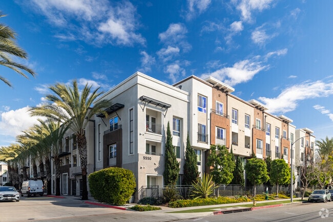
Property Record
5550 Grosvenor Blvd, Los Angeles, CA 90066
NEARBY LISTINGS FOR SALE OR LEASE
Property Detail
5550 Grosvenor Blvd
4211-003-071
TR=33003 THAT POR IN TRA 1482 LOTS 1 AND 2
Multifamilydwelling
Los Angeles
X
California
06037C1760F
1,2
2024
3.79 AC
2025
Playa Vista
275605
Los Angeles
247,737 SF
Los Angeles-Long Beach-Glendale, CA
DEMOGRAPHICS near 5550 Grosvenor Blvd
1 Mile
3 Mile
5 Mile
2024 Total Population
25,532
238,002
610,158
2029 Population
24,818
232,592
595,603
Pop Growth 2024-2029
(2.80%)
(2.27%)
(2.39%)
Average Age
40
41
40
2024 Total Households
10,746
107,209
257,725
HH Growth 2024-2029
(2.92%)
(2.43%)
(2.52%)
Median Household Inc
$127,210
$107,576
$92,545
Avg Household Size
2.30
2.10
2.30
2024 Avg HH Vehicles
2.00
2.00
2.00
Median Home Value
$1,100,446
$1,078,879
$1,049,759
Median Year Built
1978
1972
1966
Nearby Places
Map Layers
Map Styles
 Street
 Aerial
- Restaurants
- Banks
- Shops
- Fitness
- Groceries
PUBLIC TRANSPORTATION
AIRPORT
Los Angeles International
DRIVE
WALK
Distance
Los Angeles International
10 min
4.5 mi
Long Beach (Daugherty Field)
DRIVE
WALK
Distance
Long Beach (Daugherty Field)
30 min
22.6 mi
Bob Hope
DRIVE
WALK
Distance
Bob Hope
34 min
23.6 mi
Nearby Properties
Address
Land Use
TOTAL SIZE
Lot Size
Zoning
Address
Land Use
TOTAL SIZE
Lot Size
Zoning
514,260 SF
13.76 AC
LAMPV
Address
Land Use
TOTAL SIZE
Lot Size
Zoning
157,691 SF
45.86 AC
CCS1*
Address
Land Use
TOTAL SIZE
Lot Size
Zoning
346,856 SF
3.67 AC
CCC3*
Address
Land Use
TOTAL SIZE
Lot Size
Zoning
1,007,400 SF
6.45 AC
LAM(PV)
Address
Land Use
TOTAL SIZE
Lot Size
Zoning
512,019 SF
10.70 AC
LAC2(PV)
Address
Land Use
TOTAL SIZE
Lot Size
Zoning
362,414 SF
20.88 AC
LAM1
Address
Land Use
TOTAL SIZE
Lot Size
Zoning
131,967 SF
94.08 AC
LAR4
Address
Land Use
TOTAL SIZE
Lot Size
Zoning
658,463 SF
6.81 AC
LAC2(PV)
Address
Land Use
TOTAL SIZE
Lot Size
Zoning
402,060 SF
3.58 AC
LAC2
Address
Land Use
TOTAL SIZE
Lot Size
Zoning
670,596 SF
11.60 AC
LAR4
Address
Land Use
TOTAL SIZE
Lot Size
Zoning
185,810 SF
13.27 AC
LAM2
Address
Land Use
TOTAL SIZE
Lot Size
Zoning
482,248 SF
5.09 AC
LAR4(PV)
Address
Land Use
TOTAL SIZE
Lot Size
Zoning
321,055 SF
5.98 AC
LAM(PV)
Address
Land Use
TOTAL SIZE
Lot Size
Zoning
9.38 AC
LAR4(PV)
Address
Land Use
TOTAL SIZE
Lot Size
Zoning
322,002 SF
3.88 AC
LARAS4
Address
Land Use
TOTAL SIZE
Lot Size
Zoning
530,988 SF
8 AC
LAM2
Address
Land Use
TOTAL SIZE
Lot Size
Zoning
9.38 AC
LAR4(PV)
Address
Land Use
TOTAL SIZE
Lot Size
Zoning
522,511 SF
4.91 AC
LARAS4
Address
Land Use
TOTAL SIZE
Lot Size
Zoning
297,937 SF
1.59 AC
CCC3*
Address
Land Use
TOTAL SIZE
Lot Size
Zoning
392,246 SF
4 AC
LAC4
Address
Land Use
TOTAL SIZE
Lot Size
Zoning
283,733 SF
2.82 AC
CCC3
Address
Land Use
TOTAL SIZE
Lot Size
Zoning
329,810 SF
2.21 AC
LAC2
Address
Land Use
TOTAL SIZE
Lot Size
Zoning
622,357 SF
3.42 AC
LAC2
Address
Land Use
TOTAL SIZE
Lot Size
Zoning
384,621 SF
2.50 AC
LAR4(PV)
Address
Land Use
TOTAL SIZE
Lot Size
Zoning
632,476 SF
10.56 AC
LAC2
Address
Land Use
TOTAL SIZE
Lot Size
Zoning
145,427 SF
2.06 AC
LAC2(PV)
Address
Land Use
TOTAL SIZE
Lot Size
Zoning
329,322 SF
1.28 AC
LAC2
Address
Land Use
TOTAL SIZE
Lot Size
Zoning
784,680 SF
18.28 AC
LAM1
Address
Land Use
TOTAL SIZE
Lot Size
Zoning
530,660 SF
20.58 AC
CCC3*
Address
Land Use
TOTAL SIZE
Lot Size
Zoning
284,937 SF
3 AC
LARAS4
The World's #1 Commercial Real Estate Marketplace
Connect with us
© 2025 CoStar Group
The information above has been obtained from sources believed reliable. While we do not doubt its accuracy we have not verified it and make no guarantee, warranty or representation about it. It is your responsibility to independently confirm its accuracy and completeness. Any projections, opinions, assumptions, or estimates used are for example only and do not represent the current or future performance of the property. The value of this transaction to you depends on tax and other factors which should be evaluated by your tax, financial, and legal advisors. You and your advisors should conduct a careful, independent investigation of the property to determine to your satisfaction the suitability of the property for your needs.