Property Record
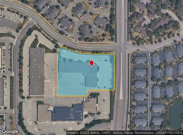
5550 Upper 147Th St W, Saint Paul, MN 55124


Current Lease Availabilities
NEARBY LISTINGS FOR SALE OR LEASE
Property Detail
5550 Upper 147Th St W
Minneapolis-St. Paul-Bloomington, MN-WI
Valley Business Park 3Rd Addition
01-81102-01-020
VALLEY BUSINESS PARK 3RD ADDITION 2 1
Commercialnec
Dakota
X
Minnesota
27037C0210E
20
2024
4.67 AC
2024
Burnsville/Eagan/Apple Vy
060841
Minneapolis/St Paul
48,922 SF
DEMOGRAPHICS near 5550 Upper 147Th St W
1 Mile
3 Mile
5 Mile
2024 Total Population
8,165
82,937
180,081
2029 Population
8,272
84,710
184,212
Pop Growth 2024-2029
+ 1.31%
+ 2.14%
+ 2.29%
Average Age
40
39
39
2024 Total Households
3,139
30,589
65,307
HH Growth 2024-2029
+ 1.31%
+ 2.26%
+ 2.39%
Median Household Inc
$89,991
$98,802
$106,578
Avg Household Size
2.60
2.60
2.70
2024 Avg HH Vehicles
2.00
2.00
2.00
Median Home Value
$312,065
$323,938
$342,290
Median Year Built
1988
1992
1990
Nearby Places
Map Layers
Map Styles
 Street
 Aerial
- Restaurants
- Banks
- Shops
- Fitness
- Groceries
PUBLIC TRANSPORTATION
AIRPORT
Minneapolis-St Paul International/Wold-Chamberlain
DRIVE
WALK
Distance
Minneapolis-St Paul International/Wold-Chamberlain
23 min
13.3 mi
Nearby Properties
Address
Land Use
TOTAL SIZE
Lot Size
Zoning
Address
Land Use
TOTAL SIZE
Lot Size
Zoning
124,880 SF
20.24 AC
Address
Land Use
TOTAL SIZE
Lot Size
Zoning
435,642 SF
12.28 AC
Address
Land Use
TOTAL SIZE
Lot Size
Zoning
413,138 SF
11.86 AC
Address
Land Use
TOTAL SIZE
Lot Size
Zoning
312,292 SF
4.77 AC
Address
Land Use
TOTAL SIZE
Lot Size
Zoning
98,397 SF
12.42 AC
Address
Land Use
TOTAL SIZE
Lot Size
Zoning
269,828 SF
3.58 AC
Address
Land Use
TOTAL SIZE
Lot Size
Zoning
422,000 SF
62.13 AC
Address
Land Use
TOTAL SIZE
Lot Size
Zoning
361,645 SF
75.60 AC
Address
Land Use
TOTAL SIZE
Lot Size
Zoning
18,687 SF
7.71 AC
Address
Land Use
TOTAL SIZE
Lot Size
Zoning
277,504 SF
5.27 AC
Address
Land Use
TOTAL SIZE
Lot Size
Zoning
351,484 SF
57.09 AC
Address
Land Use
TOTAL SIZE
Lot Size
Zoning
Address
Land Use
TOTAL SIZE
Lot Size
Zoning
278,440 SF
13.61 AC
Address
Land Use
TOTAL SIZE
Lot Size
Zoning
193,413 SF
2.95 AC
Address
Land Use
TOTAL SIZE
Lot Size
Zoning
207,187 SF
2.45 AC
Address
Land Use
TOTAL SIZE
Lot Size
Zoning
181,250 SF
2.68 AC
Address
Land Use
TOTAL SIZE
Lot Size
Zoning
232,598 SF
3.61 AC
Address
Land Use
TOTAL SIZE
Lot Size
Zoning
181,880 SF
3.23 AC
Address
Land Use
TOTAL SIZE
Lot Size
Zoning
179,476 SF
2.46 AC
Address
Land Use
TOTAL SIZE
Lot Size
Zoning
168,324 SF
2.66 AC
Address
Land Use
TOTAL SIZE
Lot Size
Zoning
134,140 SF
6.39 AC
Address
Land Use
TOTAL SIZE
Lot Size
Zoning
Address
Land Use
TOTAL SIZE
Lot Size
Zoning
183,197 SF
2.20 AC
Address
Land Use
TOTAL SIZE
Lot Size
Zoning
226,621 SF
35.56 AC
Address
Land Use
TOTAL SIZE
Lot Size
Zoning
130,876 SF
11.25 AC
Address
Land Use
TOTAL SIZE
Lot Size
Zoning
210,772 SF
15.28 AC
Address
Land Use
TOTAL SIZE
Lot Size
Zoning
246,662 SF
22.62 AC
Address
Land Use
TOTAL SIZE
Lot Size
Zoning
214,000 SF
28.74 AC
Address
Land Use
TOTAL SIZE
Lot Size
Zoning
247,930 SF
16.48 AC
The World's #1 Commercial Real Estate Marketplace
Connect with us
© 2025 CoStar Group
The information above has been obtained from sources believed reliable. While we do not doubt its accuracy we have not verified it and make no guarantee, warranty or representation about it. It is your responsibility to independently confirm its accuracy and completeness. Any projections, opinions, assumptions, or estimates used are for example only and do not represent the current or future performance of the property. The value of this transaction to you depends on tax and other factors which should be evaluated by your tax, financial, and legal advisors. You and your advisors should conduct a careful, independent investigation of the property to determine to your satisfaction the suitability of the property for your needs.