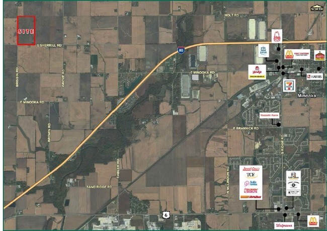
Property Record
5551 E Sherrill Rd, Minooka, IL 60447


Property Detail
5551 E Sherrill Rd
Chicago-Naperville-Elgin, IL-IN
100.53 AC TR LYG SW 1/4 SEC 31-35-8 (EXC ROW TAKEN 12-20828)
09-31-300-003
KENDALL
Farms
Illinois
B and X Area of moderate flood hazard, usually the area between the limits of the 100-year and 500-year floods.
100.57 AC
2024
Joliet/Central Will
2024
Chicago
890703
NEARBY LISTINGS FOR SALE OR LEASE
DEMOGRAPHICS near 5551 E Sherrill Rd
1 mile
3 mile
5 mile
2025 Total Population
47
1,727
7,639
2030 Population
49
1,771
7,903
Pop Growth 2025-2030
+ 4.26%
+ 2.55%
+ 3.46%
Average Age
38
39
37
2025 Total Households
16
599
2,528
HH Growth 2025-2030
+ 6.25%
+ 2.67%
+ 3.32%
Median Household Inc
$118,749
$112,752
$113,753
Avg Household Size
2.80
2.80
3.00
2025 Avg HH Vehicles
3.00
3.00
3.00
Median Home Value
$299,999
$292,815
$302,613
Median Year Built
1997
2001
2002
Nearby Places
Map Layers
Map Styles
 Street
 Aerial
Transit
 Traffic
 Biking
Places
Listings with unknown addresses are not visible on the map
- Restaurants
- Banks
- Shops
- Fitness
- Groceries
Nearby Properties
Address
Land Use
TOTAL SIZE
Lot Size
Zoning
Address
Land Use
TOTAL SIZE
Lot Size
Zoning
3,360 SF
43.42 AC
Address
Land Use
TOTAL SIZE
Lot Size
Zoning
5,590 SF
5 AC
Address
Land Use
TOTAL SIZE
Lot Size
Zoning
Address
Land Use
TOTAL SIZE
Lot Size
Zoning
160.50 AC
Address
Land Use
TOTAL SIZE
Lot Size
Zoning
160.04 AC
Address
Land Use
TOTAL SIZE
Lot Size
Zoning
150 AC
Address
Land Use
TOTAL SIZE
Lot Size
Zoning
157.73 AC
Address
Land Use
TOTAL SIZE
Lot Size
Zoning
143 AC
Address
Land Use
TOTAL SIZE
Lot Size
Zoning
155.25 AC
Address
Land Use
TOTAL SIZE
Lot Size
Zoning
119.56 AC
Address
Land Use
TOTAL SIZE
Lot Size
Zoning
155.02 AC
Address
Land Use
TOTAL SIZE
Lot Size
Zoning
99 AC
Address
Land Use
TOTAL SIZE
Lot Size
Zoning
Address
Land Use
TOTAL SIZE
Lot Size
Zoning
103.06 AC
Address
Land Use
TOTAL SIZE
Lot Size
Zoning
2,352 SF
4.78 AC
Address
Land Use
TOTAL SIZE
Lot Size
Zoning
104.16 AC
Address
Land Use
TOTAL SIZE
Lot Size
Zoning
90.01 AC
Address
Land Use
TOTAL SIZE
Lot Size
Zoning
92.62 AC
Address
Land Use
TOTAL SIZE
Lot Size
Zoning
92.62 AC
Address
Land Use
TOTAL SIZE
Lot Size
Zoning
79.93 AC
Address
Land Use
TOTAL SIZE
Lot Size
Zoning
79.45 AC
Address
Land Use
TOTAL SIZE
Lot Size
Zoning
76.24 AC
Address
Land Use
TOTAL SIZE
Lot Size
Zoning
70.66 AC
Address
Land Use
TOTAL SIZE
Lot Size
Zoning
82.16 AC
Address
Land Use
TOTAL SIZE
Lot Size
Zoning
76.43 AC
The World's #1 Commercial Real Estate Marketplace
Connect with us
© 2026 CoStar Group
The information above has been obtained from sources believed reliable. While we do not doubt its accuracy we have not verified it and make no guarantee, warranty or representation about it. It is your responsibility to independently confirm its accuracy and completeness. Any projections, opinions, assumptions, or estimates used are for example only and do not represent the current or future performance of the property. The value of this transaction to you depends on tax and other factors which should be evaluated by your tax, financial, and legal advisors. You and your advisors should conduct a careful, independent investigation of the property to determine to your satisfaction the suitability of the property for your needs.