Property Record
5553 S Peoria Ave, Tulsa, OK 74105
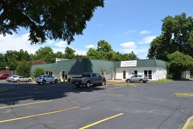
This Property Is For Sale
Current Lease Availabilities
NEARBY LISTINGS FOR SALE OR LEASE
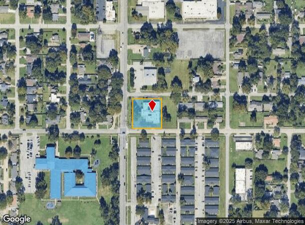
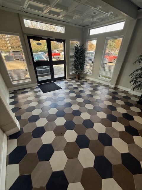
Property Detail
5553 S Peoria Ave
29125-93-31-07020
J E Nichols Sub
Officebuilding
E 185 OF W 200 BLK 5
X
Tulsa
40143C0353L
Oklahoma
2025
0.78 AC
2025
South Central
006804
Tulsa
10,461 SF
Tulsa, OK
DEMOGRAPHICS near 5553 S Peoria Ave
1 Mile
3 Mile
5 Mile
2024 Total Population
14,439
72,288
184,071
2029 Population
15,016
74,949
190,837
Pop Growth 2024-2029
+ 4.00%
+ 3.68%
+ 3.68%
Average Age
39
40
40
2024 Total Households
7,156
33,018
84,665
HH Growth 2024-2029
+ 4.01%
+ 3.69%
+ 3.79%
Median Household Inc
$33,685
$55,046
$57,264
Avg Household Size
1.90
2.10
2.10
2024 Avg HH Vehicles
1.00
2.00
2.00
Median Home Value
$155,145
$251,231
$226,129
Median Year Built
1968
1971
1971
Nearby Places
Map Layers
Map Styles
 Street
 Aerial
- Restaurants
- Banks
- Shops
- Fitness
- Groceries
PUBLIC TRANSPORTATION
AIRPORT
Tulsa International
DRIVE
WALK
Distance
Tulsa International
25 min
13.4 mi
Nearby Properties
Address
Land Use
TOTAL SIZE
Lot Size
Zoning
Address
Land Use
TOTAL SIZE
Lot Size
Zoning
1,584,609 SF
84.41 AC
AG
Address
Land Use
TOTAL SIZE
Lot Size
Zoning
790,247 SF
149.86 AC
RS3
Address
Land Use
TOTAL SIZE
Lot Size
Zoning
49,992 SF
33.23 AC
AG
Address
Land Use
TOTAL SIZE
Lot Size
Zoning
358,576 SF
38.21 AC
RM1
Address
Land Use
TOTAL SIZE
Lot Size
Zoning
114,791 SF
23.40 AC
RE
Address
Land Use
TOTAL SIZE
Lot Size
Zoning
61,153 SF
7.16 AC
CH
Address
Land Use
TOTAL SIZE
Lot Size
Zoning
310,629 SF
19.19 AC
OM
Address
Land Use
TOTAL SIZE
Lot Size
Zoning
290,963 SF
10.77 AC
RM1
Address
Land Use
TOTAL SIZE
Lot Size
Zoning
325 SF
44.06 AC
RM2
Address
Land Use
TOTAL SIZE
Lot Size
Zoning
266,675 SF
12.31 AC
RM1
Address
Land Use
TOTAL SIZE
Lot Size
Zoning
119,056 SF
28.06 AC
CM
Address
Land Use
TOTAL SIZE
Lot Size
Zoning
147,881 SF
35.20 AC
RS2
Address
Land Use
TOTAL SIZE
Lot Size
Zoning
98,590 SF
6.41 AC
OM
Address
Land Use
TOTAL SIZE
Lot Size
Zoning
107,538 SF
19.74 AC
OM
Address
Land Use
TOTAL SIZE
Lot Size
Zoning
62,000 SF
7.20 AC
OM
Address
Land Use
TOTAL SIZE
Lot Size
Zoning
15.98 AC
OMH
Address
Land Use
TOTAL SIZE
Lot Size
Zoning
56,984 SF
5.54 AC
RS3
Address
Land Use
TOTAL SIZE
Lot Size
Zoning
132,105 SF
9.32 AC
RS3
Address
Land Use
TOTAL SIZE
Lot Size
Zoning
58,864 SF
5.18 AC
RS3
Address
Land Use
TOTAL SIZE
Lot Size
Zoning
62,792 SF
5.18 AC
RM1
Address
Land Use
TOTAL SIZE
Lot Size
Zoning
53,220 SF
4.93 AC
CH
Address
Land Use
TOTAL SIZE
Lot Size
Zoning
30,418 SF
7.86 AC
CM
Address
Land Use
TOTAL SIZE
Lot Size
Zoning
1,011,877 SF
5.55 AC
CH
Address
Land Use
TOTAL SIZE
Lot Size
Zoning
330,521 SF
22.04 AC
PUD
Address
Land Use
TOTAL SIZE
Lot Size
Zoning
84,791 SF
8.04 AC
RS3
Address
Land Use
TOTAL SIZE
Lot Size
Zoning
35,785 SF
4.55 AC
RS1
Address
Land Use
TOTAL SIZE
Lot Size
Zoning
1 SF
11.34 AC
CS
Address
Land Use
TOTAL SIZE
Lot Size
Zoning
51,423 SF
1.03 AC
OM
Address
Land Use
TOTAL SIZE
Lot Size
Zoning
968,758 SF
4.86 AC
CH
Address
Land Use
TOTAL SIZE
Lot Size
Zoning
110,382 SF
9.81 AC
RS3
The World's #1 Commercial Real Estate Marketplace
Connect with us
© 2026 CoStar Group
The information above has been obtained from sources believed reliable. While we do not doubt its accuracy we have not verified it and make no guarantee, warranty or representation about it. It is your responsibility to independently confirm its accuracy and completeness. Any projections, opinions, assumptions, or estimates used are for example only and do not represent the current or future performance of the property. The value of this transaction to you depends on tax and other factors which should be evaluated by your tax, financial, and legal advisors. You and your advisors should conduct a careful, independent investigation of the property to determine to your satisfaction the suitability of the property for your needs.