Property Record
5555 Saint Charles Rd, Berkeley, IL 60163
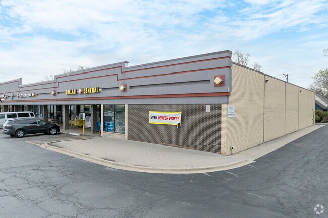


Property Detail
5555 Saint Charles Rd
Chicago-Naperville-Elgin, IL-IN
(WOLF)(ROAD)(HIGHLANDS) ROBERTSON & YOUNGS SUB IN SEC 7 SEC 07-39-12
15-07-213-067-0000
COOK
Commercialbuilding
Illinois
B and X Area of moderate flood hazard, usually the area between the limits of the 100-year and 500-year floods.
9,8
2023
1.93 AC
2025
Melrose Park Area
816800
Chicago
23,703 SF
NEARBY LISTINGS FOR SALE OR LEASE
DEMOGRAPHICS near 5555 Saint Charles Rd
1 mile
3 mile
5 mile
2025 Total Population
14,897
137,823
320,884
2030 Population
14,998
138,533
323,500
Pop Growth 2025-2030
+ 0.68%
+ 0.52%
+ 0.82%
Average Age
41
40
41
2025 Total Households
4,980
46,840
114,542
HH Growth 2025-2030
+ 0.46%
+ 0.44%
+ 0.78%
Median Household Inc
$82,533
$91,087
$90,314
Avg Household Size
2.90
2.80
2.70
2025 Avg HH Vehicles
2.00
2.00
2.00
Median Home Value
$247,184
$299,203
$314,488
Median Year Built
1956
1957
1957
Nearby Places
Map Layers
Map Styles
 Street
 Aerial
Layers
 Traffic
 Biking
Places
Listings with unknown addresses are not visible on the map
- Restaurants
- Banks
- Shops
- Fitness
- Groceries
PUBLIC TRANSPORTATION
COMMUTER RAIL
Berkeley Station (Union Pacific West Line - Northeast Illinois Regional Commuter Railroad (Metra))
Drive
Walk
Distance
Berkeley Station (Union Pacific West Line - Northeast Illinois Regional Commuter Railroad (Metra))
3 min
16 min
0.9 mi
Bellwood Station (Union Pacific West Line - Northeast Illinois Regional Commuter Railroad (Metra))
Drive
Walk
Distance
Bellwood Station (Union Pacific West Line - Northeast Illinois Regional Commuter Railroad (Metra))
4 min
1.6 mi
AIRPORT
Chicago O'Hare International
Drive
Walk
Distance
Chicago O'Hare International
19 min
9.9 mi
Chicago Midway International
Drive
Walk
Distance
Chicago Midway International
24 min
13.6 mi
Freight Ports
Port Milwaukee
Drive
Walk
Distance
Port Milwaukee
101 min
83.9 mi
SALE & LEASE HISTORY
LISTING DATE
SALE/LEASE

Dec 01, 2017
For Lease
The World's #1 Commercial Real Estate Marketplace
Connect with us
© 2026 CoStar Group
The information above has been obtained from sources believed reliable. While we do not doubt its accuracy we have not verified it and make no guarantee, warranty or representation about it. It is your responsibility to independently confirm its accuracy and completeness. Any projections, opinions, assumptions, or estimates used are for example only and do not represent the current or future performance of the property. The value of this transaction to you depends on tax and other factors which should be evaluated by your tax, financial, and legal advisors. You and your advisors should conduct a careful, independent investigation of the property to determine to your satisfaction the suitability of the property for your needs.