Property Record
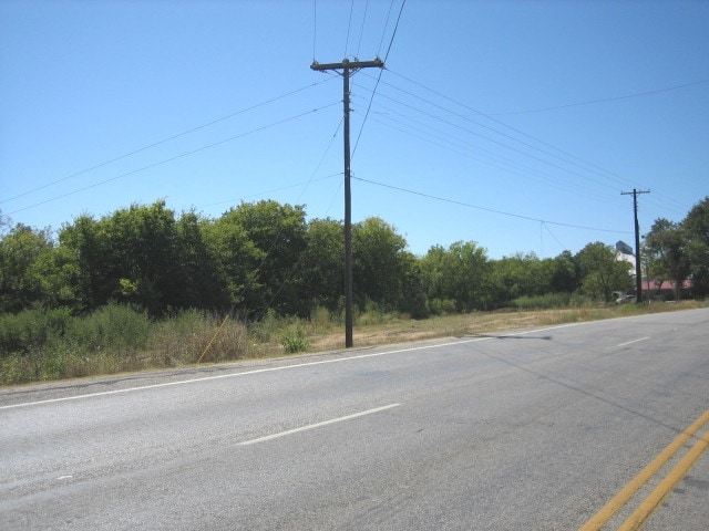
702 E Us Highway 79, Thorndale, TX 76577

Property Detail
702 E Us Highway 79
Other Market Areas
S16150 LIENDO (THORNDALE) BLK 42 LOT 5-7
R68000
Milam
Residentialacreage
Texas
2025
5-7
2025
0.80 AC
950800
Central Texas Area
NEARBY LISTINGS FOR SALE OR LEASE
-
-
View all Thorndale listings for sale on LoopNet.com
DEMOGRAPHICS near 702 E Us Highway 79
1 mile
3 mile
5 mile
2025 Total Population
1,037
1,531
2,290
2030 Population
1,052
1,564
2,369
Pop Growth 2025-2030
+ 1.45%
+ 2.16%
+ 3.45%
Average Age
42
42
43
2025 Total Households
415
606
895
HH Growth 2025-2030
+ 1.69%
+ 2.31%
+ 3.46%
Median Household Inc
$68,418
$71,249
$74,683
Avg Household Size
2.50
2.50
2.60
2025 Avg HH Vehicles
2.00
2.00
2.00
Median Home Value
$193,749
$212,025
$238,596
Median Year Built
1975
1981
1985
Nearby Places
Map Layers
Map Styles
 Street
 Aerial
Transit
 Traffic
 Biking
Places
Listings with unknown addresses are not visible on the map
- Restaurants
- Banks
- Shops
- Fitness
- Groceries
Nearby Properties
Address
Land Use
TOTAL SIZE
Lot Size
Zoning
Address
Land Use
TOTAL SIZE
Lot Size
Zoning
2,384 SF
1,166 AC
Address
Land Use
TOTAL SIZE
Lot Size
Zoning
45,779 SF
9.33 AC
Address
Land Use
TOTAL SIZE
Lot Size
Zoning
1,972 SF
411.11 AC
Address
Land Use
TOTAL SIZE
Lot Size
Zoning
1,700 SF
352.05 AC
Address
Land Use
TOTAL SIZE
Lot Size
Zoning
1,844 SF
276.17 AC
Address
Land Use
TOTAL SIZE
Lot Size
Zoning
267.62 AC
Address
Land Use
TOTAL SIZE
Lot Size
Zoning
13,980 SF
8.53 AC
Address
Land Use
TOTAL SIZE
Lot Size
Zoning
1,360 SF
8 AC
Address
Land Use
TOTAL SIZE
Lot Size
Zoning
11,140 SF
1.12 AC
Address
Land Use
TOTAL SIZE
Lot Size
Zoning
2,269 SF
137.03 AC
Address
Land Use
TOTAL SIZE
Lot Size
Zoning
2,290 SF
138.46 AC
Address
Land Use
TOTAL SIZE
Lot Size
Zoning
1,216 SF
97.99 AC
Address
Land Use
TOTAL SIZE
Lot Size
Zoning
125.33 AC
Address
Land Use
TOTAL SIZE
Lot Size
Zoning
2,016 SF
99.92 AC
Address
Land Use
TOTAL SIZE
Lot Size
Zoning
2,389 SF
120.23 AC
Address
Land Use
TOTAL SIZE
Lot Size
Zoning
2,320 SF
109.57 AC
Address
Land Use
TOTAL SIZE
Lot Size
Zoning
3,145 SF
106.53 AC
Address
Land Use
TOTAL SIZE
Lot Size
Zoning
11,910 SF
6.20 AC
Address
Land Use
TOTAL SIZE
Lot Size
Zoning
9,000 SF
0.70 AC
Address
Land Use
TOTAL SIZE
Lot Size
Zoning
1,148 SF
100 AC
Address
Land Use
TOTAL SIZE
Lot Size
Zoning
100.50 AC
Address
Land Use
TOTAL SIZE
Lot Size
Zoning
9,200 SF
1.24 AC
Address
Land Use
TOTAL SIZE
Lot Size
Zoning
92.53 AC
Address
Land Use
TOTAL SIZE
Lot Size
Zoning
1,624 SF
78 AC
Address
Land Use
TOTAL SIZE
Lot Size
Zoning
89.27 AC
Address
Land Use
TOTAL SIZE
Lot Size
Zoning
3,500 SF
1.13 AC
Address
Land Use
TOTAL SIZE
Lot Size
Zoning
8,680 SF
Address
Land Use
TOTAL SIZE
Lot Size
Zoning
5,788 SF
82.97 AC
Address
Land Use
TOTAL SIZE
Lot Size
Zoning
8,664 SF
1.40 AC
The World's #1 Commercial Real Estate Marketplace
Connect with us
© 2026 CoStar Group
The information above has been obtained from sources believed reliable. While we do not doubt its accuracy we have not verified it and make no guarantee, warranty or representation about it. It is your responsibility to independently confirm its accuracy and completeness. Any projections, opinions, assumptions, or estimates used are for example only and do not represent the current or future performance of the property. The value of this transaction to you depends on tax and other factors which should be evaluated by your tax, financial, and legal advisors. You and your advisors should conduct a careful, independent investigation of the property to determine to your satisfaction the suitability of the property for your needs.