Property Record
5557 E Main Rd, Stafford, NY 14143
NEARBY LISTINGS FOR SALE OR LEASE
-
-
View all Stafford listings for sale on LoopNet.com
Property Detail
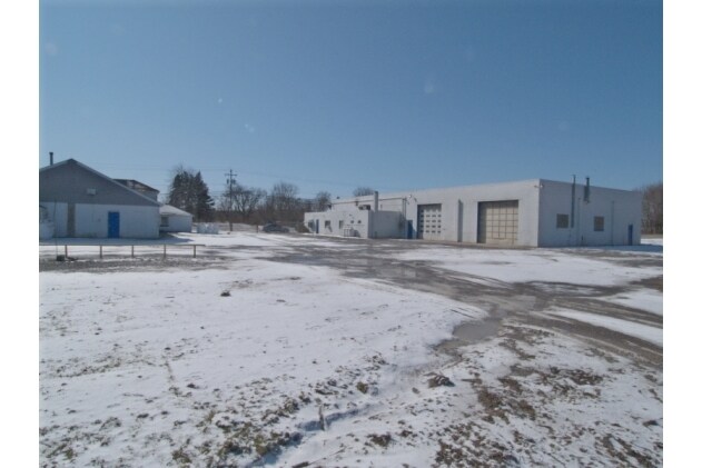
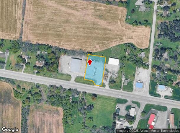
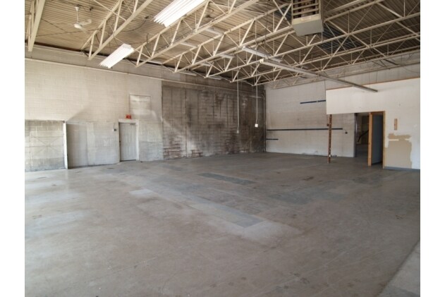
5557 E Main Rd
Batavia, NY
Genesee
184400-005-000-0001-010-011
New York
Warehouse
10.011
2025
1.10 AC
2024
Rochester Other Areas
951100
Other Market Areas
5,184 SF
DEMOGRAPHICS near 5557 E Main Rd
1 Mile
3 Mile
5 Mile
2024 Total Population
372
6,853
21,861
2029 Population
372
6,812
21,502
Pop Growth 2024-2029
0.00%
(0.60%)
(1.64%)
Average Age
45
44
43
2024 Total Households
160
2,992
9,390
HH Growth 2024-2029
0.00%
(0.57%)
(1.66%)
Median Household Inc
$73,437
$65,354
$58,507
Avg Household Size
2.30
2.10
2.20
2024 Avg HH Vehicles
2.00
2.00
2.00
Median Home Value
$147,500
$157,475
$136,561
Median Year Built
1960
1969
1953
Nearby Places
- Restaurants
- Banks
- Shops
- Fitness
- Groceries
PUBLIC TRANSPORTATION
AIRPORT
Frederick Douglass/Greater Rochester International
DRIVE
WALK
Distance
Frederick Douglass/Greater Rochester International
41 min
28.2 mi
Freight Ports
Albany, NY Port
DRIVE
WALK
Distance
Albany, NY Port
296 min
250.2 mi
Nearby Properties
Address
Land Use
TOTAL SIZE
Lot Size
Zoning
Address
Land Use
TOTAL SIZE
Lot Size
Zoning
341,981 SF
81 AC
Address
Land Use
TOTAL SIZE
Lot Size
Zoning
254,672 SF
204.30 AC
Address
Land Use
TOTAL SIZE
Lot Size
Zoning
79,235 SF
23.40 AC
Address
Land Use
TOTAL SIZE
Lot Size
Zoning
3,731 SF
67.10 AC
1
Address
Land Use
TOTAL SIZE
Lot Size
Zoning
Address
Land Use
TOTAL SIZE
Lot Size
Zoning
643,014 SF
33.50 AC
Address
Land Use
TOTAL SIZE
Lot Size
Zoning
25,514 SF
11.30 AC
Address
Land Use
TOTAL SIZE
Lot Size
Zoning
41,042 SF
10 AC
Address
Land Use
TOTAL SIZE
Lot Size
Zoning
3.29 AC
Address
Land Use
TOTAL SIZE
Lot Size
Zoning
128,620 SF
9.82 AC
Address
Land Use
TOTAL SIZE
Lot Size
Zoning
696 SF
63.20 AC
Address
Land Use
TOTAL SIZE
Lot Size
Zoning
44,559 SF
27.70 AC
Address
Land Use
TOTAL SIZE
Lot Size
Zoning
91,360 SF
10.30 AC
08 - GOVER
Address
Land Use
TOTAL SIZE
Lot Size
Zoning
37,834 SF
4.50 AC
Address
Land Use
TOTAL SIZE
Lot Size
Zoning
2,240 SF
8.10 AC
Address
Land Use
TOTAL SIZE
Lot Size
Zoning
11,970 SF
9 AC
Address
Land Use
TOTAL SIZE
Lot Size
Zoning
9,620 SF
11.70 AC
Address
Land Use
TOTAL SIZE
Lot Size
Zoning
49,786 SF
5.48 AC
C
Address
Land Use
TOTAL SIZE
Lot Size
Zoning
14,720 SF
2.10 AC
Address
Land Use
TOTAL SIZE
Lot Size
Zoning
97,548 SF
10.38 AC
Address
Land Use
TOTAL SIZE
Lot Size
Zoning
19,802 SF
7.44 AC
Address
Land Use
TOTAL SIZE
Lot Size
Zoning
90,000 SF
5.10 AC
Address
Land Use
TOTAL SIZE
Lot Size
Zoning
79,235 SF
23.10 AC
Address
Land Use
TOTAL SIZE
Lot Size
Zoning
11,308 SF
3 AC
Address
Land Use
TOTAL SIZE
Lot Size
Zoning
61,200 SF
10.40 AC
Address
Land Use
TOTAL SIZE
Lot Size
Zoning
30.40 AC
Address
Land Use
TOTAL SIZE
Lot Size
Zoning
30.20 AC
Address
Land Use
TOTAL SIZE
Lot Size
Zoning
1,197 SF
82.50 AC
08 - GOVER
Address
Land Use
TOTAL SIZE
Lot Size
Zoning
233,520 SF
23.25 AC
Address
Land Use
TOTAL SIZE
Lot Size
Zoning
1.05 AC
The World's #1 Commercial Real Estate Marketplace
Connect with us
© 2025 CoStar Group
The information above has been obtained from sources believed reliable. While we do not doubt its accuracy we have not verified it and make no guarantee, warranty or representation about it. It is your responsibility to independently confirm its accuracy and completeness. Any projections, opinions, assumptions, or estimates used are for example only and do not represent the current or future performance of the property. The value of this transaction to you depends on tax and other factors which should be evaluated by your tax, financial, and legal advisors. You and your advisors should conduct a careful, independent investigation of the property to determine to your satisfaction the suitability of the property for your needs.