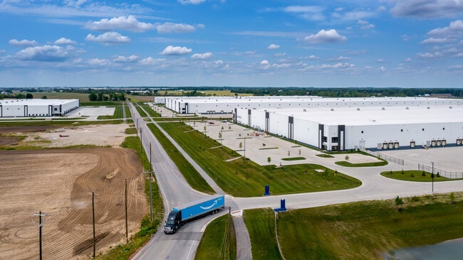
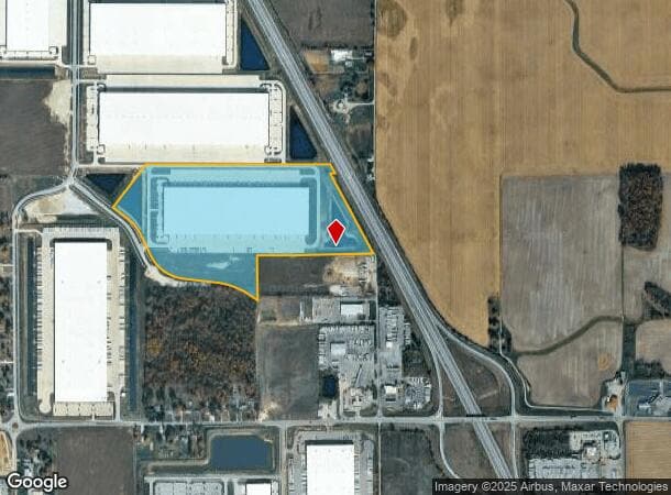
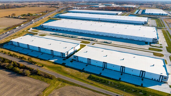
Property Record
5559 N Graham Rd, Whiteland, IN 46184
NEARBY LISTINGS FOR SALE OR LEASE
Property Detail
5559 N Graham Rd
Indianapolis
Mohr Logistics Park Phase 1 Section 1
Indianapolis-Carmel-Anderson, IN
MOHR LOGISTICS PARK PHASE 1 SEC 1 LOT 9
41-05-23-042-002.000-028
Johnson
Storageyardopenstoragelightequipmentmaterial
Indiana
2024
9
2025
62.89 AC
610102
Johnson County
826,800 SF
DEMOGRAPHICS near 5559 N Graham Rd
1 Mile
3 Mile
5 Mile
2024 Total Population
305
21,159
68,985
2029 Population
328
22,625
73,743
Pop Growth 2024-2029
+ 7.54%
+ 6.93%
+ 6.90%
Average Age
37
38
38
2024 Total Households
108
7,547
25,766
HH Growth 2024-2029
+ 7.41%
+ 7.09%
+ 7.07%
Median Household Inc
$82,812
$81,743
$77,563
Avg Household Size
2.80
2.80
2.60
2024 Avg HH Vehicles
2.00
2.00
2.00
Median Home Value
$183,673
$186,540
$195,680
Median Year Built
1996
1996
1995
Nearby Places
- Restaurants
- Banks
- Shops
- Fitness
- Groceries
PUBLIC TRANSPORTATION
AIRPORT
Indianapolis International
DRIVE
WALK
Distance
Indianapolis International
49 min
28.7 mi
Freight Ports
Port of Toledo
DRIVE
WALK
Distance
Port of Toledo
293 min
240.6 mi
SALE & LEASE HISTORY
LISTING DATE
SALE/LEASE

Mar 05, 2021
For Lease
Nearby Properties
Address
Land Use
TOTAL SIZE
Lot Size
Zoning
Address
Land Use
TOTAL SIZE
Lot Size
Zoning
1,057,350 SF
60.62 AC
Address
Land Use
TOTAL SIZE
Lot Size
Zoning
984,410 SF
73.31 AC
Address
Land Use
TOTAL SIZE
Lot Size
Zoning
845,880 SF
45.31 AC
Address
Land Use
TOTAL SIZE
Lot Size
Zoning
1,103,760 SF
84.07 AC
Address
Land Use
TOTAL SIZE
Lot Size
Zoning
997,650 SF
67.25 AC
Address
Land Use
TOTAL SIZE
Lot Size
Zoning
816,376 SF
65.10 AC
Address
Land Use
TOTAL SIZE
Lot Size
Zoning
34.59 AC
Address
Land Use
TOTAL SIZE
Lot Size
Zoning
588,200 SF
44.31 AC
Address
Land Use
TOTAL SIZE
Lot Size
Zoning
530,400 SF
29.63 AC
Address
Land Use
TOTAL SIZE
Lot Size
Zoning
446,500 SF
45.43 AC
Address
Land Use
TOTAL SIZE
Lot Size
Zoning
32.60 AC
Address
Land Use
TOTAL SIZE
Lot Size
Zoning
1,968 SF
37.45 AC
Address
Land Use
TOTAL SIZE
Lot Size
Zoning
56,100 SF
50.05 AC
Address
Land Use
TOTAL SIZE
Lot Size
Zoning
136,760 SF
31.47 AC
Address
Land Use
TOTAL SIZE
Lot Size
Zoning
178,880 SF
9.03 AC
Address
Land Use
TOTAL SIZE
Lot Size
Zoning
135,000 SF
13.24 AC
Address
Land Use
TOTAL SIZE
Lot Size
Zoning
168,480 SF
8.42 AC
Address
Land Use
TOTAL SIZE
Lot Size
Zoning
130,440 SF
10.05 AC
Address
Land Use
TOTAL SIZE
Lot Size
Zoning
114,852 SF
8.50 AC
Address
Land Use
TOTAL SIZE
Lot Size
Zoning
20.19 AC
Address
Land Use
TOTAL SIZE
Lot Size
Zoning
7.19 AC
Address
Land Use
TOTAL SIZE
Lot Size
Zoning
15,504 SF
72.69 AC
Address
Land Use
TOTAL SIZE
Lot Size
Zoning
160,700 SF
25.56 AC
Address
Land Use
TOTAL SIZE
Lot Size
Zoning
290,449 SF
22.82 AC
Address
Land Use
TOTAL SIZE
Lot Size
Zoning
65,100 SF
8.50 AC
Address
Land Use
TOTAL SIZE
Lot Size
Zoning
36,033 SF
15.12 AC
Address
Land Use
TOTAL SIZE
Lot Size
Zoning
68,423 SF
41.73 AC
Address
Land Use
TOTAL SIZE
Lot Size
Zoning
17,021 SF
30.20 AC
B2
Address
Land Use
TOTAL SIZE
Lot Size
Zoning
92,842 SF
27.26 AC
The World's #1 Commercial Real Estate Marketplace
Connect with us
© 2025 CoStar Group
The information above has been obtained from sources believed reliable. While we do not doubt its accuracy we have not verified it and make no guarantee, warranty or representation about it. It is your responsibility to independently confirm its accuracy and completeness. Any projections, opinions, assumptions, or estimates used are for example only and do not represent the current or future performance of the property. The value of this transaction to you depends on tax and other factors which should be evaluated by your tax, financial, and legal advisors. You and your advisors should conduct a careful, independent investigation of the property to determine to your satisfaction the suitability of the property for your needs.