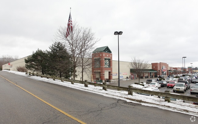
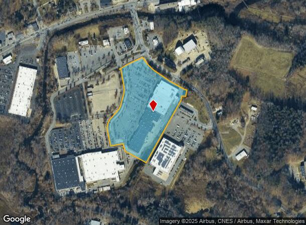
Property Record
555A Hubbard Ave, Pittsfield, MA 01201
NEARBY LISTINGS FOR SALE OR LEASE
Property Detail
555A Hubbard Ave
Pittsfield, MA
Berkshire
PITT-000013M-000001-000101
Massachusetts
Commercialnec
101
2022
14.63 AC
2025
Massachusetts North/West Area
935200
Other Market Areas
DEMOGRAPHICS near 555A Hubbard Ave
1 Mile
3 Mile
5 Mile
2024 Total Population
1,956
28,272
49,034
2029 Population
1,914
27,717
48,191
Pop Growth 2024-2029
(2.15%)
(1.96%)
(1.72%)
Average Age
49
44
44
2024 Total Households
904
12,643
21,973
HH Growth 2024-2029
(2.43%)
(2.10%)
(1.80%)
Median Household Inc
$50,417
$58,362
$58,012
Avg Household Size
2.00
2.20
2.10
2024 Avg HH Vehicles
1.00
1.00
2.00
Median Home Value
$217,148
$211,978
$223,216
Median Year Built
1958
1952
1950
Nearby Places
Map Layers
Map Styles
 Street
 Aerial
- Restaurants
- Banks
- Shops
- Fitness
- Groceries
PUBLIC TRANSPORTATION
COMMUTER RAIL
DRIVE
WALK
Distance
9 min
4.0 mi
AIRPORT
Albany International
DRIVE
WALK
Distance
Albany International
82 min
50.0 mi
SALE & LEASE HISTORY
LISTING DATE
SALE/LEASE

Sep 25, 2016
For Lease
Sep 13, 2017
For Lease
Nearby Properties
Address
Land Use
TOTAL SIZE
Lot Size
Zoning
Address
Land Use
TOTAL SIZE
Lot Size
Zoning
8.36 AC
BG
Address
Land Use
TOTAL SIZE
Lot Size
Zoning
92 AC
R-4
Address
Land Use
TOTAL SIZE
Lot Size
Zoning
600 SF
19.89 AC
R20
Address
Land Use
TOTAL SIZE
Lot Size
Zoning
284,301 SF
8.70 AC
DCD
Address
Land Use
TOTAL SIZE
Lot Size
Zoning
Address
Land Use
TOTAL SIZE
Lot Size
Zoning
6.15 AC
IG
Address
Land Use
TOTAL SIZE
Lot Size
Zoning
165,400 SF
0.49 AC
IG
Address
Land Use
TOTAL SIZE
Lot Size
Zoning
237.50 AC
R6
Address
Land Use
TOTAL SIZE
Lot Size
Zoning
22.83 AC
I2
Address
Land Use
TOTAL SIZE
Lot Size
Zoning
14.40 AC
I1
Address
Land Use
TOTAL SIZE
Lot Size
Zoning
41,395 SF
0.98 AC
BG
Address
Land Use
TOTAL SIZE
Lot Size
Zoning
11.60 AC
I2
Address
Land Use
TOTAL SIZE
Lot Size
Zoning
57,170 SF
18.87 AC
R1
Address
Land Use
TOTAL SIZE
Lot Size
Zoning
12.50 AC
RG
Address
Land Use
TOTAL SIZE
Lot Size
Zoning
87,081 SF
11.50 AC
IG
Address
Land Use
TOTAL SIZE
Lot Size
Zoning
242,525 SF
12.52 AC
BC
Address
Land Use
TOTAL SIZE
Lot Size
Zoning
128,036 SF
14.92 AC
IG
Address
Land Use
TOTAL SIZE
Lot Size
Zoning
79,095 SF
14.89 AC
IG
Address
Land Use
TOTAL SIZE
Lot Size
Zoning
183,260 SF
6 AC
IG
Address
Land Use
TOTAL SIZE
Lot Size
Zoning
11.77 AC
IG
Address
Land Use
TOTAL SIZE
Lot Size
Zoning
37,551 SF
6.50 AC
R6
Address
Land Use
TOTAL SIZE
Lot Size
Zoning
86.21 AC
MC
Address
Land Use
TOTAL SIZE
Lot Size
Zoning
102,954 SF
11.98 AC
IG
Address
Land Use
TOTAL SIZE
Lot Size
Zoning
225,775 SF
1.57 AC
BG
Address
Land Use
TOTAL SIZE
Lot Size
Zoning
82,160 SF
5.40 AC
RM
Address
Land Use
TOTAL SIZE
Lot Size
Zoning
35 AC
RG
Address
Land Use
TOTAL SIZE
Lot Size
Zoning
8.20 AC
R-3
Address
Land Use
TOTAL SIZE
Lot Size
Zoning
57,646 SF
10.60 AC
R12
Address
Land Use
TOTAL SIZE
Lot Size
Zoning
28 AC
I2
The World's #1 Commercial Real Estate Marketplace
Connect with us
© 2026 CoStar Group
The information above has been obtained from sources believed reliable. While we do not doubt its accuracy we have not verified it and make no guarantee, warranty or representation about it. It is your responsibility to independently confirm its accuracy and completeness. Any projections, opinions, assumptions, or estimates used are for example only and do not represent the current or future performance of the property. The value of this transaction to you depends on tax and other factors which should be evaluated by your tax, financial, and legal advisors. You and your advisors should conduct a careful, independent investigation of the property to determine to your satisfaction the suitability of the property for your needs.