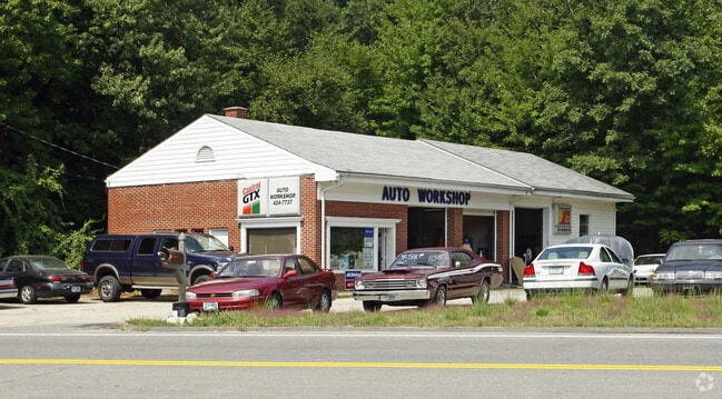
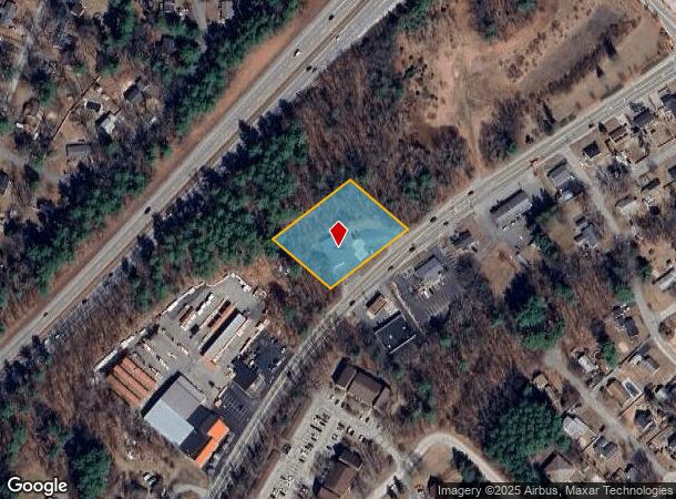
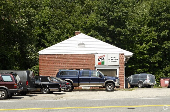
Property Record
556 Daniel Webster Hwy, Merrimack, NH 03054
NEARBY LISTINGS FOR SALE OR LEASE
Property Detail
556 Daniel Webster Hwy
MRMK-000601D-000009
Hillsborough
Commercialbuilding
New Hampshire
X
9
33011C0388D
1.12 AC
2024
Hillsborough
2024
Boston
014101
Manchester-Nashua, NH
2,044 SF
DEMOGRAPHICS near 556 Daniel Webster Hwy
1 Mile
3 Mile
5 Mile
2024 Total Population
4,614
28,142
55,147
2029 Population
4,702
28,900
56,683
Pop Growth 2024-2029
+ 1.91%
+ 2.69%
+ 2.79%
Average Age
42
42
42
2024 Total Households
1,941
10,668
20,270
HH Growth 2024-2029
+ 1.80%
+ 2.72%
+ 2.82%
Median Household Inc
$94,975
$115,663
$122,548
Avg Household Size
2.30
2.60
2.70
2024 Avg HH Vehicles
2.00
2.00
2.00
Median Home Value
$335,310
$372,555
$400,685
Median Year Built
1983
1984
1985
Nearby Places
Map Layers
Map Styles
 Street
 Aerial
- Restaurants
- Banks
- Shops
- Fitness
- Groceries
PUBLIC TRANSPORTATION
AIRPORT
Manchester Boston Regional
DRIVE
WALK
Distance
Manchester Boston Regional
14 min
5.7 mi
Freight Ports
Port of Boston
DRIVE
WALK
Distance
Port of Boston
81 min
59.6 mi
Nearby Properties
Address
Land Use
TOTAL SIZE
Lot Size
Zoning
Address
Land Use
TOTAL SIZE
Lot Size
Zoning
768,020 SF
74.47 AC
I-II
Address
Land Use
TOTAL SIZE
Lot Size
Zoning
202,546 SF
55 AC
RESIDE
Address
Land Use
TOTAL SIZE
Lot Size
Zoning
3,615 SF
21.02 AC
C2- GE
Address
Land Use
TOTAL SIZE
Lot Size
Zoning
56,997 SF
31.28 AC
INDUST
Address
Land Use
TOTAL SIZE
Lot Size
Zoning
42,228 SF
15.58 AC
PZ
Address
Land Use
TOTAL SIZE
Lot Size
Zoning
24,495 SF
13.05 AC
RESIDE
Address
Land Use
TOTAL SIZE
Lot Size
Zoning
5,894 SF
12.50 AC
RESIDE
Address
Land Use
TOTAL SIZE
Lot Size
Zoning
1.63 AC
RES
Address
Land Use
TOTAL SIZE
Lot Size
Zoning
Address
Land Use
TOTAL SIZE
Lot Size
Zoning
70,301 SF
7.90 AC
INDUST
Address
Land Use
TOTAL SIZE
Lot Size
Zoning
69,045 SF
35 AC
RESIDE
Address
Land Use
TOTAL SIZE
Lot Size
Zoning
107,615 SF
13.34 AC
PZ
Address
Land Use
TOTAL SIZE
Lot Size
Zoning
70,098 SF
7.69 AC
C2- GE
Address
Land Use
TOTAL SIZE
Lot Size
Zoning
Address
Land Use
TOTAL SIZE
Lot Size
Zoning
47,726 SF
1.70 AC
C2- GE
Address
Land Use
TOTAL SIZE
Lot Size
Zoning
240,111 SF
21.18 AC
INDUST
Address
Land Use
TOTAL SIZE
Lot Size
Zoning
69,031 SF
62.01 AC
RES
Address
Land Use
TOTAL SIZE
Lot Size
Zoning
50,963 SF
C2- GE
Address
Land Use
TOTAL SIZE
Lot Size
Zoning
142,740 SF
3.16 AC
INDUST
Address
Land Use
TOTAL SIZE
Lot Size
Zoning
57,842 SF
45.44 AC
INDUST
Address
Land Use
TOTAL SIZE
Lot Size
Zoning
65,234 SF
8.33 AC
C2- GE
Address
Land Use
TOTAL SIZE
Lot Size
Zoning
103,272 SF
4.51 AC
PZ
Address
Land Use
TOTAL SIZE
Lot Size
Zoning
129,290 SF
18.35 AC
INDUST
Address
Land Use
TOTAL SIZE
Lot Size
Zoning
43,395 SF
4.18 AC
INDUST
Address
Land Use
TOTAL SIZE
Lot Size
Zoning
38,547 SF
12.80 AC
COMM
Address
Land Use
TOTAL SIZE
Lot Size
Zoning
1 AC
RESIDE
Address
Land Use
TOTAL SIZE
Lot Size
Zoning
6.20 AC
RES
Address
Land Use
TOTAL SIZE
Lot Size
Zoning
25,985 SF
2.51 AC
C2- GE
Address
Land Use
TOTAL SIZE
Lot Size
Zoning
256.45 AC
TRANSI
Address
Land Use
TOTAL SIZE
Lot Size
Zoning
11,064 SF
19.56 AC
PZ
The World's #1 Commercial Real Estate Marketplace
Connect with us
© 2025 CoStar Group
The information above has been obtained from sources believed reliable. While we do not doubt its accuracy we have not verified it and make no guarantee, warranty or representation about it. It is your responsibility to independently confirm its accuracy and completeness. Any projections, opinions, assumptions, or estimates used are for example only and do not represent the current or future performance of the property. The value of this transaction to you depends on tax and other factors which should be evaluated by your tax, financial, and legal advisors. You and your advisors should conduct a careful, independent investigation of the property to determine to your satisfaction the suitability of the property for your needs.