Property Record
5570 Mcfarlane Rd, Sebastopol, CA 95472


Property Detail
5570 Mcfarlane Rd
062-010-017
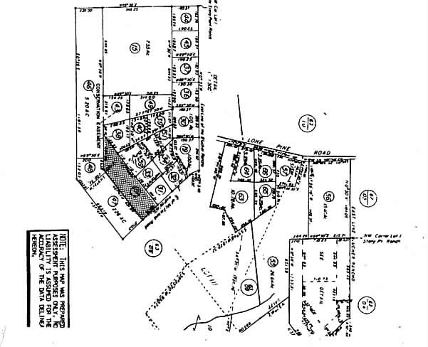
LOT 110
Multifamilydwelling
Sonoma
RR3
California
B and X Area of moderate flood hazard, usually the area between the limits of the 100-year and 500-year floods.
110
2024
2 AC
2025
Northwest Sonoma County
153501
North Bay/Santa Rosa
2,518 SF
Santa Rosa-Petaluma, CA
NEARBY LISTINGS FOR SALE OR LEASE
-
-
View all Sebastopol listings for sale on LoopNet.com
DEMOGRAPHICS near 5570 Mcfarlane Rd
1 mile
3 mile
5 mile
2025 Total Population
1,642
8,140
59,074
2030 Population
1,516
7,542
58,194
Pop Growth 2025-2030
(7.67%)
(7.35%)
(1.49%)
Average Age
48
48
42
2025 Total Households
634
3,136
21,285
HH Growth 2025-2030
(7.73%)
(7.33%)
(1.69%)
Median Household Inc
$109,459
$99,724
$96,779
Avg Household Size
2.50
2.50
2.70
2025 Avg HH Vehicles
2.00
2.00
2.00
Median Home Value
$947,019
$1,008,333
$777,542
Median Year Built
1971
1972
1978
Nearby Places
Map Layers
Map Styles
 Street
 Aerial
Transit
 Traffic
 Biking
Places
Listings with unknown addresses are not visible on the map
- Restaurants
- Banks
- Shops
- Fitness
- Groceries
PUBLIC TRANSPORTATION
COMMUTER RAIL
Smart Cotati (Main Line - Sonoma Marin Area Rail Transit)
Drive
Walk
Distance
Smart Cotati (Main Line - Sonoma Marin Area Rail Transit)
13 min
6.7 mi
Smart Rohnert Park (Main Line - Sonoma Marin Area Rail Transit)
Drive
Walk
Distance
Smart Rohnert Park (Main Line - Sonoma Marin Area Rail Transit)
14 min
7.2 mi
AIRPORT
Charles M Schulz - Sonoma County
Drive
Walk
Distance
Charles M Schulz - Sonoma County
29 min
15.9 mi
Freight Ports
Port of Richmond
Drive
Walk
Distance
Port of Richmond
63 min
45.9 mi
Nearby Properties
Address
Land Use
TOTAL SIZE
Lot Size
Zoning
Address
Land Use
TOTAL SIZE
Lot Size
Zoning
104.12 AC
Address
Land Use
TOTAL SIZE
Lot Size
Zoning
17,064 SF
21.15 AC
Address
Land Use
TOTAL SIZE
Lot Size
Zoning
9,896 SF
493.74 AC
Address
Land Use
TOTAL SIZE
Lot Size
Zoning
51,837 SF
8.50 AC
Address
Land Use
TOTAL SIZE
Lot Size
Zoning
20,473 SF
1.02 AC
CITYSE
Address
Land Use
TOTAL SIZE
Lot Size
Zoning
23,572 SF
1.74 AC
CITYSE
Address
Land Use
TOTAL SIZE
Lot Size
Zoning
57,564 SF
3.33 AC
M3
Address
Land Use
TOTAL SIZE
Lot Size
Zoning
43,858 SF
2.35 AC
Address
Land Use
TOTAL SIZE
Lot Size
Zoning
2,048 SF
39 AC
DA20
Address
Land Use
TOTAL SIZE
Lot Size
Zoning
44.46 AC
DA10
Address
Land Use
TOTAL SIZE
Lot Size
Zoning
13,072 SF
11.34 AC
RR2
Address
Land Use
TOTAL SIZE
Lot Size
Zoning
10,893 SF
12.38 AC
DA10
Address
Land Use
TOTAL SIZE
Lot Size
Zoning
842 SF
2.96 AC
RR3
Address
Land Use
TOTAL SIZE
Lot Size
Zoning
0.94 AC
CITYSE
Address
Land Use
TOTAL SIZE
Lot Size
Zoning
17,604 SF
5 AC
M3
Address
Land Use
TOTAL SIZE
Lot Size
Zoning
28,624 SF
2.72 AC
CITYSE
Address
Land Use
TOTAL SIZE
Lot Size
Zoning
3,578 SF
8 AC
DA10
Address
Land Use
TOTAL SIZE
Lot Size
Zoning
8,113 SF
106.73 AC
Address
Land Use
TOTAL SIZE
Lot Size
Zoning
194,750 SF
39.44 AC
DA40
Address
Land Use
TOTAL SIZE
Lot Size
Zoning
6,731 SF
8.23 AC
Address
Land Use
TOTAL SIZE
Lot Size
Zoning
5,323 SF
72 AC
LEA160
Address
Land Use
TOTAL SIZE
Lot Size
Zoning
6,893 SF
10.10 AC
Address
Land Use
TOTAL SIZE
Lot Size
Zoning
2,331 SF
18.13 AC
Address
Land Use
TOTAL SIZE
Lot Size
Zoning
13,581 SF
1.55 AC
CITYSE
Address
Land Use
TOTAL SIZE
Lot Size
Zoning
3,673 SF
2.91 AC
AR10
Address
Land Use
TOTAL SIZE
Lot Size
Zoning
75.82 AC
Address
Land Use
TOTAL SIZE
Lot Size
Zoning
1,200 SF
12.52 AC
Address
Land Use
TOTAL SIZE
Lot Size
Zoning
9,031 SF
0.14 AC
Address
Land Use
TOTAL SIZE
Lot Size
Zoning
2,856 SF
12.76 AC
Address
Land Use
TOTAL SIZE
Lot Size
Zoning
38,881 SF
23.86 AC
DA10
The World's #1 Commercial Real Estate Marketplace
Connect with us
© 2026 CoStar Group
The information above has been obtained from sources believed reliable. While we do not doubt its accuracy we have not verified it and make no guarantee, warranty or representation about it. It is your responsibility to independently confirm its accuracy and completeness. Any projections, opinions, assumptions, or estimates used are for example only and do not represent the current or future performance of the property. The value of this transaction to you depends on tax and other factors which should be evaluated by your tax, financial, and legal advisors. You and your advisors should conduct a careful, independent investigation of the property to determine to your satisfaction the suitability of the property for your needs.