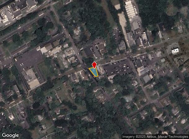
Property Record
55700 Route 25, Southold, NY 11971
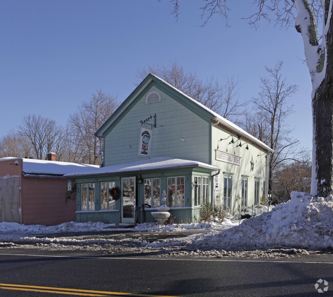
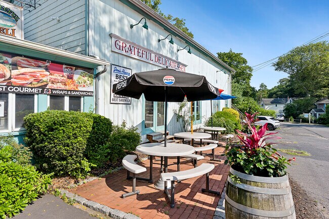
This Property Is For Sale
NEARBY LISTINGS FOR SALE OR LEASE
Property Detail
55700 Route 25
1000-062-00-03-00-007-000
BOOK 12332 PAGE 128 BILL 007057
Restaurantbuilding
Suffolk
X
New York
36103C0158H
7
2024
0.12 AC
2024
Eastern Suffolk
170204
Long Island (New York)
3,402 SF
Nassau County-Suffolk County, NY
DEMOGRAPHICS near 55700 Route 25
1 Mile
3 Mile
5 Mile
2024 Total Population
2,565
9,008
20,660
2029 Population
2,593
9,319
21,265
Pop Growth 2024-2029
+ 1.09%
+ 3.45%
+ 2.93%
Average Age
48
49
48
2024 Total Households
1,051
3,869
8,849
HH Growth 2024-2029
+ 0.86%
+ 3.39%
+ 2.90%
Median Household Inc
$83,493
$98,391
$95,692
Avg Household Size
2.30
2.30
2.30
2024 Avg HH Vehicles
2.00
2.00
2.00
Median Home Value
$681,445
$741,920
$760,184
Median Year Built
1969
1973
1973
Nearby Places
Map Layers
Map Styles
 Street
 Aerial
- Restaurants
- Banks
- Shops
- Fitness
- Groceries
PUBLIC TRANSPORTATION
TRANSIT/SUBWAY
Southold Station (Greenport Branch - Long Island Rail Road)
DRIVE
WALK
Distance
Southold Station (Greenport Branch - Long Island Rail Road)
1 min
7 min
0.4 mi
COMMUTER RAIL
Southold Station (Greenport Branch - Long Island Rail Road)
DRIVE
WALK
Distance
Southold Station (Greenport Branch - Long Island Rail Road)
1 min
7 min
0.4 mi
Greenport Station (Greenport Branch - Long Island Rail Road)
DRIVE
WALK
Distance
Greenport Station (Greenport Branch - Long Island Rail Road)
8 min
4.3 mi
Freight Ports
Port of New Haven
DRIVE
WALK
Distance
Port of New Haven
173 min
76.7 mi
Nearby Properties
Address
Land Use
TOTAL SIZE
Lot Size
Zoning
Address
Land Use
TOTAL SIZE
Lot Size
Zoning
9,468 SF
3.20 AC
AA
Address
Land Use
TOTAL SIZE
Lot Size
Zoning
904 SF
20.30 AC
AA
Address
Land Use
TOTAL SIZE
Lot Size
Zoning
38.11 AC
R-40 RO
Address
Land Use
TOTAL SIZE
Lot Size
Zoning
778 SF
7.68 AC
AA
Address
Land Use
TOTAL SIZE
Lot Size
Zoning
4.12 AC
AA
Address
Land Use
TOTAL SIZE
Lot Size
Zoning
1.62 AC
AA
Address
Land Use
TOTAL SIZE
Lot Size
Zoning
1.80 AC
AA
Address
Land Use
TOTAL SIZE
Lot Size
Zoning
2.30 AC
AA
Address
Land Use
TOTAL SIZE
Lot Size
Zoning
Address
Land Use
TOTAL SIZE
Lot Size
Zoning
1.90 AC
AA
Address
Land Use
TOTAL SIZE
Lot Size
Zoning
1.90 AC
AA
Address
Land Use
TOTAL SIZE
Lot Size
Zoning
8.35 AC
LB R-80
Address
Land Use
TOTAL SIZE
Lot Size
Zoning
0.35 AC
HD
Address
Land Use
TOTAL SIZE
Lot Size
Zoning
3.58 AC
HD
Address
Land Use
TOTAL SIZE
Lot Size
Zoning
0.50 AC
AA
Address
Land Use
TOTAL SIZE
Lot Size
Zoning
0.50 AC
AA
Address
Land Use
TOTAL SIZE
Lot Size
Zoning
0.02 AC
Address
Land Use
TOTAL SIZE
Lot Size
Zoning
2.60 AC
HB
Address
Land Use
TOTAL SIZE
Lot Size
Zoning
2,042 SF
0.46 AC
A
Address
Land Use
TOTAL SIZE
Lot Size
Zoning
2.48 AC
Address
Land Use
TOTAL SIZE
Lot Size
Zoning
0.02 AC
Address
Land Use
TOTAL SIZE
Lot Size
Zoning
17.34 AC
Address
Land Use
TOTAL SIZE
Lot Size
Zoning
12.10 AC
R-80 B
Address
Land Use
TOTAL SIZE
Lot Size
Zoning
3.20 AC
R-80
Address
Land Use
TOTAL SIZE
Lot Size
Zoning
68 AC
R-80
Address
Land Use
TOTAL SIZE
Lot Size
Zoning
0.75 AC
AA
Address
Land Use
TOTAL SIZE
Lot Size
Zoning
Address
Land Use
TOTAL SIZE
Lot Size
Zoning
10.50 AC
R-40
Address
Land Use
TOTAL SIZE
Lot Size
Zoning
4.33 AC
R-40 RO
Address
Land Use
TOTAL SIZE
Lot Size
Zoning
4.33 AC
R-80
The World's #1 Commercial Real Estate Marketplace
Connect with us
© 2026 CoStar Group
The information above has been obtained from sources believed reliable. While we do not doubt its accuracy we have not verified it and make no guarantee, warranty or representation about it. It is your responsibility to independently confirm its accuracy and completeness. Any projections, opinions, assumptions, or estimates used are for example only and do not represent the current or future performance of the property. The value of this transaction to you depends on tax and other factors which should be evaluated by your tax, financial, and legal advisors. You and your advisors should conduct a careful, independent investigation of the property to determine to your satisfaction the suitability of the property for your needs.