Property Record
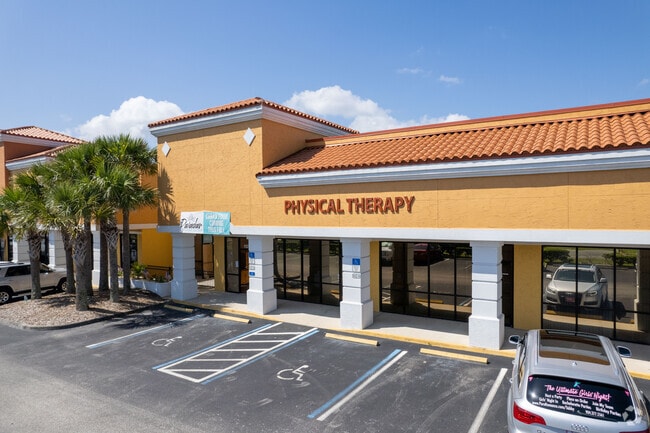
5575 A1a S, Saint Augustine, FL 32080


Property Detail
5575 A1a S
182790-0020
12-20 21 HAWAIIAN ISLE EST TRACT B OR2328/1452 & 3205/806(LEASE) &3387/335
Regionalshoppingcenterormallwithanchorstore
ST. JOHNS
CN
Florida
AE The base floodplain where base flood elevations are provided. AE Zones are now used on new format FIRMs instead of A1-A30 Zones.
b
2025
1.72 AC
2026
St Johns County
021404
Jacksonville (Florida)
19,542 SF
Jacksonville, FL
NEARBY LISTINGS FOR SALE OR LEASE
DEMOGRAPHICS near 5575 A1a S
1 mile
3 mile
5 mile
2025 Total Population
3,823
16,778
46,952
2030 Population
4,601
20,066
55,275
Pop Growth 2025-2030
+ 20.35%
+ 19.60%
+ 17.73%
Average Age
56
56
52
2025 Total Households
1,863
8,496
22,121
HH Growth 2025-2030
+ 20.72%
+ 20.10%
+ 18.31%
Median Household Inc
$78,528
$83,238
$80,521
Avg Household Size
2.00
2.00
2.10
2025 Avg HH Vehicles
2.00
2.00
2.00
Median Home Value
$603,168
$569,658
$501,173
Median Year Built
1990
1991
1993
Nearby Places
Map Layers
Map Styles
 Street
 Aerial
Layers
 Traffic
 Biking
Places
Listings with unknown addresses are not visible on the map
- Restaurants
- Banks
- Shops
- Fitness
- Groceries
SALE & LEASE HISTORY
LISTING DATE
SALE/LEASE

Mar 30, 2017
For Lease
Dec 02, 2024
For Lease
Nearby Properties
Address
Land Use
TOTAL SIZE
Lot Size
Zoning
Address
Land Use
TOTAL SIZE
Lot Size
Zoning
106,797 SF
10.80 AC
Address
Land Use
TOTAL SIZE
Lot Size
Zoning
7,133 SF
18.57 AC
RS3
Address
Land Use
TOTAL SIZE
Lot Size
Zoning
8,556 SF
20.32 AC
CHT
Address
Land Use
TOTAL SIZE
Lot Size
Zoning
12,697 SF
26.99 AC
PUD
Address
Land Use
TOTAL SIZE
Lot Size
Zoning
62,867 SF
48.30 AC
OR
Address
Land Use
TOTAL SIZE
Lot Size
Zoning
52,011 SF
11.51 AC
CG-B
Address
Land Use
TOTAL SIZE
Lot Size
Zoning
85,726 SF
13.01 AC
PUD
Address
Land Use
TOTAL SIZE
Lot Size
Zoning
8,997 SF
7.13 AC
PUD
Address
Land Use
TOTAL SIZE
Lot Size
Zoning
26,624 SF
2.24 AC
PUD
Address
Land Use
TOTAL SIZE
Lot Size
Zoning
1,179.40 AC
OR
Address
Land Use
TOTAL SIZE
Lot Size
Zoning
38.17 AC
OR
Address
Land Use
TOTAL SIZE
Lot Size
Zoning
10,178 SF
1.44 AC
CHT/R3
Address
Land Use
TOTAL SIZE
Lot Size
Zoning
6,464 SF
0.80 AC
RS2
Address
Land Use
TOTAL SIZE
Lot Size
Zoning
1.85 AC
RG2
Address
Land Use
TOTAL SIZE
Lot Size
Zoning
Address
Land Use
TOTAL SIZE
Lot Size
Zoning
24,779 SF
29.89 AC
OR
Address
Land Use
TOTAL SIZE
Lot Size
Zoning
6,750 SF
0.84 AC
RS2
Address
Land Use
TOTAL SIZE
Lot Size
Zoning
12,705 SF
0.32 AC
CG
Address
Land Use
TOTAL SIZE
Lot Size
Zoning
2,339 SF
8.80 AC
CHT
Address
Land Use
TOTAL SIZE
Lot Size
Zoning
4,988 SF
0.79 AC
RS2
Address
Land Use
TOTAL SIZE
Lot Size
Zoning
15.34 AC
PUD
Address
Land Use
TOTAL SIZE
Lot Size
Zoning
5,707 SF
0.90 AC
RS3
Address
Land Use
TOTAL SIZE
Lot Size
Zoning
14,376 SF
1.67 AC
CG-B
Address
Land Use
TOTAL SIZE
Lot Size
Zoning
10,540 SF
1.72 AC
PSD
Address
Land Use
TOTAL SIZE
Lot Size
Zoning
10,712 SF
1.09 AC
BU-1A
Address
Land Use
TOTAL SIZE
Lot Size
Zoning
10,132 SF
2.25 AC
PUD
Address
Land Use
TOTAL SIZE
Lot Size
Zoning
1,788 SF
2.17 AC
OR
Address
Land Use
TOTAL SIZE
Lot Size
Zoning
2,280 SF
9.28 AC
PUD
Address
Land Use
TOTAL SIZE
Lot Size
Zoning
1,152 SF
293.60 AC
OR
Address
Land Use
TOTAL SIZE
Lot Size
Zoning
10,010 SF
1.10 AC
BU-1A
The World's #1 Commercial Real Estate Marketplace
Connect with us
© 2026 CoStar Group
The information above has been obtained from sources believed reliable. While we do not doubt its accuracy we have not verified it and make no guarantee, warranty or representation about it. It is your responsibility to independently confirm its accuracy and completeness. Any projections, opinions, assumptions, or estimates used are for example only and do not represent the current or future performance of the property. The value of this transaction to you depends on tax and other factors which should be evaluated by your tax, financial, and legal advisors. You and your advisors should conduct a careful, independent investigation of the property to determine to your satisfaction the suitability of the property for your needs.