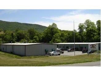
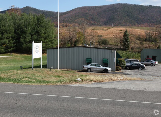
Property Record
5575 Hollins Rd, Roanoke, VA 24019

Property Detail
5575 Hollins Rd
028.13-02-09.06-0000
NEW PAR 1A SUB OF ORIG PAR 1 E SIDE OF RT 601
Lightindustrial
Roanoke
I1
Virginia
B and X Area of moderate flood hazard, usually the area between the limits of the 100-year and 500-year floods.
1.36 AC
2026
Northeast Roanoke
2026
Roanoke
030203
Roanoke, VA
5,000 SF
NEARBY LISTINGS FOR SALE OR LEASE
-
-
View all Roanoke listings for lease on LoopNet.com
DEMOGRAPHICS near 5575 Hollins Rd
1 mile
3 mile
5 mile
2025 Total Population
4,145
38,032
89,661
2030 Population
4,181
37,982
89,769
Pop Growth 2025-2030
+ 0.87%
(0.13%)
+ 0.12%
Average Age
43
42
41
2025 Total Households
1,609
15,651
37,378
HH Growth 2025-2030
+ 0.87%
(0.17%)
+ 0.12%
Median Household Inc
$87,211
$68,307
$60,667
Avg Household Size
2.40
2.30
2.30
2025 Avg HH Vehicles
2.00
2.00
2.00
Median Home Value
$306,650
$257,483
$235,346
Median Year Built
1985
1974
1971
Nearby Places
Map Layers
Map Styles
 Street
 Aerial
Layers
 Traffic
 Biking
Places
Listings with unknown addresses are not visible on the map
- Restaurants
- Banks
- Shops
- Fitness
- Groceries
PUBLIC TRANSPORTATION
AIRPORT
Roanoke/Blacksburg Regional (Woodrum Field)
Drive
Walk
Distance
Roanoke/Blacksburg Regional (Woodrum Field)
13 min
4.7 mi
SALE & LEASE HISTORY
LISTING DATE
SALE/LEASE

Jun 20, 2018
For Lease
Nearby Properties
Address
Land Use
TOTAL SIZE
Lot Size
Zoning
Address
Land Use
TOTAL SIZE
Lot Size
Zoning
8,930 SF
604.76 AC
AD
Address
Land Use
TOTAL SIZE
Lot Size
Zoning
24,126 SF
20.11 AC
R3
Address
Land Use
TOTAL SIZE
Lot Size
Zoning
387,684 SF
27.44 AC
I-1
Address
Land Use
TOTAL SIZE
Lot Size
Zoning
40.12 AC
M-1
Address
Land Use
TOTAL SIZE
Lot Size
Zoning
142,048 SF
21.38 AC
I-1
Address
Land Use
TOTAL SIZE
Lot Size
Zoning
609,211 SF
41.01 AC
I1C
Address
Land Use
TOTAL SIZE
Lot Size
Zoning
40.04 AC
M-2
Address
Land Use
TOTAL SIZE
Lot Size
Zoning
29.63 AC
I-1
Address
Land Use
TOTAL SIZE
Lot Size
Zoning
15,312 SF
182.27 AC
AG3
Address
Land Use
TOTAL SIZE
Lot Size
Zoning
10,878 SF
10.34 AC
RMF
Address
Land Use
TOTAL SIZE
Lot Size
Zoning
207,812 SF
22.62 AC
CLS
Address
Land Use
TOTAL SIZE
Lot Size
Zoning
22.52 AC
R-1
Address
Land Use
TOTAL SIZE
Lot Size
Zoning
124,725 SF
6.53 AC
I1
Address
Land Use
TOTAL SIZE
Lot Size
Zoning
446,526 SF
28.10 AC
I-1
Address
Land Use
TOTAL SIZE
Lot Size
Zoning
48,935 SF
9.15 AC
RMF
Address
Land Use
TOTAL SIZE
Lot Size
Zoning
139,654 SF
4.77 AC
C2S
Address
Land Use
TOTAL SIZE
Lot Size
Zoning
22,950 SF
9.50 AC
R3
Address
Land Use
TOTAL SIZE
Lot Size
Zoning
36.98 AC
M-1
Address
Land Use
TOTAL SIZE
Lot Size
Zoning
333,572 SF
20 AC
I-1
Address
Land Use
TOTAL SIZE
Lot Size
Zoning
48.26 AC
I-1
Address
Land Use
TOTAL SIZE
Lot Size
Zoning
90,571 SF
10.34 AC
INPUD
Address
Land Use
TOTAL SIZE
Lot Size
Zoning
22,950 SF
16.70 AC
R3
Address
Land Use
TOTAL SIZE
Lot Size
Zoning
69,212 SF
19.65 AC
R3S
Address
Land Use
TOTAL SIZE
Lot Size
Zoning
130,957 SF
15.12 AC
CLS
Address
Land Use
TOTAL SIZE
Lot Size
Zoning
135,212 SF
11.29 AC
CLS
Address
Land Use
TOTAL SIZE
Lot Size
Zoning
134,019 SF
14.84 AC
C2
Address
Land Use
TOTAL SIZE
Lot Size
Zoning
112,165 SF
9.27 AC
CLS
Address
Land Use
TOTAL SIZE
Lot Size
Zoning
123,019 SF
21.84 AC
I-1
Address
Land Use
TOTAL SIZE
Lot Size
Zoning
70,091 SF
11.82 AC
R1
Address
Land Use
TOTAL SIZE
Lot Size
Zoning
35,582 SF
16.36 AC
I2S
The World's #1 Commercial Real Estate Marketplace
Connect with us
© 2026 CoStar Group
The information above has been obtained from sources believed reliable. While we do not doubt its accuracy we have not verified it and make no guarantee, warranty or representation about it. It is your responsibility to independently confirm its accuracy and completeness. Any projections, opinions, assumptions, or estimates used are for example only and do not represent the current or future performance of the property. The value of this transaction to you depends on tax and other factors which should be evaluated by your tax, financial, and legal advisors. You and your advisors should conduct a careful, independent investigation of the property to determine to your satisfaction the suitability of the property for your needs.