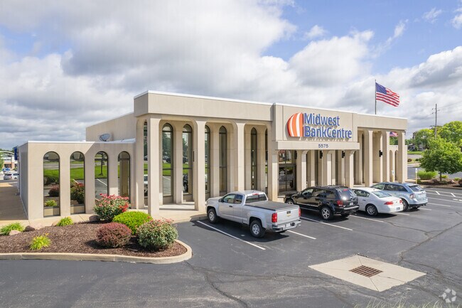
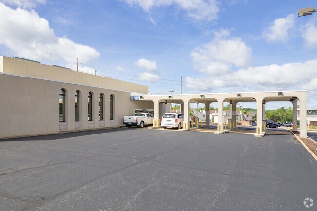
Property Record
5575 Telegraph Rd, Saint Louis, MO 63129

Property Detail
5575 Telegraph Rd
31H-11-0817
OAKVILLE SHOPPING CENTER TRACT PT C
Financialbuilding
Saint Louis
C-8
Missouri
B and X Area of moderate flood hazard, usually the area between the limits of the 100-year and 500-year floods.
2.12 AC
2024
Southwest County
2025
St. Louis
220441
St. Louis, MO-IL
15,926 SF
NEARBY LISTINGS FOR SALE OR LEASE
DEMOGRAPHICS near 5575 Telegraph Rd
1 mile
3 mile
5 mile
2025 Total Population
10,437
53,258
128,551
2030 Population
10,216
52,361
126,964
Pop Growth 2025-2030
(2.12%)
(1.68%)
(1.23%)
Average Age
44
43
43
2025 Total Households
4,588
22,667
54,180
HH Growth 2025-2030
(2.18%)
(1.70%)
(1.25%)
Median Household Inc
$85,110
$86,052
$82,601
Avg Household Size
2.20
2.30
2.30
2025 Avg HH Vehicles
2.00
2.00
2.00
Median Home Value
$262,377
$274,449
$259,357
Median Year Built
1975
1976
1973
Nearby Places
Map Layers
Map Styles
 Street
 Aerial
Layers
 Traffic
 Biking
Places
Listings with unknown addresses are not visible on the map
- Restaurants
- Banks
- Shops
- Fitness
- Groceries
PUBLIC TRANSPORTATION
AIRPORT
St Louis Lambert International
Drive
Walk
Distance
St Louis Lambert International
43 min
23.9 mi
Scott AFB/Midamerica St Louis
Drive
Walk
Distance
Scott AFB/Midamerica St Louis
54 min
37.2 mi
Nearby Properties
Address
Land Use
TOTAL SIZE
Lot Size
Zoning
Address
Land Use
TOTAL SIZE
Lot Size
Zoning
160,931 SF
141.53 AC
NU
Address
Land Use
TOTAL SIZE
Lot Size
Zoning
739,781 SF
22.08 AC
C3
Address
Land Use
TOTAL SIZE
Lot Size
Zoning
391,268 SF
132.29 AC
R4
Address
Land Use
TOTAL SIZE
Lot Size
Zoning
31.25 AC
R2
Address
Land Use
TOTAL SIZE
Lot Size
Zoning
225,758 SF
16.85 AC
R4
Address
Land Use
TOTAL SIZE
Lot Size
Zoning
140,783 SF
15.51 AC
C-8
Address
Land Use
TOTAL SIZE
Lot Size
Zoning
342,288 SF
19.97 AC
R7
Address
Land Use
TOTAL SIZE
Lot Size
Zoning
27.92 AC
R2
Address
Land Use
TOTAL SIZE
Lot Size
Zoning
237,114 SF
18.12 AC
M1
Address
Land Use
TOTAL SIZE
Lot Size
Zoning
216,121 SF
20.04 AC
C-8
Address
Land Use
TOTAL SIZE
Lot Size
Zoning
386,377 SF
21.34 AC
R7
Address
Land Use
TOTAL SIZE
Lot Size
Zoning
163,144 SF
14.14 AC
C-8
Address
Land Use
TOTAL SIZE
Lot Size
Zoning
1,268 SF
19.85 AC
R2
Address
Land Use
TOTAL SIZE
Lot Size
Zoning
38.59 AC
NU
Address
Land Use
TOTAL SIZE
Lot Size
Zoning
143,076 SF
18.99 AC
C-8
Address
Land Use
TOTAL SIZE
Lot Size
Zoning
127,090 SF
11.28 AC
C-8
Address
Land Use
TOTAL SIZE
Lot Size
Zoning
12.37 AC
R4
Address
Land Use
TOTAL SIZE
Lot Size
Zoning
188,205 SF
14.86 AC
R2
Address
Land Use
TOTAL SIZE
Lot Size
Zoning
205,040 SF
13.93 AC
M
Address
Land Use
TOTAL SIZE
Lot Size
Zoning
267,886 SF
27.34 AC
R6
Address
Land Use
TOTAL SIZE
Lot Size
Zoning
58,287 SF
18.90 AC
NU
Address
Land Use
TOTAL SIZE
Lot Size
Zoning
62,006 SF
7.94 AC
C5
Address
Land Use
TOTAL SIZE
Lot Size
Zoning
197.30 AC
PS
Address
Land Use
TOTAL SIZE
Lot Size
Zoning
59,500 SF
17.78 AC
M
Address
Land Use
TOTAL SIZE
Lot Size
Zoning
36,724 SF
16.28 AC
C-8
Address
Land Use
TOTAL SIZE
Lot Size
Zoning
130,680 SF
9.99 AC
R7
Address
Land Use
TOTAL SIZE
Lot Size
Zoning
8.89 AC
R3
Address
Land Use
TOTAL SIZE
Lot Size
Zoning
69,340 SF
5.37 AC
Address
Land Use
TOTAL SIZE
Lot Size
Zoning
147,060 SF
7.42 AC
R6
Address
Land Use
TOTAL SIZE
Lot Size
Zoning
170,082 SF
5.49 AC
R6
The World's #1 Commercial Real Estate Marketplace
Connect with us
© 2026 CoStar Group
The information above has been obtained from sources believed reliable. While we do not doubt its accuracy we have not verified it and make no guarantee, warranty or representation about it. It is your responsibility to independently confirm its accuracy and completeness. Any projections, opinions, assumptions, or estimates used are for example only and do not represent the current or future performance of the property. The value of this transaction to you depends on tax and other factors which should be evaluated by your tax, financial, and legal advisors. You and your advisors should conduct a careful, independent investigation of the property to determine to your satisfaction the suitability of the property for your needs.