Property Record
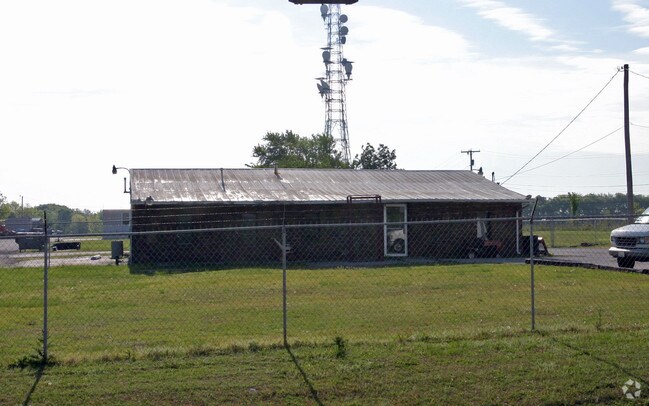
5577 S 193Rd East Ave, Broken Arrow, OK 74014

NEARBY LISTINGS FOR SALE OR LEASE
Property Detail
5577 S 193Rd East Ave
730001871
31-19-15 S10 AC LOT 2 LESS A TRACT OF LAND IN SW NW DESCRIBED AS COMM SW COR OF NW -N88'50'55.34"E DIS 24.75' TO POB -N88'50'
Officebuilding
Wagoner
X
Oklahoma
40143C0385M
2
2024
9.73 AC
2025
Wagoner County
030506
Tulsa
3,000 SF
Tulsa, OK
DEMOGRAPHICS near 5577 S 193Rd East Ave
1 Mile
3 Mile
5 Mile
2024 Total Population
9,102
49,124
111,675
2029 Population
10,058
53,673
119,365
Pop Growth 2024-2029
+ 10.50%
+ 9.26%
+ 6.89%
Average Age
36
37
37
2024 Total Households
3,669
18,428
41,703
HH Growth 2024-2029
+ 10.68%
+ 8.99%
+ 6.74%
Median Household Inc
$65,558
$75,550
$71,261
Avg Household Size
2.40
2.60
2.60
2024 Avg HH Vehicles
2.00
2.00
2.00
Median Home Value
$197,853
$207,425
$192,252
Median Year Built
2005
2002
1992
Nearby Places
Map Layers
Map Styles
 Street
 Aerial
- Restaurants
- Banks
- Shops
- Fitness
- Groceries
PUBLIC TRANSPORTATION
AIRPORT
Tulsa International
DRIVE
WALK
Distance
Tulsa International
26 min
17.6 mi
Freight Ports
Tulsa Port Of Catoosa
DRIVE
WALK
Distance
Tulsa Port Of Catoosa
19 min
11.3 mi
Nearby Properties
Address
Land Use
TOTAL SIZE
Lot Size
Zoning
Address
Land Use
TOTAL SIZE
Lot Size
Zoning
197,676 SF
13.38 AC
CH
Address
Land Use
TOTAL SIZE
Lot Size
Zoning
435,822 SF
43.42 AC
R1
Address
Land Use
TOTAL SIZE
Lot Size
Zoning
115,003 SF
59.09 AC
CG
Address
Land Use
TOTAL SIZE
Lot Size
Zoning
125,902 SF
19.15 AC
CH
Address
Land Use
TOTAL SIZE
Lot Size
Zoning
59,108 SF
11.18 AC
R3
Address
Land Use
TOTAL SIZE
Lot Size
Zoning
53,139 SF
108.91 AC
A1
Address
Land Use
TOTAL SIZE
Lot Size
Zoning
84,927 SF
4.81 AC
RM2
Address
Land Use
TOTAL SIZE
Lot Size
Zoning
75,444 SF
23.92 AC
R1
Address
Land Use
TOTAL SIZE
Lot Size
Zoning
58,695 SF
5.34 AC
RM
Address
Land Use
TOTAL SIZE
Lot Size
Zoning
77,260 SF
0.58 AC
R3
Address
Land Use
TOTAL SIZE
Lot Size
Zoning
49,113 SF
5.42 AC
R3
Address
Land Use
TOTAL SIZE
Lot Size
Zoning
222,768 SF
20.24 AC
CS
Address
Land Use
TOTAL SIZE
Lot Size
Zoning
58,627 SF
6.07 AC
CG
Address
Land Use
TOTAL SIZE
Lot Size
Zoning
363,154 SF
23.09 AC
IL
Address
Land Use
TOTAL SIZE
Lot Size
Zoning
36,408 SF
10.46 AC
IL
Address
Land Use
TOTAL SIZE
Lot Size
Zoning
239,868 SF
14.84 AC
CG
Address
Land Use
TOTAL SIZE
Lot Size
Zoning
13,691 SF
2.04 AC
CH
Address
Land Use
TOTAL SIZE
Lot Size
Zoning
8.25 AC
CH
Address
Land Use
TOTAL SIZE
Lot Size
Zoning
367,352 SF
17.83 AC
CG
Address
Land Use
TOTAL SIZE
Lot Size
Zoning
28,071 SF
Address
Land Use
TOTAL SIZE
Lot Size
Zoning
155,646 SF
14.53 AC
RM
Address
Land Use
TOTAL SIZE
Lot Size
Zoning
28,348 SF
0.90 AC
DM
Address
Land Use
TOTAL SIZE
Lot Size
Zoning
283,250 SF
13.87 AC
A1
Address
Land Use
TOTAL SIZE
Lot Size
Zoning
6.75 AC
CH
Address
Land Use
TOTAL SIZE
Lot Size
Zoning
51,741 SF
2.41 AC
R3
Address
Land Use
TOTAL SIZE
Lot Size
Zoning
60,460 SF
2.28 AC
NCU
Address
Land Use
TOTAL SIZE
Lot Size
Zoning
153,125 SF
10.65 AC
RM2
Address
Land Use
TOTAL SIZE
Lot Size
Zoning
10,140 SF
18.57 AC
R1
Address
Land Use
TOTAL SIZE
Lot Size
Zoning
20,633 SF
5.53 AC
Address
Land Use
TOTAL SIZE
Lot Size
Zoning
314,047 SF
12.60 AC
RM
The World's #1 Commercial Real Estate Marketplace
Connect with us
© 2026 CoStar Group
The information above has been obtained from sources believed reliable. While we do not doubt its accuracy we have not verified it and make no guarantee, warranty or representation about it. It is your responsibility to independently confirm its accuracy and completeness. Any projections, opinions, assumptions, or estimates used are for example only and do not represent the current or future performance of the property. The value of this transaction to you depends on tax and other factors which should be evaluated by your tax, financial, and legal advisors. You and your advisors should conduct a careful, independent investigation of the property to determine to your satisfaction the suitability of the property for your needs.