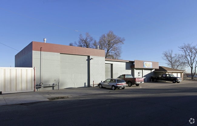
Property Record
5579 Pecos St, Denver, CO 80221
Current Lease Availabilities
NEARBY LISTINGS FOR SALE OR LEASE
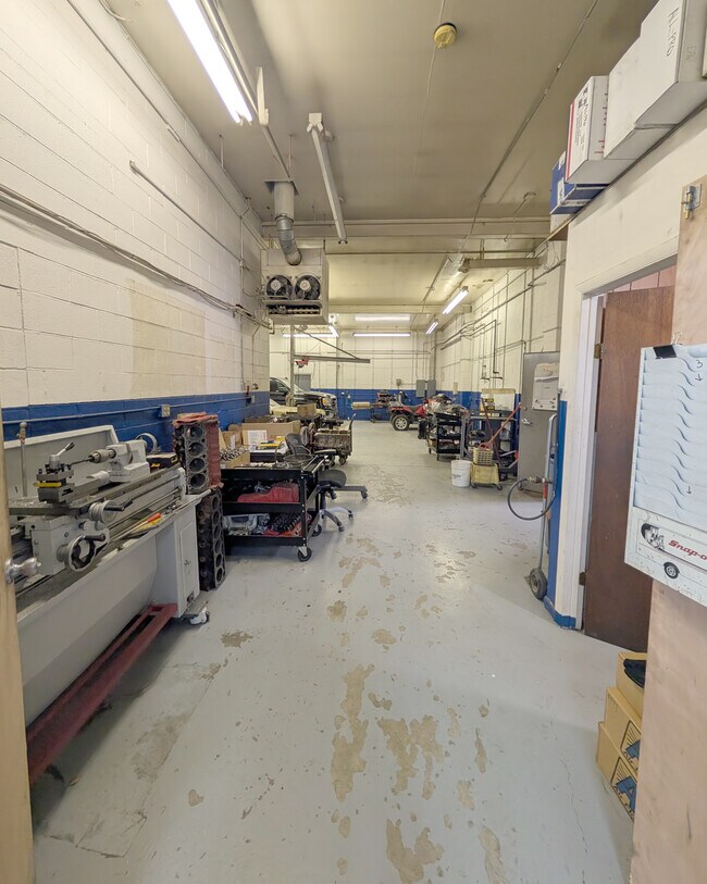
Property Detail
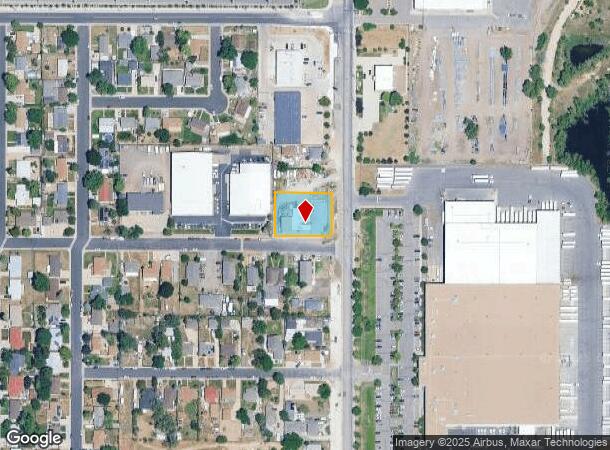
5579 Pecos St
Denver-Aurora-Lakewood, CO
Greenwood Amended
1825-16-2-02-019
Adams
Sfr
Colorado
X
0.47 AC
08059C0220F
Northwest Denver
5,416 SF
Denver
DEMOGRAPHICS near 5579 Pecos St
1 Mile
3 Mile
5 Mile
2024 Total Population
6,699
127,652
417,725
2029 Population
6,917
131,005
426,026
Pop Growth 2024-2029
+ 3.25%
+ 2.63%
+ 1.99%
Average Age
39
37
37
2024 Total Households
2,508
56,184
188,806
HH Growth 2024-2029
+ 3.07%
+ 2.53%
+ 1.93%
Median Household Inc
$86,342
$87,961
$76,225
Avg Household Size
2.60
2.20
2.10
2024 Avg HH Vehicles
2.00
2.00
2.00
Median Home Value
$467,252
$538,067
$481,697
Median Year Built
1958
1980
1972
Nearby Places
- Restaurants
- Banks
- Shops
- Fitness
- Groceries
PUBLIC TRANSPORTATION
COMMUTER RAIL
Pecos Junction Station Track 1 (Union Station to Westminster Station - Regional Transportation District, Union Station to Wheat Ridge Ward Station - Regional Transportation District)
DRIVE
WALK
Distance
Pecos Junction Station Track 1 (Union Station to Westminster Station - Regional Transportation District, Union Station to Wheat Ridge Ward Station - Regional Transportation District)
2 min
15 min
0.8 mi
Clear Creek - Federal Station Track 1 (Union Station to Wheat Ridge Ward Station - Regional Transportation District)
DRIVE
WALK
Distance
Clear Creek - Federal Station Track 1 (Union Station to Wheat Ridge Ward Station - Regional Transportation District)
5 min
1.8 mi
AIRPORT
Denver International
DRIVE
WALK
Distance
Denver International
31 min
24.1 mi
Freight Ports
Tulsa Port Of Catoosa
DRIVE
WALK
Distance
Tulsa Port Of Catoosa
728 min
709.6 mi
Nearby Properties
Address
Land Use
TOTAL SIZE
Lot Size
Zoning
Address
Land Use
TOTAL SIZE
Lot Size
Zoning
396,741 SF
8.12 AC
A1
Address
Land Use
TOTAL SIZE
Lot Size
Zoning
611,828 SF
0.94 AC
PUD
Address
Land Use
TOTAL SIZE
Lot Size
Zoning
290,821 SF
1.16 AC
PUD
Address
Land Use
TOTAL SIZE
Lot Size
Zoning
888,385 SF
20.40 AC
I-A
Address
Land Use
TOTAL SIZE
Lot Size
Zoning
860,132 SF
68.50 AC
R-5
Address
Land Use
TOTAL SIZE
Lot Size
Zoning
424,862 SF
32.28 AC
G-MU-3
Address
Land Use
TOTAL SIZE
Lot Size
Zoning
281,209 SF
1.66 AC
C-MX-12
Address
Land Use
TOTAL SIZE
Lot Size
Zoning
265,054 SF
1.39 AC
C-MX-5
Address
Land Use
TOTAL SIZE
Lot Size
Zoning
203,148 SF
1.36 AC
C-MX-5
Address
Land Use
TOTAL SIZE
Lot Size
Zoning
222,000 SF
2.98 AC
PUD-G
Address
Land Use
TOTAL SIZE
Lot Size
Zoning
268,690 SF
1.23 AC
PUD
Address
Land Use
TOTAL SIZE
Lot Size
Zoning
25,000 SF
40.42 AC
I-A
Address
Land Use
TOTAL SIZE
Lot Size
Zoning
3,188 SF
81.17 AC
I-B
Address
Land Use
TOTAL SIZE
Lot Size
Zoning
230,246 SF
0.79 AC
I-MX-8
Address
Land Use
TOTAL SIZE
Lot Size
Zoning
921,863 SF
2.01 AC
C-MX
Address
Land Use
TOTAL SIZE
Lot Size
Zoning
178,845 SF
0.59 AC
PUD
Address
Land Use
TOTAL SIZE
Lot Size
Zoning
798,837 SF
1.67 AC
C-MX
Address
Land Use
TOTAL SIZE
Lot Size
Zoning
159,202 SF
1.03 AC
C-MX-5
Address
Land Use
TOTAL SIZE
Lot Size
Zoning
8,295 SF
2.57 AC
C-RX
Address
Land Use
TOTAL SIZE
Lot Size
Zoning
398,180 SF
33.31 AC
R1C
Address
Land Use
TOTAL SIZE
Lot Size
Zoning
238,888 SF
1.13 AC
C-MX-12
Address
Land Use
TOTAL SIZE
Lot Size
Zoning
177,366 SF
3.85 AC
C-MX-8
Address
Land Use
TOTAL SIZE
Lot Size
Zoning
551,915 SF
25.76 AC
Address
Land Use
TOTAL SIZE
Lot Size
Zoning
201,798 SF
0.71 AC
I-MX-5
Address
Land Use
TOTAL SIZE
Lot Size
Zoning
102,550 SF
1.06 AC
T-MU
Address
Land Use
TOTAL SIZE
Lot Size
Zoning
172,690 SF
0.62 AC
C-MX-12
Address
Land Use
TOTAL SIZE
Lot Size
Zoning
470,539 SF
23.59 AC
Address
Land Use
TOTAL SIZE
Lot Size
Zoning
176,795 SF
0.81 AC
I-MX-12
Address
Land Use
TOTAL SIZE
Lot Size
Zoning
109,234 SF
0.77 AC
PUD
Address
Land Use
TOTAL SIZE
Lot Size
Zoning
352,600 SF
18.21 AC
I-B
The World's #1 Commercial Real Estate Marketplace
Connect with us
© 2025 CoStar Group
The information above has been obtained from sources believed reliable. While we do not doubt its accuracy we have not verified it and make no guarantee, warranty or representation about it. It is your responsibility to independently confirm its accuracy and completeness. Any projections, opinions, assumptions, or estimates used are for example only and do not represent the current or future performance of the property. The value of this transaction to you depends on tax and other factors which should be evaluated by your tax, financial, and legal advisors. You and your advisors should conduct a careful, independent investigation of the property to determine to your satisfaction the suitability of the property for your needs.