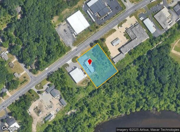
Property Record
5588 W River Dr Ne, Comstock Park, MI 49321


NEARBY LISTINGS FOR SALE OR LEASE
Property Detail
5588 W River Dr Ne
Grand Rapids-Wyoming, MI
PART NE 1/4 & PART GOVT LOT 1 COM 220.0 FT S 49D 51M W ALONG WLY LINE OF M.N. RR R/W /100 FT WIDE/ FROM E&W 1/4 LINE TH S 49D
41-10-20-426-008
Kent
Commercialnec
Michigan
AE
1
26081C0285D
1.99 AC
2024
Comstock/Alpine
2025
West Michigan
011102
DEMOGRAPHICS near 5588 W River Dr Ne
1 Mile
3 Mile
5 Mile
2024 Total Population
2,755
34,139
84,391
2029 Population
2,796
34,435
85,212
Pop Growth 2024-2029
+ 1.49%
+ 0.87%
+ 0.97%
Average Age
41
41
40
2024 Total Households
983
13,498
34,252
HH Growth 2024-2029
+ 1.53%
+ 0.87%
+ 0.94%
Median Household Inc
$99,144
$78,738
$75,576
Avg Household Size
2.80
2.50
2.40
2024 Avg HH Vehicles
2.00
2.00
2.00
Median Home Value
$266,334
$254,554
$254,926
Median Year Built
1990
1979
1979
Nearby Places
Map Layers
Map Styles
 Street
 Aerial
- Restaurants
- Banks
- Shops
- Fitness
- Groceries
PUBLIC TRANSPORTATION
COMMUTER RAIL
Grand Rapids Vernon J. Ehlers Station (Pere Marquette - Amtrak)
DRIVE
WALK
Distance
Grand Rapids Vernon J. Ehlers Station (Pere Marquette - Amtrak)
12 min
9.0 mi
AIRPORT
Gerald R Ford International
DRIVE
WALK
Distance
Gerald R Ford International
31 min
21.2 mi
Freight Ports
Port Milwaukee
DRIVE
WALK
Distance
Port Milwaukee
315 min
270.1 mi
Nearby Properties
Address
Land Use
TOTAL SIZE
Lot Size
Zoning
Address
Land Use
TOTAL SIZE
Lot Size
Zoning
25.41 AC
Address
Land Use
TOTAL SIZE
Lot Size
Zoning
Address
Land Use
TOTAL SIZE
Lot Size
Zoning
Address
Land Use
TOTAL SIZE
Lot Size
Zoning
Address
Land Use
TOTAL SIZE
Lot Size
Zoning
16.34 AC
Address
Land Use
TOTAL SIZE
Lot Size
Zoning
Address
Land Use
TOTAL SIZE
Lot Size
Zoning
Address
Land Use
TOTAL SIZE
Lot Size
Zoning
Address
Land Use
TOTAL SIZE
Lot Size
Zoning
9.11 AC
R-3
Address
Land Use
TOTAL SIZE
Lot Size
Zoning
8.77 AC
R-3
Address
Land Use
TOTAL SIZE
Lot Size
Zoning
14.36 AC
MON-MDR
Address
Land Use
TOTAL SIZE
Lot Size
Zoning
8.43 AC
Address
Land Use
TOTAL SIZE
Lot Size
Zoning
Address
Land Use
TOTAL SIZE
Lot Size
Zoning
Address
Land Use
TOTAL SIZE
Lot Size
Zoning
97.71 AC
Address
Land Use
TOTAL SIZE
Lot Size
Zoning
8 AC
MON-MDR
Address
Land Use
TOTAL SIZE
Lot Size
Zoning
8.68 AC
MON-MDR
Address
Land Use
TOTAL SIZE
Lot Size
Zoning
Address
Land Use
TOTAL SIZE
Lot Size
Zoning
Address
Land Use
TOTAL SIZE
Lot Size
Zoning
Address
Land Use
TOTAL SIZE
Lot Size
Zoning
97.84 AC
Address
Land Use
TOTAL SIZE
Lot Size
Zoning
Address
Land Use
TOTAL SIZE
Lot Size
Zoning
Address
Land Use
TOTAL SIZE
Lot Size
Zoning
Address
Land Use
TOTAL SIZE
Lot Size
Zoning
171,155 SF
14.47 AC
I-2
Address
Land Use
TOTAL SIZE
Lot Size
Zoning
Address
Land Use
TOTAL SIZE
Lot Size
Zoning
53.97 AC
Address
Land Use
TOTAL SIZE
Lot Size
Zoning
16.45 AC
Address
Land Use
TOTAL SIZE
Lot Size
Zoning
Address
Land Use
TOTAL SIZE
Lot Size
Zoning
20.20 AC
The World's #1 Commercial Real Estate Marketplace
Connect with us
© 2025 CoStar Group
The information above has been obtained from sources believed reliable. While we do not doubt its accuracy we have not verified it and make no guarantee, warranty or representation about it. It is your responsibility to independently confirm its accuracy and completeness. Any projections, opinions, assumptions, or estimates used are for example only and do not represent the current or future performance of the property. The value of this transaction to you depends on tax and other factors which should be evaluated by your tax, financial, and legal advisors. You and your advisors should conduct a careful, independent investigation of the property to determine to your satisfaction the suitability of the property for your needs.