Property Record
559 Ohio Pike, Cincinnati, OH 45255


Save to a Folder
{{folder.Name}}
{{folder.ListingIds.length}} Properties
{{folder.ListingIds.length}} Property
Create a New Folder
Property Detail
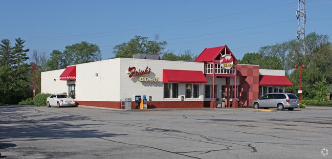
559 Ohio Pike
41-32-16B-133
FRISCHS REST
Restaurantbuilding
CLERMONT
B and X Area of moderate flood hazard, usually the area between the limits of the 100-year and 500-year floods.
Ohio
2025
1.79 AC
2025
Eastgate/Anderson Twp
041404
Cincinnati/Dayton
5,871 SF
Cincinnati, OH-KY-IN
NEARBY LISTINGS FOR SALE OR LEASE
DEMOGRAPHICS near 559 Ohio Pike
1 mile
3 mile
5 mile
2025 Total Population
9,598
52,132
119,738
2030 Population
9,748
52,878
121,424
Pop Growth 2025-2030
+ 1.56%
+ 1.43%
+ 1.41%
Average Age
41
42
41
2025 Total Households
4,405
21,652
48,760
HH Growth 2025-2030
+ 1.82%
+ 1.73%
+ 1.62%
Median Household Inc
$73,049
$81,579
$85,482
Avg Household Size
2.10
2.30
2.40
2025 Avg HH Vehicles
2.00
2.00
2.00
Median Home Value
$256,701
$296,210
$295,651
Median Year Built
1984
1981
1980
Nearby Places
Map Layers
Map Styles
 Street
 Aerial
Layers
 Traffic
 Biking
Places
Listings with unknown addresses are not visible on the map
- Restaurants
- Banks
- Shops
- Fitness
- Groceries
PUBLIC TRANSPORTATION
AIRPORT
Cincinnati/Northern Kentucky International
Drive
Walk
Distance
Cincinnati/Northern Kentucky International
37 min
23.5 mi
Freight Ports
Port of Toledo
Drive
Walk
Distance
Port of Toledo
247 min
212.7 mi
Nearby Properties
Address
Land Use
TOTAL SIZE
Lot Size
Zoning
Address
Land Use
TOTAL SIZE
Lot Size
Zoning
26.42 AC
Address
Land Use
TOTAL SIZE
Lot Size
Zoning
7,560 SF
79.10 AC
Address
Land Use
TOTAL SIZE
Lot Size
Zoning
50,382 SF
33.05 AC
Address
Land Use
TOTAL SIZE
Lot Size
Zoning
3.87 AC
Address
Land Use
TOTAL SIZE
Lot Size
Zoning
25.31 AC
Address
Land Use
TOTAL SIZE
Lot Size
Zoning
8,914 SF
37.70 AC
Address
Land Use
TOTAL SIZE
Lot Size
Zoning
154,426 SF
35.05 AC
Address
Land Use
TOTAL SIZE
Lot Size
Zoning
25.27 AC
Address
Land Use
TOTAL SIZE
Lot Size
Zoning
Address
Land Use
TOTAL SIZE
Lot Size
Zoning
52,178 SF
5.98 AC
Address
Land Use
TOTAL SIZE
Lot Size
Zoning
11.96 AC
Address
Land Use
TOTAL SIZE
Lot Size
Zoning
5.09 AC
Address
Land Use
TOTAL SIZE
Lot Size
Zoning
236,920 SF
18.94 AC
Address
Land Use
TOTAL SIZE
Lot Size
Zoning
36.96 AC
Address
Land Use
TOTAL SIZE
Lot Size
Zoning
88,932 SF
11.21 AC
Address
Land Use
TOTAL SIZE
Lot Size
Zoning
16.77 AC
Address
Land Use
TOTAL SIZE
Lot Size
Zoning
56,080 SF
4.40 AC
Address
Land Use
TOTAL SIZE
Lot Size
Zoning
1,680 SF
13.55 AC
Address
Land Use
TOTAL SIZE
Lot Size
Zoning
72,272 SF
20.31 AC
Address
Land Use
TOTAL SIZE
Lot Size
Zoning
78,145 SF
19.91 AC
Address
Land Use
TOTAL SIZE
Lot Size
Zoning
14.12 AC
Address
Land Use
TOTAL SIZE
Lot Size
Zoning
12,000 SF
22.66 AC
Address
Land Use
TOTAL SIZE
Lot Size
Zoning
25.59 AC
Address
Land Use
TOTAL SIZE
Lot Size
Zoning
26,637 SF
6.97 AC
Address
Land Use
TOTAL SIZE
Lot Size
Zoning
9,088 SF
42.09 AC
Address
Land Use
TOTAL SIZE
Lot Size
Zoning
980 SF
5.01 AC
Address
Land Use
TOTAL SIZE
Lot Size
Zoning
50,212 SF
10.61 AC
Address
Land Use
TOTAL SIZE
Lot Size
Zoning
14.17 AC
Address
Land Use
TOTAL SIZE
Lot Size
Zoning
3,803 SF
21.34 AC
Address
Land Use
TOTAL SIZE
Lot Size
Zoning
70,456 SF
15.28 AC
The World's #1 Commercial Real Estate Marketplace
Connect with us
© 2026 CoStar Group
The information above has been obtained from sources believed reliable. While we do not doubt its accuracy we have not verified it and make no guarantee, warranty or representation about it. It is your responsibility to independently confirm its accuracy and completeness. Any projections, opinions, assumptions, or estimates used are for example only and do not represent the current or future performance of the property. The value of this transaction to you depends on tax and other factors which should be evaluated by your tax, financial, and legal advisors. You and your advisors should conduct a careful, independent investigation of the property to determine to your satisfaction the suitability of the property for your needs.