Property Record
5590 42Nd St, Jurupa Valley, CA 92509

NEARBY LISTINGS FOR SALE OR LEASE
Property Detail
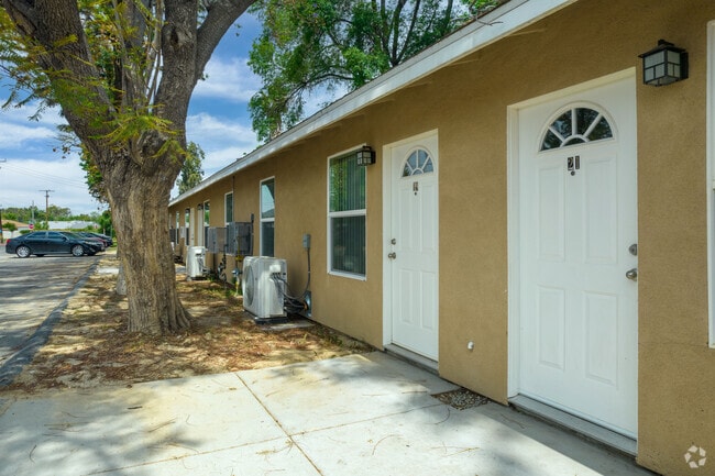
5590 42Nd St
Riverside-San Bernardino-Ontario, CA
Rubidoux Ro M & N Survey
181-170-003
.71 ACRES M/L IN POR LOT 8 MB 007/036 SB RUBIDOUX RO M & N SURVEY
Apartment
Riverside
X
California
06065C0706H
8
2024
0.71 AC
2025
Rubidoux
040302
Inland Empire (California)
10,686 SF
DEMOGRAPHICS near 5590 42Nd St
1 Mile
3 Mile
5 Mile
2024 Total Population
16,441
98,779
267,762
2029 Population
17,188
103,933
280,053
Pop Growth 2024-2029
+ 4.54%
+ 5.22%
+ 4.59%
Average Age
33
36
35
2024 Total Households
4,155
28,372
75,277
HH Growth 2024-2029
+ 4.00%
+ 4.84%
+ 4.32%
Median Household Inc
$53,432
$81,050
$75,876
Avg Household Size
3.70
3.20
3.30
2024 Avg HH Vehicles
2.00
2.00
2.00
Median Home Value
$336,437
$445,624
$442,894
Median Year Built
1974
1969
1973
Nearby Places
Map Layers
Map Styles
 Street
 Aerial
- Restaurants
- Banks
- Shops
- Fitness
- Groceries
PUBLIC TRANSPORTATION
COMMUTER RAIL
Riverside-Downtown (91 Line - Southern California Regional Rail Authority (Metrolink), Inland Empire-Orange County Line - Southern California Regional Rail Authority (Metrolink), Riverside Line - Southern California Regional Rail Authority (Metrolink))
DRIVE
WALK
Distance
Riverside-Downtown (91 Line - Southern California Regional Rail Authority (Metrolink), Inland Empire-Orange County Line - Southern California Regional Rail Authority (Metrolink), Riverside Line - Southern California Regional Rail Authority (Metrolink))
8 min
3.4 mi
Pedley (Riverside Line - Southern California Regional Rail Authority (Metrolink))
DRIVE
WALK
Distance
Pedley (Riverside Line - Southern California Regional Rail Authority (Metrolink))
9 min
4.6 mi
AIRPORT
Ontario International
DRIVE
WALK
Distance
Ontario International
22 min
15.5 mi
Freight Ports
Port of Long Beach
DRIVE
WALK
Distance
Port of Long Beach
77 min
59.1 mi
SALE & LEASE HISTORY
LISTING DATE
SALE/LEASE

Sep 24, 2016
For Sale
Nearby Properties
Address
Land Use
TOTAL SIZE
Lot Size
Zoning
Address
Land Use
TOTAL SIZE
Lot Size
Zoning
1,186,950 SF
54.77 AC
Address
Land Use
TOTAL SIZE
Lot Size
Zoning
1,000,177 SF
46 AC
Address
Land Use
TOTAL SIZE
Lot Size
Zoning
412,950 SF
23.16 AC
C2
Address
Land Use
TOTAL SIZE
Lot Size
Zoning
247,416 SF
10.17 AC
Address
Land Use
TOTAL SIZE
Lot Size
Zoning
350,278 SF
1.21 AC
Address
Land Use
TOTAL SIZE
Lot Size
Zoning
156,241 SF
2.55 AC
Address
Land Use
TOTAL SIZE
Lot Size
Zoning
139,454 SF
0.97 AC
DSP
Address
Land Use
TOTAL SIZE
Lot Size
Zoning
37,729 SF
3.23 AC
Address
Land Use
TOTAL SIZE
Lot Size
Zoning
210,004 SF
11.68 AC
Address
Land Use
TOTAL SIZE
Lot Size
Zoning
87,600 SF
0.39 AC
Address
Land Use
TOTAL SIZE
Lot Size
Zoning
244,495 SF
17.53 AC
MH
Address
Land Use
TOTAL SIZE
Lot Size
Zoning
134,944 SF
2.52 AC
Address
Land Use
TOTAL SIZE
Lot Size
Zoning
122,023 SF
6.83 AC
Address
Land Use
TOTAL SIZE
Lot Size
Zoning
272,472 SF
24.49 AC
N2
Address
Land Use
TOTAL SIZE
Lot Size
Zoning
69,660 SF
0.62 AC
C3
Address
Land Use
TOTAL SIZE
Lot Size
Zoning
180,215 SF
14.73 AC
Address
Land Use
TOTAL SIZE
Lot Size
Zoning
446,832 SF
5.03 AC
Address
Land Use
TOTAL SIZE
Lot Size
Zoning
83,572 SF
2.93 AC
Address
Land Use
TOTAL SIZE
Lot Size
Zoning
156,688 SF
6.09 AC
BMP
Address
Land Use
TOTAL SIZE
Lot Size
Zoning
306,278 SF
2.50 AC
C3
Address
Land Use
TOTAL SIZE
Lot Size
Zoning
85,322 SF
0.48 AC
Address
Land Use
TOTAL SIZE
Lot Size
Zoning
118,526 SF
1.61 AC
Address
Land Use
TOTAL SIZE
Lot Size
Zoning
139.49 AC
Address
Land Use
TOTAL SIZE
Lot Size
Zoning
308,680 SF
1.41 AC
Address
Land Use
TOTAL SIZE
Lot Size
Zoning
74,305 SF
1.15 AC
C3
Address
Land Use
TOTAL SIZE
Lot Size
Zoning
16.90 AC
MSC
Address
Land Use
TOTAL SIZE
Lot Size
Zoning
6.38 AC
The World's #1 Commercial Real Estate Marketplace
Connect with us
© 2025 CoStar Group
The information above has been obtained from sources believed reliable. While we do not doubt its accuracy we have not verified it and make no guarantee, warranty or representation about it. It is your responsibility to independently confirm its accuracy and completeness. Any projections, opinions, assumptions, or estimates used are for example only and do not represent the current or future performance of the property. The value of this transaction to you depends on tax and other factors which should be evaluated by your tax, financial, and legal advisors. You and your advisors should conduct a careful, independent investigation of the property to determine to your satisfaction the suitability of the property for your needs.