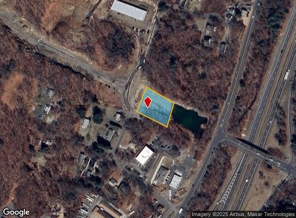
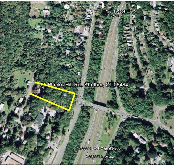
Property Record
56 Blacks Hill Rd, Shelton, CT 06484

NEARBY LISTINGS FOR SALE OR LEASE
Property Detail
56 Blacks Hill Rd
SHEL-000105-000000-000008
Fairfield
Governmentalpublicusegeneral
Connecticut
X
8
09001C0315F
0.76 AC
2025
Shelton
2025
Westchester/So Connecticut
110301
Bridgeport-Stamford-Norwalk, CT
1,382 SF
DEMOGRAPHICS near 56 Blacks Hill Rd
1 Mile
3 Mile
5 Mile
2024 Total Population
9,817
52,813
103,959
2029 Population
9,886
52,912
104,123
Pop Growth 2024-2029
+ 0.70%
+ 0.19%
+ 0.16%
Average Age
42
43
43
2024 Total Households
4,213
22,039
41,194
HH Growth 2024-2029
+ 0.64%
+ 0.10%
+ 0.13%
Median Household Inc
$88,236
$82,853
$95,778
Avg Household Size
2.30
2.30
2.50
2024 Avg HH Vehicles
2.00
2.00
2.00
Median Home Value
$308,253
$316,553
$356,591
Median Year Built
1977
1969
1969
Nearby Places
Map Layers
Map Styles
 Street
 Aerial
- Restaurants
- Banks
- Shops
- Fitness
- Groceries
PUBLIC TRANSPORTATION
COMMUTER RAIL
Derby-Shelton Station (New Haven Line - Metro-North Commuter Railroad Company (Metro-North))
DRIVE
WALK
Distance
Derby-Shelton Station (New Haven Line - Metro-North Commuter Railroad Company (Metro-North))
4 min
1.9 mi
Ansonia Station (New Haven Line - Metro-North Commuter Railroad Company (Metro-North))
DRIVE
WALK
Distance
Ansonia Station (New Haven Line - Metro-North Commuter Railroad Company (Metro-North))
6 min
3.6 mi
AIRPORT
Tweed/New Haven
DRIVE
WALK
Distance
Tweed/New Haven
27 min
16.0 mi
Freight Ports
Port of New Haven
DRIVE
WALK
Distance
Port of New Haven
21 min
13.1 mi
Nearby Properties
Address
Land Use
TOTAL SIZE
Lot Size
Zoning
Address
Land Use
TOTAL SIZE
Lot Size
Zoning
68,102 SF
4.44 AC
IB-2
Address
Land Use
TOTAL SIZE
Lot Size
Zoning
1,444 SF
50.40 AC
R-1
Address
Land Use
TOTAL SIZE
Lot Size
Zoning
236,601 SF
12.85 AC
IA-3
Address
Land Use
TOTAL SIZE
Lot Size
Zoning
4,320 SF
29.27 AC
R-1
Address
Land Use
TOTAL SIZE
Lot Size
Zoning
287,760 SF
4.98 AC
PDD6
Address
Land Use
TOTAL SIZE
Lot Size
Zoning
287,760 SF
6.32 AC
PDD6
Address
Land Use
TOTAL SIZE
Lot Size
Zoning
172,324 SF
46.29 AC
R-1
Address
Land Use
TOTAL SIZE
Lot Size
Zoning
271,336 SF
11.45 AC
PDD2
Address
Land Use
TOTAL SIZE
Lot Size
Zoning
166,388 SF
58 AC
A
Address
Land Use
TOTAL SIZE
Lot Size
Zoning
168,139 SF
7.90 AC
LIP
Address
Land Use
TOTAL SIZE
Lot Size
Zoning
249,462 SF
21.79 AC
IB-1
Address
Land Use
TOTAL SIZE
Lot Size
Zoning
11.73 AC
CB-1
Address
Land Use
TOTAL SIZE
Lot Size
Zoning
122,278 SF
14 AC
A
Address
Land Use
TOTAL SIZE
Lot Size
Zoning
52.09 AC
P
Address
Land Use
TOTAL SIZE
Lot Size
Zoning
300,288 SF
12.50 AC
PDD2
Address
Land Use
TOTAL SIZE
Lot Size
Zoning
454,846 SF
36.10 AC
IA-3
Address
Land Use
TOTAL SIZE
Lot Size
Zoning
158,266 SF
7.95 AC
PDD6
Address
Land Use
TOTAL SIZE
Lot Size
Zoning
22,560 SF
68.78 AC
PDD1
Address
Land Use
TOTAL SIZE
Lot Size
Zoning
10,761 SF
11.72 AC
PDD
Address
Land Use
TOTAL SIZE
Lot Size
Zoning
54,475 SF
2.78 AC
1A-2
Address
Land Use
TOTAL SIZE
Lot Size
Zoning
33,880 SF
3 AC
LIP
Address
Land Use
TOTAL SIZE
Lot Size
Zoning
13,111 SF
6.49 AC
IA-2
Address
Land Use
TOTAL SIZE
Lot Size
Zoning
147,168 SF
8.83 AC
R-1
Address
Land Use
TOTAL SIZE
Lot Size
Zoning
152,016 SF
9.97 AC
OPD
Address
Land Use
TOTAL SIZE
Lot Size
Zoning
133,200 SF
10.69 AC
PDD6
Address
Land Use
TOTAL SIZE
Lot Size
Zoning
156,893 SF
15.46 AC
IB-1
Address
Land Use
TOTAL SIZE
Lot Size
Zoning
84,275 SF
1.43 AC
IA-3
Address
Land Use
TOTAL SIZE
Lot Size
Zoning
38,411 SF
4.49 AC
I-1
Address
Land Use
TOTAL SIZE
Lot Size
Zoning
110,888 SF
5.27 AC
IA-2
Address
Land Use
TOTAL SIZE
Lot Size
Zoning
152,842 SF
15.02 AC
PDD1
The World's #1 Commercial Real Estate Marketplace
Connect with us
© 2025 CoStar Group
The information above has been obtained from sources believed reliable. While we do not doubt its accuracy we have not verified it and make no guarantee, warranty or representation about it. It is your responsibility to independently confirm its accuracy and completeness. Any projections, opinions, assumptions, or estimates used are for example only and do not represent the current or future performance of the property. The value of this transaction to you depends on tax and other factors which should be evaluated by your tax, financial, and legal advisors. You and your advisors should conduct a careful, independent investigation of the property to determine to your satisfaction the suitability of the property for your needs.