Property Record
56 Empire Dr, Belleville, IL 62220


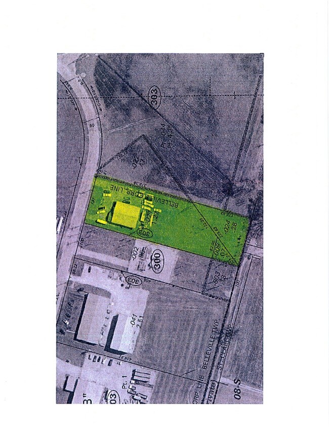
Property Detail
56 Empire Dr
St. Louis, MO-IL
GAY, EDW J, LANDS, PARTITION PLAT LOT/SEC-1 PT A02765074
08-25.0-303-021
Saint Clair
Commercialnec
Illinois
2024
1.10 AC
2024
Illinois
503304
St. Louis
3,960 SF
NEARBY LISTINGS FOR SALE OR LEASE
DEMOGRAPHICS near 56 Empire Dr
1 mile
3 mile
5 mile
2025 Total Population
1,520
30,548
70,114
2030 Population
1,479
29,890
68,833
Pop Growth 2025-2030
(2.70%)
(2.15%)
(1.83%)
Average Age
38
40
40
2025 Total Households
593
12,458
28,352
HH Growth 2025-2030
(2.70%)
(2.12%)
(1.90%)
Median Household Inc
$56,666
$67,673
$74,727
Avg Household Size
2.50
2.30
2.40
2025 Avg HH Vehicles
2.00
2.00
2.00
Median Home Value
$146,610
$169,758
$187,842
Median Year Built
1976
1971
1977
Nearby Places
Map Layers
Map Styles
 Street
 Aerial
Layers
 Traffic
 Biking
Places
Listings with unknown addresses are not visible on the map
- Restaurants
- Banks
- Shops
- Fitness
- Groceries
PUBLIC TRANSPORTATION
COMMUTER RAIL
Belleville (Lambert Airport Shiloh-Scott - St. Louis MetroLink (MetroLink))
Drive
Walk
Distance
Belleville (Lambert Airport Shiloh-Scott - St. Louis MetroLink (MetroLink))
10 min
3.1 mi
College (Lambert Airport Shiloh-Scott - St. Louis MetroLink (MetroLink))
Drive
Walk
Distance
College (Lambert Airport Shiloh-Scott - St. Louis MetroLink (MetroLink))
9 min
3.2 mi
AIRPORT
Scott AFB/Midamerica St Louis
Drive
Walk
Distance
Scott AFB/Midamerica St Louis
23 min
10.3 mi
St Louis Lambert International
Drive
Walk
Distance
St Louis Lambert International
48 min
31.8 mi
Nearby Properties
Address
Land Use
TOTAL SIZE
Lot Size
Zoning
Address
Land Use
TOTAL SIZE
Lot Size
Zoning
3,388 SF
22.25 AC
Address
Land Use
TOTAL SIZE
Lot Size
Zoning
217,542 SF
17.71 AC
Address
Land Use
TOTAL SIZE
Lot Size
Zoning
139,172 SF
15.78 AC
Address
Land Use
TOTAL SIZE
Lot Size
Zoning
19,576 SF
22.78 AC
Address
Land Use
TOTAL SIZE
Lot Size
Zoning
20.63 AC
Address
Land Use
TOTAL SIZE
Lot Size
Zoning
126,937 SF
11.98 AC
Address
Land Use
TOTAL SIZE
Lot Size
Zoning
86,482 SF
8 AC
Address
Land Use
TOTAL SIZE
Lot Size
Zoning
155,488 SF
16.54 AC
Address
Land Use
TOTAL SIZE
Lot Size
Zoning
26,233 SF
17.61 AC
Address
Land Use
TOTAL SIZE
Lot Size
Zoning
88,468 SF
10.48 AC
Address
Land Use
TOTAL SIZE
Lot Size
Zoning
4,818 SF
3.64 AC
Address
Land Use
TOTAL SIZE
Lot Size
Zoning
5.03 AC
Address
Land Use
TOTAL SIZE
Lot Size
Zoning
23,951 SF
0.89 AC
Address
Land Use
TOTAL SIZE
Lot Size
Zoning
4,400 SF
2.56 AC
Address
Land Use
TOTAL SIZE
Lot Size
Zoning
30,000 SF
9.05 AC
Address
Land Use
TOTAL SIZE
Lot Size
Zoning
32,463 SF
9.70 AC
Address
Land Use
TOTAL SIZE
Lot Size
Zoning
12,010 SF
2.49 AC
Address
Land Use
TOTAL SIZE
Lot Size
Zoning
47,369 SF
4.17 AC
Address
Land Use
TOTAL SIZE
Lot Size
Zoning
12.99 AC
Address
Land Use
TOTAL SIZE
Lot Size
Zoning
45,394 SF
4.13 AC
Address
Land Use
TOTAL SIZE
Lot Size
Zoning
36,445 SF
6.07 AC
Address
Land Use
TOTAL SIZE
Lot Size
Zoning
5,872 SF
1.15 AC
Address
Land Use
TOTAL SIZE
Lot Size
Zoning
2.98 AC
Address
Land Use
TOTAL SIZE
Lot Size
Zoning
3,456 SF
5.99 AC
Address
Land Use
TOTAL SIZE
Lot Size
Zoning
35,528 SF
15.83 AC
Address
Land Use
TOTAL SIZE
Lot Size
Zoning
61,340 SF
16.33 AC
Address
Land Use
TOTAL SIZE
Lot Size
Zoning
27,410 SF
2.64 AC
Address
Land Use
TOTAL SIZE
Lot Size
Zoning
13,028 SF
1.46 AC
Address
Land Use
TOTAL SIZE
Lot Size
Zoning
5,456 SF
1.42 AC
Address
Land Use
TOTAL SIZE
Lot Size
Zoning
5,010 SF
1.93 AC
The World's #1 Commercial Real Estate Marketplace
Connect with us
© 2026 CoStar Group
The information above has been obtained from sources believed reliable. While we do not doubt its accuracy we have not verified it and make no guarantee, warranty or representation about it. It is your responsibility to independently confirm its accuracy and completeness. Any projections, opinions, assumptions, or estimates used are for example only and do not represent the current or future performance of the property. The value of this transaction to you depends on tax and other factors which should be evaluated by your tax, financial, and legal advisors. You and your advisors should conduct a careful, independent investigation of the property to determine to your satisfaction the suitability of the property for your needs.