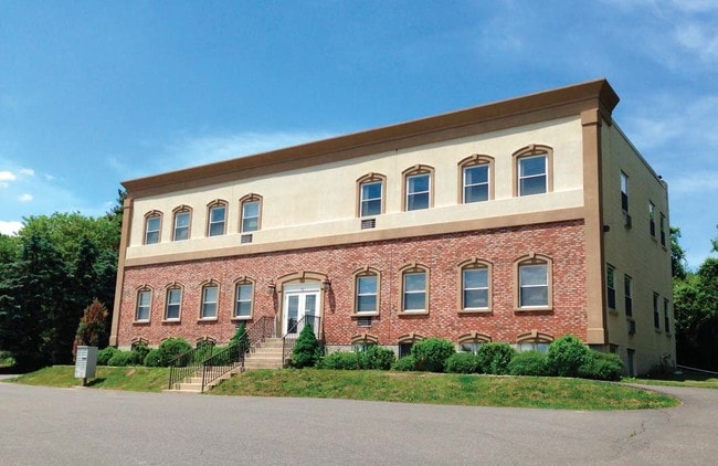
Property Record
56 State Route 173, Hampton, NJ 08827

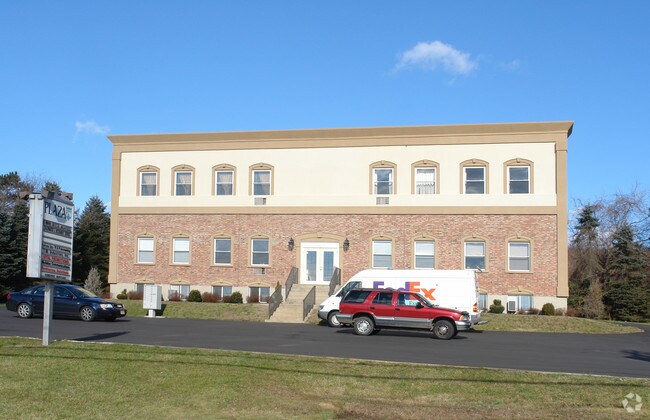
Current Lease Availabilities
Property Detail
56 State Route 173
25-00011-0000-00020
Hunterdon
Officebuilding
New Jersey
PC
20
B and X Area of moderate flood hazard, usually the area between the limits of the 100-year and 500-year floods.
0.95 AC
2024
Hunterdon
2025
Northern New Jersey
010701
Newark, NJ
NEARBY LISTINGS FOR SALE OR LEASE
DEMOGRAPHICS near 56 State Route 173
1 mile
3 mile
5 mile
2025 Total Population
906
10,777
31,884
2030 Population
918
11,015
32,575
Pop Growth 2025-2030
+ 1.32%
+ 2.21%
+ 2.17%
Average Age
46
44
44
2025 Total Households
146
3,618
11,780
HH Growth 2025-2030
+ 6.16%
+ 2.99%
+ 2.46%
Median Household Inc
$201,351
$137,463
$137,012
Avg Household Size
2.90
2.50
2.50
2025 Avg HH Vehicles
3.00
2.00
2.00
Median Home Value
$547,945
$460,514
$462,113
Median Year Built
1990
1978
1979
Nearby Places
Map Layers
Map Styles
 Street
 Aerial
Transit
 Traffic
 Biking
Places
Listings with unknown addresses are not visible on the map
- Restaurants
- Banks
- Shops
- Fitness
- Groceries
PUBLIC TRANSPORTATION
COMMUTER RAIL
Annandale (Raritan Valley Line - NJ Transit Commuter Rail (NJ Transit))
Drive
Walk
Distance
Annandale (Raritan Valley Line - NJ Transit Commuter Rail (NJ Transit))
8 min
5.1 mi
High Bridge (Raritan Valley Line - NJ Transit Commuter Rail (NJ Transit))
Drive
Walk
Distance
High Bridge (Raritan Valley Line - NJ Transit Commuter Rail (NJ Transit))
9 min
5.8 mi
AIRPORT
Lehigh Valley International
Drive
Walk
Distance
Lehigh Valley International
45 min
29.5 mi
Trenton Mercer
Drive
Walk
Distance
Trenton Mercer
51 min
33.6 mi
Freight Ports
New York Container Terminal
Drive
Walk
Distance
New York Container Terminal
65 min
49.1 mi
Nearby Properties
Address
Land Use
TOTAL SIZE
Lot Size
Zoning
Address
Land Use
TOTAL SIZE
Lot Size
Zoning
328.35 AC
INS
Address
Land Use
TOTAL SIZE
Lot Size
Zoning
1,740.74 AC
INS
Address
Land Use
TOTAL SIZE
Lot Size
Zoning
500.58 AC
WM
Address
Land Use
TOTAL SIZE
Lot Size
Zoning
255.40 AC
WM
Address
Land Use
TOTAL SIZE
Lot Size
Zoning
2.27 AC
OR1
Address
Land Use
TOTAL SIZE
Lot Size
Zoning
36.51 AC
C-N
Address
Land Use
TOTAL SIZE
Lot Size
Zoning
2,526 SF
339.93 AC
RC
Address
Land Use
TOTAL SIZE
Lot Size
Zoning
3,205 SF
22.05 AC
CR
Address
Land Use
TOTAL SIZE
Lot Size
Zoning
151.92 AC
INS
Address
Land Use
TOTAL SIZE
Lot Size
Zoning
157.99 AC
INS
Address
Land Use
TOTAL SIZE
Lot Size
Zoning
Address
Land Use
TOTAL SIZE
Lot Size
Zoning
2.40 AC
OR1
Address
Land Use
TOTAL SIZE
Lot Size
Zoning
1,120 SF
103 AC
INS
Address
Land Use
TOTAL SIZE
Lot Size
Zoning
12.60 AC
VR
Address
Land Use
TOTAL SIZE
Lot Size
Zoning
5.36 AC
PUD
Address
Land Use
TOTAL SIZE
Lot Size
Zoning
4,948 SF
354.37 AC
CR
Address
Land Use
TOTAL SIZE
Lot Size
Zoning
71.36 AC
INS
Address
Land Use
TOTAL SIZE
Lot Size
Zoning
Address
Land Use
TOTAL SIZE
Lot Size
Zoning
1.88 AC
OB-2
Address
Land Use
TOTAL SIZE
Lot Size
Zoning
10.18 AC
OB-4
Address
Land Use
TOTAL SIZE
Lot Size
Zoning
7,680 SF
9.32 AC
CR
Address
Land Use
TOTAL SIZE
Lot Size
Zoning
5.24 AC
C-N
Address
Land Use
TOTAL SIZE
Lot Size
Zoning
11.75 AC
PO
Address
Land Use
TOTAL SIZE
Lot Size
Zoning
Address
Land Use
TOTAL SIZE
Lot Size
Zoning
1,392 SF
5.89 AC
PC
Address
Land Use
TOTAL SIZE
Lot Size
Zoning
5.17 AC
Q
Address
Land Use
TOTAL SIZE
Lot Size
Zoning
54.31 AC
INS
Address
Land Use
TOTAL SIZE
Lot Size
Zoning
47,400 SF
15.68 AC
I
Address
Land Use
TOTAL SIZE
Lot Size
Zoning
5,052 SF
36.36 AC
RR50
Address
Land Use
TOTAL SIZE
Lot Size
Zoning
11,467 SF
8.98 AC
OB-2
The World's #1 Commercial Real Estate Marketplace
Connect with us
© 2026 CoStar Group
The information above has been obtained from sources believed reliable. While we do not doubt its accuracy we have not verified it and make no guarantee, warranty or representation about it. It is your responsibility to independently confirm its accuracy and completeness. Any projections, opinions, assumptions, or estimates used are for example only and do not represent the current or future performance of the property. The value of this transaction to you depends on tax and other factors which should be evaluated by your tax, financial, and legal advisors. You and your advisors should conduct a careful, independent investigation of the property to determine to your satisfaction the suitability of the property for your needs.