Property Record
56 Wentworth St, Charleston, SC 29401
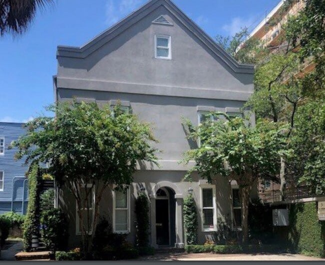
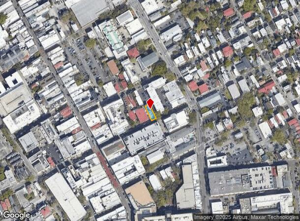
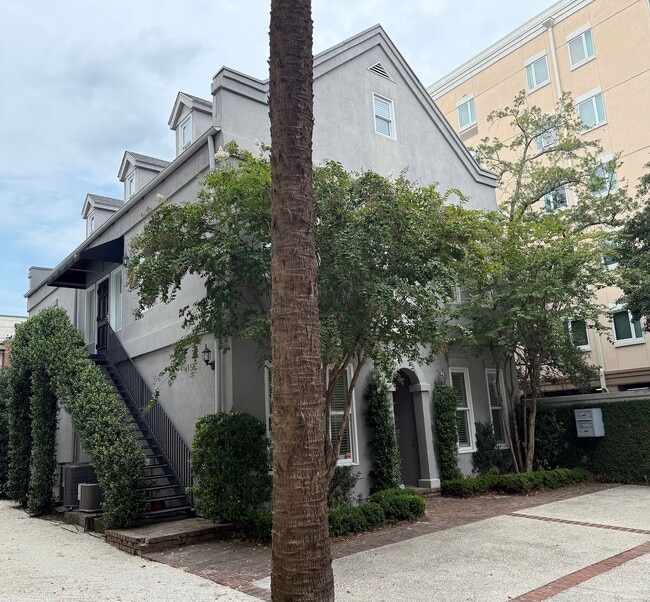
This Property Is For Sale
NEARBY LISTINGS FOR SALE OR LEASE
Property Detail
56 Wentworth St
457-04-04-049
DESCRIPTION -56 N WENTWORTH
Commercialnec
Charleston
X
South Carolina
45019C0516K
0.08 AC
2025
Downtown Charleston
2024
Charleston/N Charleston
000400
Charleston-North Charleston, SC
700 SF
DEMOGRAPHICS near 56 Wentworth St
1 Mile
3 Mile
5 Mile
2024 Total Population
18,738
53,100
128,783
2029 Population
20,511
57,630
138,969
Pop Growth 2024-2029
+ 9.46%
+ 8.53%
+ 7.91%
Average Age
38
38
40
2024 Total Households
8,756
23,960
57,323
HH Growth 2024-2029
+ 9.54%
+ 8.72%
+ 7.92%
Median Household Inc
$68,172
$71,498
$78,952
Avg Household Size
1.90
2.00
2.10
2024 Avg HH Vehicles
2.00
2.00
2.00
Median Home Value
$904,359
$637,220
$478,239
Median Year Built
1948
1965
1976
Nearby Places
- Restaurants
- Banks
- Shops
- Fitness
- Groceries
PUBLIC TRANSPORTATION
COMMUTER RAIL
Charleston Amtrak Station (Palmetto - Amtrak, Silver Meteor - Amtrak)
DRIVE
WALK
Distance
Charleston Amtrak Station (Palmetto - Amtrak, Silver Meteor - Amtrak)
10 min
7.8 mi
AIRPORT
Charleston AFB/International
DRIVE
WALK
Distance
Charleston AFB/International
21 min
14.3 mi
Freight Ports
Columbus Street Terminal
DRIVE
WALK
Distance
Columbus Street Terminal
2 min
1.2 mi
Nearby Properties
Address
Land Use
TOTAL SIZE
Lot Size
Zoning
Address
Land Use
TOTAL SIZE
Lot Size
Zoning
79,990 SF
9.22 AC
Address
Land Use
TOTAL SIZE
Lot Size
Zoning
2,592 SF
13.64 AC
Address
Land Use
TOTAL SIZE
Lot Size
Zoning
Address
Land Use
TOTAL SIZE
Lot Size
Zoning
0.62 AC
Address
Land Use
TOTAL SIZE
Lot Size
Zoning
39,150 SF
7.76 AC
Address
Land Use
TOTAL SIZE
Lot Size
Zoning
80,044 SF
2.48 AC
Address
Land Use
TOTAL SIZE
Lot Size
Zoning
85,408 SF
9.39 AC
Address
Land Use
TOTAL SIZE
Lot Size
Zoning
66,136 SF
1.88 AC
Address
Land Use
TOTAL SIZE
Lot Size
Zoning
8,472 SF
9.84 AC
Address
Land Use
TOTAL SIZE
Lot Size
Zoning
8,472 SF
9.83 AC
Address
Land Use
TOTAL SIZE
Lot Size
Zoning
Address
Land Use
TOTAL SIZE
Lot Size
Zoning
1,435 SF
1.98 AC
Address
Land Use
TOTAL SIZE
Lot Size
Zoning
6.11 AC
Address
Land Use
TOTAL SIZE
Lot Size
Zoning
17,459 SF
4.16 AC
Address
Land Use
TOTAL SIZE
Lot Size
Zoning
8,714 SF
1.60 AC
Address
Land Use
TOTAL SIZE
Lot Size
Zoning
Address
Land Use
TOTAL SIZE
Lot Size
Zoning
1,282 SF
8.42 AC
Address
Land Use
TOTAL SIZE
Lot Size
Zoning
Address
Land Use
TOTAL SIZE
Lot Size
Zoning
Address
Land Use
TOTAL SIZE
Lot Size
Zoning
5,733 SF
0.10 AC
Address
Land Use
TOTAL SIZE
Lot Size
Zoning
43,934 SF
1.50 AC
Address
Land Use
TOTAL SIZE
Lot Size
Zoning
14,240 SF
3.50 AC
Address
Land Use
TOTAL SIZE
Lot Size
Zoning
8,740 SF
0.58 AC
Address
Land Use
TOTAL SIZE
Lot Size
Zoning
1,150 SF
Address
Land Use
TOTAL SIZE
Lot Size
Zoning
24,320 SF
1.31 AC
Address
Land Use
TOTAL SIZE
Lot Size
Zoning
29,910 SF
2.82 AC
Address
Land Use
TOTAL SIZE
Lot Size
Zoning
41,070 SF
0.61 AC
Address
Land Use
TOTAL SIZE
Lot Size
Zoning
Address
Land Use
TOTAL SIZE
Lot Size
Zoning
22,825 SF
4.36 AC
Address
Land Use
TOTAL SIZE
Lot Size
Zoning
6.57 AC
The World's #1 Commercial Real Estate Marketplace
Connect with us
© 2025 CoStar Group
The information above has been obtained from sources believed reliable. While we do not doubt its accuracy we have not verified it and make no guarantee, warranty or representation about it. It is your responsibility to independently confirm its accuracy and completeness. Any projections, opinions, assumptions, or estimates used are for example only and do not represent the current or future performance of the property. The value of this transaction to you depends on tax and other factors which should be evaluated by your tax, financial, and legal advisors. You and your advisors should conduct a careful, independent investigation of the property to determine to your satisfaction the suitability of the property for your needs.