Property Record
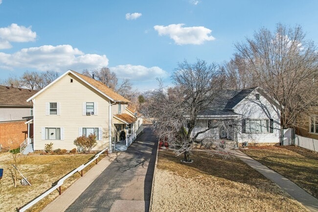
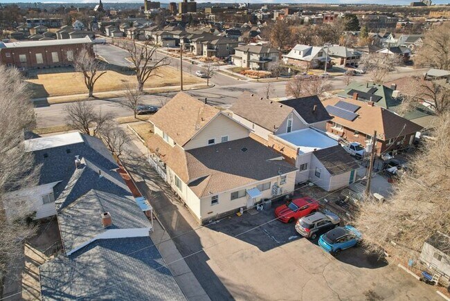
560 21St St, Ogden, UT 84401


NEARBY LISTINGS FOR SALE OR LEASE
Property Detail
560 21St St
Ogden, UT
Plat A Ogden City Survey
01-045-0004
PART OF LOTS 1 AND 10, BLOCK 55, PLAT A, OGDEN CITY SURVEY, WEBER COUNTY, UTAH: BEGINNING 9 RODS WEST OF THE SOUTHEAST CORNER
Highriseapartments
Weber
X
Utah
49057C0427F
1,10
2025
0.60 AC
2025
East Central Ogden
200900
Salt Lake City
1,610 SF
DEMOGRAPHICS near 560 21St St
1 Mile
3 Mile
5 Mile
2024 Total Population
17,257
81,209
154,895
2029 Population
18,584
87,151
166,383
Pop Growth 2024-2029
+ 7.69%
+ 7.32%
+ 7.42%
Average Age
36
35
36
2024 Total Households
7,408
30,192
56,074
HH Growth 2024-2029
+ 7.84%
+ 7.55%
+ 7.63%
Median Household Inc
$40,732
$53,153
$61,708
Avg Household Size
2.20
2.60
2.70
2024 Avg HH Vehicles
2.00
2.00
2.00
Median Home Value
$260,069
$286,536
$329,372
Median Year Built
1957
1961
1975
Nearby Places
Map Layers
Map Styles
 Street
 Aerial
- Restaurants
- Banks
- Shops
- Fitness
- Groceries
PUBLIC TRANSPORTATION
COMMUTER RAIL
Ogden (FrontRunner North - Utah Transit Authority (UTA))
DRIVE
WALK
Distance
Ogden (FrontRunner North - Utah Transit Authority (UTA))
3 min
1.1 mi
Roy (FrontRunner North - Utah Transit Authority (UTA))
DRIVE
WALK
Distance
Roy (FrontRunner North - Utah Transit Authority (UTA))
11 min
5.9 mi
AIRPORT
Salt Lake City International
DRIVE
WALK
Distance
Salt Lake City International
50 min
40.2 mi
SALE & LEASE HISTORY
LISTING DATE
SALE/LEASE

Mar 14, 2025
For Sale
Nearby Properties
Address
Land Use
TOTAL SIZE
Lot Size
Zoning
Address
Land Use
TOTAL SIZE
Lot Size
Zoning
841,756 SF
45.79 AC
Address
Land Use
TOTAL SIZE
Lot Size
Zoning
111,832 SF
24.92 AC
Address
Land Use
TOTAL SIZE
Lot Size
Zoning
128,867 SF
3.36 AC
Address
Land Use
TOTAL SIZE
Lot Size
Zoning
97,932 SF
3.07 AC
Address
Land Use
TOTAL SIZE
Lot Size
Zoning
52,200 SF
9.95 AC
Address
Land Use
TOTAL SIZE
Lot Size
Zoning
305,444 SF
1.58 AC
Address
Land Use
TOTAL SIZE
Lot Size
Zoning
152,877 SF
4.96 AC
Address
Land Use
TOTAL SIZE
Lot Size
Zoning
9,464 SF
6.82 AC
Address
Land Use
TOTAL SIZE
Lot Size
Zoning
21,684 SF
8.38 AC
Address
Land Use
TOTAL SIZE
Lot Size
Zoning
48,177 SF
5.54 AC
Address
Land Use
TOTAL SIZE
Lot Size
Zoning
106,752 SF
10.35 AC
Address
Land Use
TOTAL SIZE
Lot Size
Zoning
22,227 SF
10.81 AC
Address
Land Use
TOTAL SIZE
Lot Size
Zoning
66,896 SF
7.50 AC
Address
Land Use
TOTAL SIZE
Lot Size
Zoning
101,191 SF
4.14 AC
Address
Land Use
TOTAL SIZE
Lot Size
Zoning
119,043 SF
2.05 AC
Address
Land Use
TOTAL SIZE
Lot Size
Zoning
95,949 SF
3.29 AC
Address
Land Use
TOTAL SIZE
Lot Size
Zoning
166,800 SF
0.12 AC
Address
Land Use
TOTAL SIZE
Lot Size
Zoning
19,594 SF
1.12 AC
Address
Land Use
TOTAL SIZE
Lot Size
Zoning
47,750 SF
2.10 AC
Address
Land Use
TOTAL SIZE
Lot Size
Zoning
255,596 SF
15.98 AC
The World's #1 Commercial Real Estate Marketplace
Connect with us
© 2026 CoStar Group
The information above has been obtained from sources believed reliable. While we do not doubt its accuracy we have not verified it and make no guarantee, warranty or representation about it. It is your responsibility to independently confirm its accuracy and completeness. Any projections, opinions, assumptions, or estimates used are for example only and do not represent the current or future performance of the property. The value of this transaction to you depends on tax and other factors which should be evaluated by your tax, financial, and legal advisors. You and your advisors should conduct a careful, independent investigation of the property to determine to your satisfaction the suitability of the property for your needs.