No Photo
Property Record
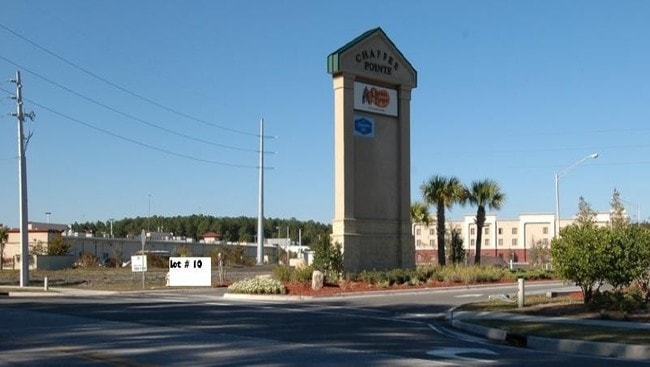
560 Chaffee Point Blvd, Jacksonville, FL 32221


Property Detail
560 Chaffee Point Blvd
006763-0760
57-37 30-2S-25E 2.26 CHAFFEE POINT SUBDIVISION LOT 10
Financialbuilding
Duval
PUD
Florida
B and X Area of moderate flood hazard, usually the area between the limits of the 100-year and 500-year floods.
10
2025
2.26 AC
2026
Riverside
011903
Jacksonville (Florida)
6,342 SF
Jacksonville, FL
NEARBY LISTINGS FOR SALE OR LEASE
DEMOGRAPHICS near 560 Chaffee Point Blvd
1 mile
3 mile
5 mile
2025 Total Population
3,411
30,465
66,064
2030 Population
3,617
32,563
70,366
Pop Growth 2025-2030
+ 6.04%
+ 6.89%
+ 6.51%
Average Age
40
38
39
2025 Total Households
1,204
10,628
23,702
HH Growth 2025-2030
+ 6.23%
+ 7.09%
+ 6.73%
Median Household Inc
$98,929
$92,848
$76,552
Avg Household Size
2.80
2.80
2.70
2025 Avg HH Vehicles
2.00
2.00
2.00
Median Home Value
$353,631
$329,131
$284,224
Median Year Built
2002
2002
1997
Nearby Places
Map Layers
Map Styles
 Street
 Aerial
Transit
 Traffic
 Biking
Places
Listings with unknown addresses are not visible on the map
- Restaurants
- Banks
- Shops
- Fitness
- Groceries
PUBLIC TRANSPORTATION
AIRPORT
Jacksonville International
Drive
Walk
Distance
Jacksonville International
33 min
22.3 mi
Freight Ports
Jacksonville Port
Drive
Walk
Distance
Jacksonville Port
25 min
16.2 mi
Nearby Properties
Address
Land Use
TOTAL SIZE
Lot Size
Zoning
Address
Land Use
TOTAL SIZE
Lot Size
Zoning
185,662 SF
1,416.80 AC
PBF-3
Address
Land Use
TOTAL SIZE
Lot Size
Zoning
505,748 SF
94.71 AC
IL
Address
Land Use
TOTAL SIZE
Lot Size
Zoning
509,686 SF
43.32 AC
IL
Address
Land Use
TOTAL SIZE
Lot Size
Zoning
139,435 SF
7.15 AC
CCG-2
Address
Land Use
TOTAL SIZE
Lot Size
Zoning
481,686 SF
43.54 AC
IL
Address
Land Use
TOTAL SIZE
Lot Size
Zoning
269,178 SF
129.93 AC
PBF-2
Address
Land Use
TOTAL SIZE
Lot Size
Zoning
2,288 SF
373.54 AC
PBF-1
Address
Land Use
TOTAL SIZE
Lot Size
Zoning
65,052 SF
15.97 AC
PUD
Address
Land Use
TOTAL SIZE
Lot Size
Zoning
30,789 SF
2.10 AC
PUD
Address
Land Use
TOTAL SIZE
Lot Size
Zoning
160,778 SF
25.46 AC
IL
Address
Land Use
TOTAL SIZE
Lot Size
Zoning
108,217 SF
178.52 AC
PBF-1
Address
Land Use
TOTAL SIZE
Lot Size
Zoning
6,792 SF
53.56 AC
PUD
Address
Land Use
TOTAL SIZE
Lot Size
Zoning
153,549 SF
15.96 AC
PBF-1
Address
Land Use
TOTAL SIZE
Lot Size
Zoning
29,022 SF
3.17 AC
PUD
Address
Land Use
TOTAL SIZE
Lot Size
Zoning
33,424 SF
2.97 AC
PUD
Address
Land Use
TOTAL SIZE
Lot Size
Zoning
307.14 AC
PUD
Address
Land Use
TOTAL SIZE
Lot Size
Zoning
53,527 SF
10.89 AC
CCG-1
Address
Land Use
TOTAL SIZE
Lot Size
Zoning
53,405 SF
6.04 AC
PUD
Address
Land Use
TOTAL SIZE
Lot Size
Zoning
36,354 SF
3.72 AC
CCG-1
Address
Land Use
TOTAL SIZE
Lot Size
Zoning
23,532 SF
3.58 AC
CCG-2
Address
Land Use
TOTAL SIZE
Lot Size
Zoning
50,506 SF
9.44 AC
PBF-2
Address
Land Use
TOTAL SIZE
Lot Size
Zoning
153,671 SF
27.09 AC
IL
Address
Land Use
TOTAL SIZE
Lot Size
Zoning
26,961 SF
1.36 AC
PUD
Address
Land Use
TOTAL SIZE
Lot Size
Zoning
25.88 AC
CCG-1
Address
Land Use
TOTAL SIZE
Lot Size
Zoning
45,252 SF
16.91 AC
CCG-1
Address
Land Use
TOTAL SIZE
Lot Size
Zoning
30,440 SF
25.01 AC
PUD
Address
Land Use
TOTAL SIZE
Lot Size
Zoning
12,384 SF
4.88 AC
RMD-MH
Address
Land Use
TOTAL SIZE
Lot Size
Zoning
35,821 SF
11.79 AC
IL
Address
Land Use
TOTAL SIZE
Lot Size
Zoning
14,722 SF
3.22 AC
CCG-2
Address
Land Use
TOTAL SIZE
Lot Size
Zoning
19,070 SF
8.06 AC
IL
The World's #1 Commercial Real Estate Marketplace
Connect with us
© 2026 CoStar Group
The information above has been obtained from sources believed reliable. While we do not doubt its accuracy we have not verified it and make no guarantee, warranty or representation about it. It is your responsibility to independently confirm its accuracy and completeness. Any projections, opinions, assumptions, or estimates used are for example only and do not represent the current or future performance of the property. The value of this transaction to you depends on tax and other factors which should be evaluated by your tax, financial, and legal advisors. You and your advisors should conduct a careful, independent investigation of the property to determine to your satisfaction the suitability of the property for your needs.