Property Record
560 Channelside Dr, Tampa, FL 33602


NEARBY LISTINGS FOR SALE OR LEASE
Property Detail
560 Channelside Dr
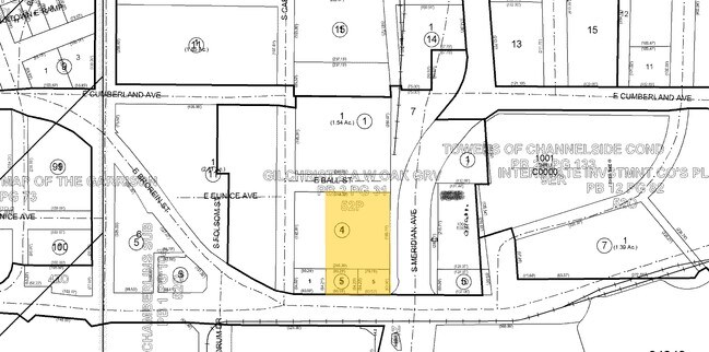
A-19-29-19-B7J-G00000-00002.0
WATER STREET TAMPA SUBDIVISION SUBPHASE 1 LOT 2 BLOCK G
Stateproperty
Hillsborough
AE
Florida
12057C0354J
2
0
1.01 AC
2024
Downtown Tampa
005101
Tampa/St Petersburg
395,122 SF
Tampa-St. Petersburg-Clearwater, FL
DEMOGRAPHICS near 560 Channelside Dr
1 Mile
3 Mile
5 Mile
2024 Total Population
23,444
104,490
241,024
2029 Population
25,644
115,072
264,230
Pop Growth 2024-2029
+ 9.38%
+ 10.13%
+ 9.63%
Average Age
36
38
39
2024 Total Households
11,525
46,644
101,446
HH Growth 2024-2029
+ 10.81%
+ 10.62%
+ 10.02%
Median Household Inc
$95,064
$66,863
$64,227
Avg Household Size
1.60
2.00
2.20
2024 Avg HH Vehicles
1.00
1.00
2.00
Median Home Value
$493,959
$411,226
$380,807
Median Year Built
2005
1988
1979
Nearby Places
Map Layers
Map Styles
 Street
 Aerial
- Restaurants
- Banks
- Shops
- Fitness
- Groceries
PUBLIC TRANSPORTATION
TRANSIT/SUBWAY
Amalie Arena Station (#8) (Tampa Historic Streetcar - Hillsborough Area Regional Transit)
DRIVE
WALK
Distance
Amalie Arena Station (#8) (Tampa Historic Streetcar - Hillsborough Area Regional Transit)
0 min
2 min
0.1 mi
Hsbc Station (#9) (Tampa Historic Streetcar - Hillsborough Area Regional Transit)
DRIVE
WALK
Distance
Hsbc Station (#9) (Tampa Historic Streetcar - Hillsborough Area Regional Transit)
0 min
5 min
0.3 mi
Cumberland Avenue Station (#7) (Tampa Historic Streetcar - Hillsborough Area Regional Transit)
DRIVE
WALK
Distance
Cumberland Avenue Station (#7) (Tampa Historic Streetcar - Hillsborough Area Regional Transit)
1 min
6 min
0.3 mi
Dick Greco Plaza Station (#10) (Tampa Historic Streetcar - Hillsborough Area Regional Transit)
DRIVE
WALK
Distance
Dick Greco Plaza Station (#10) (Tampa Historic Streetcar - Hillsborough Area Regional Transit)
1 min
9 min
0.5 mi
York Street Station (#6) (Tampa Historic Streetcar - Hillsborough Area Regional Transit)
DRIVE
WALK
Distance
York Street Station (#6) (Tampa Historic Streetcar - Hillsborough Area Regional Transit)
1 min
9 min
0.5 mi
COMMUTER RAIL
Tampa (Silver Star - Amtrak)
DRIVE
WALK
Distance
Tampa (Silver Star - Amtrak)
2 min
13 min
0.7 mi
AIRPORT
Tampa International
DRIVE
WALK
Distance
Tampa International
16 min
9.2 mi
St Pete-Clearwater International
DRIVE
WALK
Distance
St Pete-Clearwater International
33 min
19.4 mi
Freight Ports
Port of Tampa Bay
DRIVE
WALK
Distance
Port of Tampa Bay
9 min
4.1 mi
Nearby Properties
Address
Land Use
TOTAL SIZE
Lot Size
Zoning
Address
Land Use
TOTAL SIZE
Lot Size
Zoning
2,700,512 SF
87.53 AC
PD-A
Address
Land Use
TOTAL SIZE
Lot Size
Zoning
1,873,235 SF
20.98 AC
PD
Address
Land Use
TOTAL SIZE
Lot Size
Zoning
115,537 SF
0.95 AC
CBD-2
Address
Land Use
TOTAL SIZE
Lot Size
Zoning
771,501 SF
2.70 AC
CBD-2
Address
Land Use
TOTAL SIZE
Lot Size
Zoning
810,926 SF
1.05 AC
CBD-2
Address
Land Use
TOTAL SIZE
Lot Size
Zoning
690,975 SF
1.58 AC
CBD-2
Address
Land Use
TOTAL SIZE
Lot Size
Zoning
178,538 SF
128.15 AC
M-AP-1
Address
Land Use
TOTAL SIZE
Lot Size
Zoning
669,897 SF
8.13 AC
CBD-2
Address
Land Use
TOTAL SIZE
Lot Size
Zoning
499,692 SF
4.40 AC
PD
Address
Land Use
TOTAL SIZE
Lot Size
Zoning
408,619 SF
0.84 AC
CBD-2
Address
Land Use
TOTAL SIZE
Lot Size
Zoning
584,676 SF
2.97 AC
CBD-2
Address
Land Use
TOTAL SIZE
Lot Size
Zoning
367,575 SF
12.34 AC
CBD-2
Address
Land Use
TOTAL SIZE
Lot Size
Zoning
887,915 SF
0.76 AC
CBD-2
Address
Land Use
TOTAL SIZE
Lot Size
Zoning
665,741 SF
2.05 AC
CBD-2
Address
Land Use
TOTAL SIZE
Lot Size
Zoning
13,472 SF
1.26 AC
PD
Address
Land Use
TOTAL SIZE
Lot Size
Zoning
838,525 SF
1 AC
CBD-2
Address
Land Use
TOTAL SIZE
Lot Size
Zoning
625,694 SF
1 AC
CBD-2
Address
Land Use
TOTAL SIZE
Lot Size
Zoning
598,696 SF
6.75 AC
CD-3
Address
Land Use
TOTAL SIZE
Lot Size
Zoning
439,220 SF
1 AC
CBD-1
Address
Land Use
TOTAL SIZE
Lot Size
Zoning
124,768 SF
13.26 AC
CBD-2
Address
Land Use
TOTAL SIZE
Lot Size
Zoning
449,135 SF
16.72 AC
PD
Address
Land Use
TOTAL SIZE
Lot Size
Zoning
428,819 SF
5.24 AC
CBD-1
Address
Land Use
TOTAL SIZE
Lot Size
Zoning
424,985 SF
0.79 AC
CBD-2
Address
Land Use
TOTAL SIZE
Lot Size
Zoning
476,090 SF
2.02 AC
CBD-1
Address
Land Use
TOTAL SIZE
Lot Size
Zoning
647,052 SF
3.85 AC
PD
Address
Land Use
TOTAL SIZE
Lot Size
Zoning
350,039 SF
2.40 AC
PD
Address
Land Use
TOTAL SIZE
Lot Size
Zoning
465,058 SF
0.99 AC
CBD-1
Address
Land Use
TOTAL SIZE
Lot Size
Zoning
399,394 SF
4.14 AC
PD-A
Address
Land Use
TOTAL SIZE
Lot Size
Zoning
601,434 SF
4.09 AC
CBD-2
The World's #1 Commercial Real Estate Marketplace
Connect with us
© 2025 CoStar Group
The information above has been obtained from sources believed reliable. While we do not doubt its accuracy we have not verified it and make no guarantee, warranty or representation about it. It is your responsibility to independently confirm its accuracy and completeness. Any projections, opinions, assumptions, or estimates used are for example only and do not represent the current or future performance of the property. The value of this transaction to you depends on tax and other factors which should be evaluated by your tax, financial, and legal advisors. You and your advisors should conduct a careful, independent investigation of the property to determine to your satisfaction the suitability of the property for your needs.