Property Record
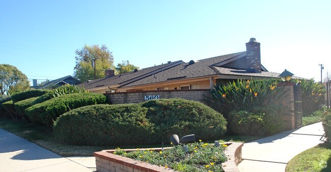
560 E Rowland St, Covina, CA 91723


Property Detail
560 E Rowland St
8451-006-006
PHILLIPS TRACT RANCHO LA PUENTE LOT COM AT INTERSECTION OF S LINE OF ROWLANDST WITH E LINE OF LOT 4 BLK 24 TH W 333.3 FT WITH A UNIFORM DEPTH OF 280.5 FT S 0 41' E PART OF LOT 4 BLK 24
Multifamilydwelling
Los Angeles
CVR3-RD300
California
B and X Area of moderate flood hazard, usually the area between the limits of the 100-year and 500-year floods.
4
2024
2.11 AC
2025
Covina-Valley
403601
Los Angeles
31,564 SF
Los Angeles-Long Beach-Glendale, CA
NEARBY LISTINGS FOR SALE OR LEASE
DEMOGRAPHICS near 560 E Rowland St
1 mile
3 mile
5 mile
2025 Total Population
22,137
160,305
413,642
2030 Population
21,942
158,452
408,273
Pop Growth 2025-2030
(0.88%)
(1.16%)
(1.30%)
Average Age
40
41
41
2025 Total Households
7,435
49,810
122,371
HH Growth 2025-2030
(1.17%)
(1.39%)
(1.52%)
Median Household Inc
$92,020
$99,732
$98,388
Avg Household Size
2.90
3.10
3.20
2025 Avg HH Vehicles
2.00
2.00
2.00
Median Home Value
$759,052
$750,384
$750,115
Median Year Built
1962
1963
1965
Nearby Places
Map Layers
Map Styles
 Street
 Aerial
Transit
 Traffic
 Biking
Places
Listings with unknown addresses are not visible on the map
- Restaurants
- Banks
- Shops
- Fitness
- Groceries
PUBLIC TRANSPORTATION
COMMUTER RAIL
Covina (San Bernardino Line - Southern California Regional Rail Authority (Metrolink))
Drive
Walk
Distance
Covina (San Bernardino Line - Southern California Regional Rail Authority (Metrolink))
3 min
1.6 mi
Baldwin Park (San Bernardino Line - Southern California Regional Rail Authority (Metrolink))
Drive
Walk
Distance
Baldwin Park (San Bernardino Line - Southern California Regional Rail Authority (Metrolink))
9 min
5.1 mi
AIRPORT
Ontario International
Drive
Walk
Distance
Ontario International
24 min
18.4 mi
Long Beach (Daugherty Field)
Drive
Walk
Distance
Long Beach (Daugherty Field)
41 min
30.9 mi
John Wayne/Orange County
Drive
Walk
Distance
John Wayne/Orange County
43 min
33.1 mi
Freight Ports
Port of Long Beach
Drive
Walk
Distance
Port of Long Beach
47 min
36.6 mi
Nearby Properties
Address
Land Use
TOTAL SIZE
Lot Size
Zoning
Address
Land Use
TOTAL SIZE
Lot Size
Zoning
702,934 SF
16.81 AC
WCCR
Address
Land Use
TOTAL SIZE
Lot Size
Zoning
546,676 SF
6.38 AC
WCCR*
Address
Land Use
TOTAL SIZE
Lot Size
Zoning
83,337 SF
38.49 AC
WCCR*
Address
Land Use
TOTAL SIZE
Lot Size
Zoning
190,824 SF
8.21 AC
WCR3-MF20*
Address
Land Use
TOTAL SIZE
Lot Size
Zoning
748,778 SF
11.48 AC
CVC3A*
Address
Land Use
TOTAL SIZE
Lot Size
Zoning
862,213 SF
21.22 AC
WCSP
Address
Land Use
TOTAL SIZE
Lot Size
Zoning
110,640 SF
2.94 AC
GDMS
Address
Land Use
TOTAL SIZE
Lot Size
Zoning
63,919 SF
2.97 AC
CVCP*
Address
Land Use
TOTAL SIZE
Lot Size
Zoning
141,780 SF
7.76 AC
CVRD
Address
Land Use
TOTAL SIZE
Lot Size
Zoning
154,820 SF
3.68 AC
WCRA
Address
Land Use
TOTAL SIZE
Lot Size
Zoning
459,461 SF
1.40 AC
WCCR*
Address
Land Use
TOTAL SIZE
Lot Size
Zoning
294,391 SF
16.90 AC
WCC5*
Address
Land Use
TOTAL SIZE
Lot Size
Zoning
108,544 SF
6.24 AC
LCC4*
Address
Land Use
TOTAL SIZE
Lot Size
Zoning
104,253 SF
2.88 AC
CVRD2000*
Address
Land Use
TOTAL SIZE
Lot Size
Zoning
184,800 SF
4.73 AC
CVTCP*
Address
Land Use
TOTAL SIZE
Lot Size
Zoning
105,936 SF
5.24 AC
WCR3-MF20*
Address
Land Use
TOTAL SIZE
Lot Size
Zoning
90,786 SF
1.66 AC
CVE5 & PCD
Address
Land Use
TOTAL SIZE
Lot Size
Zoning
195,586 SF
2.58 AC
WCCR*
Address
Land Use
TOTAL SIZE
Lot Size
Zoning
315,543 SF
9.03 AC
WCNC*
Address
Land Use
TOTAL SIZE
Lot Size
Zoning
155,907 SF
4.38 AC
CVR3-RD150
Address
Land Use
TOTAL SIZE
Lot Size
Zoning
140,956 SF
4.74 AC
WAC3*
Address
Land Use
TOTAL SIZE
Lot Size
Zoning
117,847 SF
10 AC
CVC3AY
Address
Land Use
TOTAL SIZE
Lot Size
Zoning
94,446 SF
4.97 AC
CVA1PCD*
Address
Land Use
TOTAL SIZE
Lot Size
Zoning
224,675 SF
3.50 AC
WCCS*
Address
Land Use
TOTAL SIZE
Lot Size
Zoning
160,160 SF
8.32 AC
GDR3
Address
Land Use
TOTAL SIZE
Lot Size
Zoning
350,936 SF
8.35 AC
WAC3*
Address
Land Use
TOTAL SIZE
Lot Size
Zoning
63,600 SF
4.58 AC
CVC3A*
Address
Land Use
TOTAL SIZE
Lot Size
Zoning
88,241 SF
3.92 AC
WCCR*
Address
Land Use
TOTAL SIZE
Lot Size
Zoning
295,179 SF
7.08 AC
WCCR*
Address
Land Use
TOTAL SIZE
Lot Size
Zoning
78,852 SF
2.28 AC
WCR3-MF20*
The World's #1 Commercial Real Estate Marketplace
Connect with us
© 2026 CoStar Group
The information above has been obtained from sources believed reliable. While we do not doubt its accuracy we have not verified it and make no guarantee, warranty or representation about it. It is your responsibility to independently confirm its accuracy and completeness. Any projections, opinions, assumptions, or estimates used are for example only and do not represent the current or future performance of the property. The value of this transaction to you depends on tax and other factors which should be evaluated by your tax, financial, and legal advisors. You and your advisors should conduct a careful, independent investigation of the property to determine to your satisfaction the suitability of the property for your needs.